Traveller · Explorer · Founder
Santosh Paudel
63 of Nepal's 77 districts. Ten years. Mostly by motorbike.
Santosh Paudel was born in 1999 in Birendranagar, Surkhet, and is the founder of The West Nepal. Over ten years he has travelled 63 of Nepal's 77 districts, mostly by motorbike, from Rara, Dolpa and Humla to the Mechi and the Mahakali. Today he plans journeys across the west from Kathmandu.
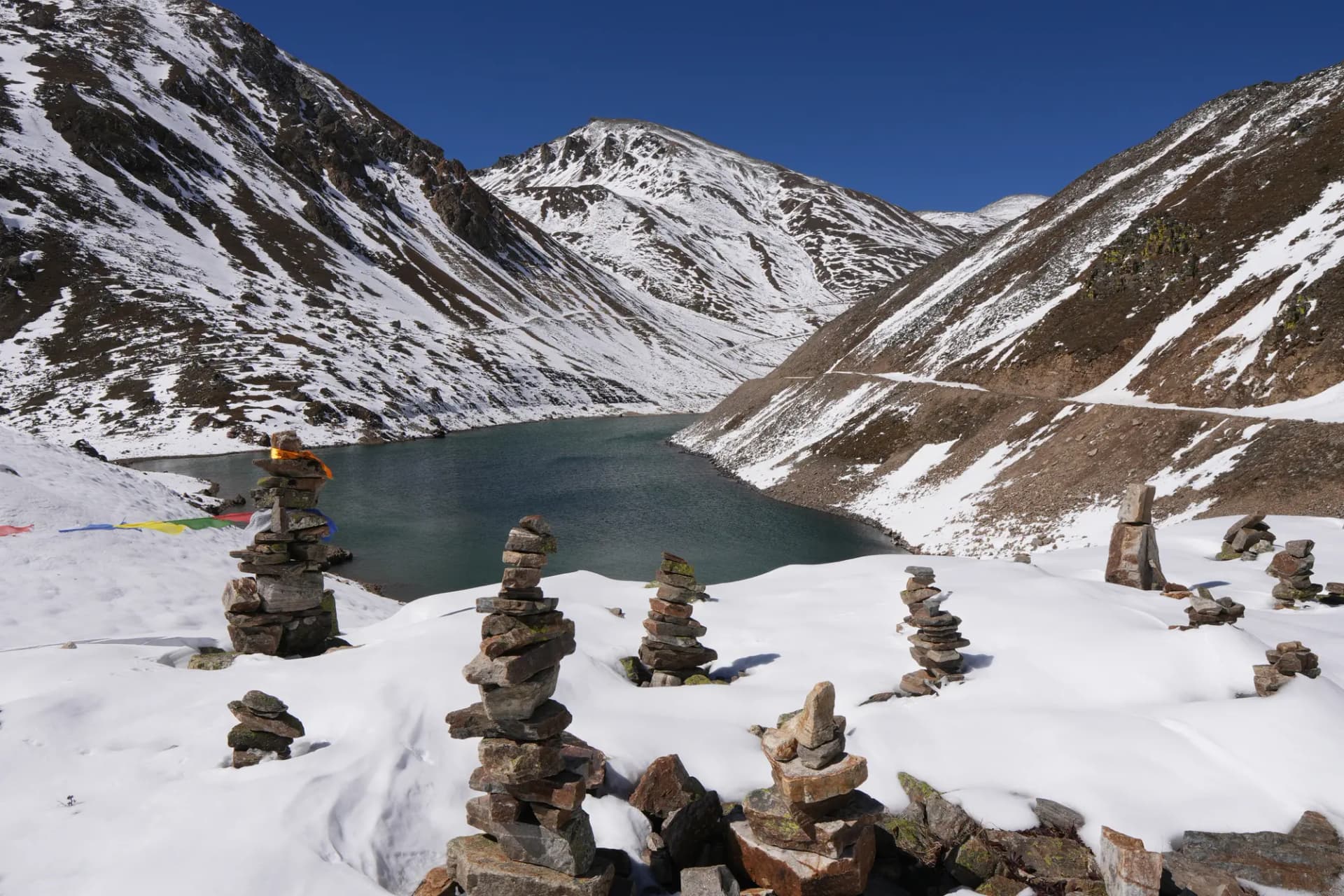
Cover: Selima Tso (Selma lake), Humla
63 of 77 districts.
Four provinces complete: Karnali, Lumbini, Gandaki, Madhesh. Fourteen districts to go.
- Karnali10 / 10
- Sudurpashchim4 / 9
- Lumbini12 / 12
- Gandaki11 / 11
- Bagmati12 / 13
- Madhesh8 / 8
- Koshi6 / 14
Every district, visited and still to go
Sudurpashchim Province
Achham, Baitadi, Bajhang, Bajura, Dadeldhura, Darchula, Doti, Kailali, Kanchanpur
Lumbini Province
Arghakhanchi, Banke, Bardiya, Dang, Gulmi, Kapilbastu, Nawalparasi West, Palpa, Pyuthan, Rolpa, Rukum East, Rupandehi
Gandaki Province
Baglung, Gorkha, Kaski, Lamjung, Manang, Mustang, Myagdi, Nawalparasi East, Parbat, Syangja, Tanahu
Bagmati Province
Bhaktapur, Chitawan, Dhading, Dolakha, Kabhrepalanchok, Kathmandu, Lalitpur, Makawanpur, Nuwakot, Ramechhap, Rasuwa, Sindhuli, Sindhupalchok
Madhesh Province
Bara, Dhanusha, Mahottari, Parsa, Rautahat, Saptari, Sarlahi, Siraha
Koshi Province
Bhojpur, Dhankuta, Ilam, Jhapa, Khotang, Morang, Okhaldhunga, Panchthar, Sankhuwasabha, Solukhumbu, Sunsari, Taplejung, Terhathum, Udayapur
Where I've been.
51 places in pictures, province by province. Every height is sourced at the foot of the page.
Dailekh Panchadham (Panchakoshi)
I revisited the Dailekh Panchadham again and again with my brother, witnessing the forever-burning fire that is now part of Chinese gas exploration.
Five Shiva shrines: Shirasthan, Nabhisthan, Padukasthan, hilltop Dhuleshwor and Kotilasthan; a motorbike covers the circuit in a day from Dailekh bazaar, 65 to 70 km from Surkhet. Natural-gas flames burn year-round, three at Shirasthan and two at Nabhisthan. Chinese drilling at nearby Jaljale reached 4,013 m; a 2026 report estimated 80.7 billion cubic metres of gas, none yet produced.
Dullu, below the shrines, was the winter capital of the Khas Malla kings of Sinja. Padukasthan's flame died in a flood in January 1978. The Shirasthan priest says the flame has burned since 1873, an oral claim; custodians have demanded that drilling never put the flames out.
116 places, and counting.
Lakes, passes, temples, towns and roads across Nepal, with the height where a reliable figure exists.
Karnali · 36
- Nara La (Nara Lagna)4,507-4,620 m
- Yari3,663-3,700 m
- Ringmo3,640-3,660 m
- Hilsa border3,640-3,720 m
- Murma Top3,627-3,630 m
- Shey Phoksundo Lake3,589-3,611 m
- Rara Lake2,975-2,990 m
- Simikot2,910 m
- Rara National Park2,800-4,039 m
- Talcha Airport2,720-2,735 m
- Sinja Valley2,500-2,600 m
- Jumla (Khalanga Bazar)2,347-2,514 m
- Shey Phoksundo National Park2,130-6,885 m
- Suligad2,075-2,080 m
- Gamgadhi2,042 m
- Dunai2,000-2,145 m
- Manma1,938-2,033 m
- Salyan Khalanga1,530 m
- Kupinde Daha1,120-1,160 m
- Birendranagar665-720 m
- Bulbule Tal665-720 m
- Deuti Bajai Temple665-720 m
- Kakrebihar
- Panchapuri
- Bheri River
- Dailekh Panchadham (Panchakoshi)
- Mahabu Lekh
- Khalanga, Jajarkot
- Tatopani hot spring, Jumla
- Mid-Hill Highway
- Karnali Highway
- Phoksundo (Suligad) Waterfall
- Bheri Corridor
- Karnali Corridor
- Kharpunath and the Chuwa Khola bridge
- Selima Tso (Selma lake)
Sudurpashchim · 7
Lumbini · 8
- Dhorpatan Hunting Reserve2,850-5,500 m
- Swargadwari2,100-2,300 m
- Tansen1,350-1,372 m
- Lumbini150 m
- Butwal150 m
- Bardiya National Park134-1,573 m
- Dalla Tharu village
- Rani Mahal (Ranighat Palace)
Gandaki · 29
- Tilicho Lake4,919-4,949 m
- Kora La4,650-4,660 m
- Annapurna Base Camp4,130 m
- Tilicho Base Camp4,100-4,150 m
- Lo Manthang3,840 m
- Muktinath Temple3,749-3,800 m
- Gangapurna Lake3,540 m
- Manang village3,519-3,540 m
- Bhratang apple farm2,850-2,900 m
- Jomsom2,720-2,743 m
- Lete2,384-2,535 m
- Ghandruk1,940-2,012 m
- Tal1,665-1,700 m
- Sarangkot1,592-1,600 m
- Manakamana Temple1,300-1,302 m
- Baglung Bazar and Burtibang1,020 m
- Mahendra Cave and Bat Cave990-1,100 m
- Gupteshwor Mahadev Cave900 m
- Beni899 m
- Besisahar760 m
- Phewa Lake742 m
- Begnas Lake650 m
- Rupa Lake600 m
- Shashwat Dham (CG Temple)
- Devghat Dham
- Devi's Fall
- ZipFlyer, Sarangkot to Hemja
- Nayapul
- Machhapuchhre
Bagmati · 27
- Kalinchowk Bhagwati Temple3,755-3,842 m
- Chandragiri Hills2,551 m
- Nagarkot2,147-2,195 m
- Lakuri Bhanjyang1,991 m
- Jiri1,877-1,946 m
- Dhulikhel1,550 m
- Bhaktapur Durbar Square1,401 m
- Siddha Pokhari1,401 m
- Patan Durbar Square1,350 m
- Swayambhunath1,336-1,400 m
- Kathmandu Durbar Square1,324-1,400 m
- Pashupatinath Temple1,324-1,400 m
- Boudhanath Stupa1,324-1,400 m
- Shivapuri Nagarjun National Park1,000-2,732 m
- Bharatpur (Narayanghat)208 m
- Chitwan National Park (Sauraha)100-815 m
- Jalbire Waterfall
- Riverside Springs Resort and the Barahsinghe brewery, Kurintar
- Kailashnath Mahadev Statue, Sanga
- Pilot Baba Ashram, Suryabinayak
- Telkot
- Chobhar Gorge and Caves
- Taudaha Lake
- Kopan Monastery
- Sharminub Monastery
- Sukute Beach and the Bhote Koshi
- BP Highway
Madhesh · 2
- Janakpur and Janaki Mandir74-78 m
- Bardibas
Koshi · 7
- Shree Antu2,328 m
- Mai Pokhari2,100-2,121 m
- Pashupatinagar border2,000 m
- Kanyam tea garden1,570-1,678 m
- Fikkal1,500 m
- Koshi Barrage
- Mechi Bridge, Kakarbhitta
The road so far.
 Bharatpur (Narayanghat)
Chapter 1 · 1999-2015
A Surkhet childhood
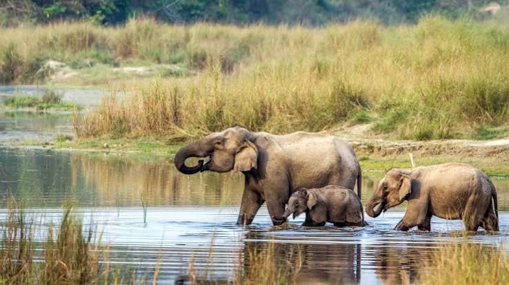
I was born and raised in Birendranagar, Surkhet, in 1999, and football was pretty much everything growing up. With my friends I cycled to Bulbule, Kakrebihar and Deuti Bajai, and the family took us on small trips around Surkhet. As a kid I stayed at my uncle's house in Narayanghat, saw the animals of Chitwan National Park, cycled with my brother to Devghat and rode the cable car up to Manakamana, which is where the traveller in me started.
- Birendranagar
- Bulbule Tal
- Kakrebihar
- Deuti Bajai Temple
- Devghat Dham
- Manakamana Temple
- Bharatpur (Narayanghat)
- Chitwan National Park (Sauraha)
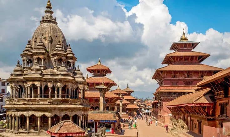 Patan Durbar Square
Chapter 2 · 2015-2017
The Kathmandu Valley, on foot and by bike
In 2015 I moved to the Kathmandu Valley and lived in Bhaktapur, and every free day became a ride or a walk with friends and my brother: the three durbar squares, Swayambhunath, Pashupatinath and Boudha, then Nagarkot, Dhulikhel, Shivapuri, Chandragiri, Lakuri Bhanjyang, Sanga, Pilot Baba, Telkot, Chobhar, Taudaha and Siddha Pokhari, and later Kalinchowk and Jiri. My first Pokhara trip came with my cousin; back home I explored Panchapuri, the Bheri and Karnali rivers and the Dailekh Panchadham, and with my family I went to Swargadwari and Lumbini.
- Panchapuri
- Bheri River
- Dailekh Panchadham (Panchakoshi)
- Lumbini
- Swargadwari
- Kathmandu Durbar Square
- Patan Durbar Square
- Bhaktapur Durbar Square
- Swayambhunath
- Pashupatinath Temple
- and 20 more
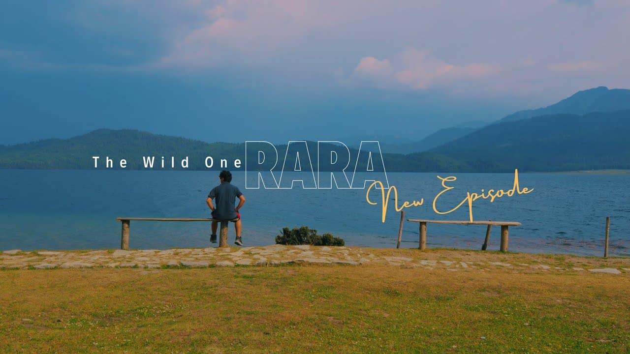 Rara Lake
Chapter 3
Rara by bus, Mahabu in snow
Riding between Kathmandu and Surkhet through Butwal, the hub of Nepal, became my first long rides. Back in Surkhet I started looking at the unexplored west: my friends and I took the bus to Rara, two days to Talcha, then hiked to the lake and on to Gamgadhi. I travelled to Salyan and Jajarkot, hiked Mahabu in snow with three friends, saw Kupinde Daha, and on a group trip guided my friends around Pokhara, Ghandruk, the zipline, the CG Temple and Lumbini; in Kathmandu I visited Kopan, Sharminub and Sukute. Then the bike came home with me to Surkhet, and the real journey began.
- Mahabu Lekh
- Kupinde Daha
- Salyan Khalanga
- Khalanga, Jajarkot
- Rara Lake
- Rara National Park
- Talcha Airport
- Gamgadhi
- Butwal
- Shashwat Dham (CG Temple)
- and 5 more
 Murma Top
Chapter 4
Karnali by bike
After the lockdown the plan came for a group ride to Rara: Surkhet to Dailekh, onto the Karnali Highway through Kalikot to Mugu, then Murma Top, Jumla, Sinja and Tatopani, and Dhorpatan. My mother and I went to Mahendranagar by way of Tikapur, Ghodaghodi and the Karnali, and in Dalla village and around Bardiya I listened to Tharu families' own stories. Then my brothers and I rode to Shey Phoksundo through Salyan and Jajarkot, parked near Dolpa, walked from Suligad to Ringmo and the waterfall, and came back through Dunai.
- Murma Top
- Jumla (Khalanga Bazar)
- Sinja Valley
- Tatopani hot spring, Jumla
- Manma
- Mid-Hill Highway
- Dhorpatan Hunting Reserve
- Karnali Highway
- Shey Phoksundo Lake
- Shey Phoksundo National Park
- and 10 more
 A day in Darjeeling on the East-West ride
Chapter 5
Mahakali to Mechi and back, two on one bike
My friend and I got the crazy idea to ride the East-West Highway from the Mahakali to the Mechi, two of us on one bike, about 2,500 km in around 20 days. We saw the Dodhara Chandani bridge, slept near the Karnali bridge, met friends at Sauraha and Jalbire, reached Janakpur and the Koshi Barrage, then climbed into cooler Ilam for Kanyam, Mai Pokhari and Fikkal and a day across the border in Darjeeling from Pashupatinagar. From the Mechi bridge we turned back by Bardibas and the BP Highway to Kathmandu, and home through Pokhara's Phewa, Begnas and Rupa lakes.
- Karnali Bridge, Chisapani
- Dodhara Chandani Bridge
- East-West Highway
- Jalbire Waterfall
- Rupa Lake
- Janakpur and Janaki Mandir
- Koshi Barrage
- BP Highway
- Bardibas
- Kanyam tea garden
- and 4 more
 A waterfall on the way to Tilicho
Chapter 6
Mustang, Manang and Annapurna
We planned two big destinations a year. Upper Mustang went the old way, Butwal, Tansen and Rani Mahal, then Beni, Lete, Jomsom, Muktinath, Lo Manthang and the China border at Kora La; a brother's wedding took us to Ilam and Sri Antu; the Tilicho ride went through Besisahar, Tal, the Bhratang apple farm and Manang to Tilicho Base Camp and the lake, with a stop at Riverside Springs and the Barahsinghe brewery on the way back. For Annapurna Base Camp we rode the Mid-Hill Highway to Burtibang and Baglung, parked at Nayapul and walked two days up to the 360-degree view, with Machhapuchhre's tail in front of us.
- Tansen
- Rani Mahal (Ranighat Palace)
- Riverside Springs Resort and the Barahsinghe brewery, Kurintar
- Nayapul
- Annapurna Base Camp
- Machhapuchhre
- Baglung Bazar and Burtibang
- Beni
- Lete
- Jomsom
- and 11 more
 On the road to Humla, October 2025
Chapter 7 · 2025
Humla, up the Karnali Corridor
In October 2025 I rode to Humla with my friends: Surkhet to Dailekh to Bajura and up the Karnali Corridor. Heading for Limi we got as far as Selma lake, deep in snow, before the snow and a bad road turned us back; then we crossed the Nara Lagna pass and came down to the Hilsa border on the Kailash Mansarovar route. It was one of the most remote trips I've done, rare in Nepal too, and still one of the most extraordinary.
- Bajura, Karnali Corridor (Pilichaur halt)
- Karnali Corridor
- Kharpunath and the Chuwa Khola bridge
- Simikot
- Yari
- Selima Tso (Selma lake)
- Nara La (Nara Lagna)
- Hilsa border
People along the way.
The places are the backdrop. These are the people and communities that taught me something.
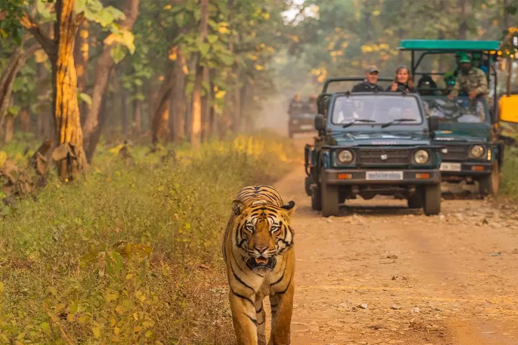
A Tharu homestay in Dalla
Bardiya
“In Dalla we listened to families' own life stories: what they invest in girls' education, early marriage, and women standing on their own.”
About 105 Tharu households; their community homestay began in March 2011, the first in Bardiya.
House to house in Ekeni
“In Ekeni, a rural community in Surkhet, we went house to house asking about income, schooling and toilets, and ran a sanitation and school awareness programme.”
The Raji priests of Deuti Bajai
Surkhet
“As a kid I cycled to Deuti Bajai, Bulbule and Kakrebihar with my friends.”
Its priests come only from the indigenous Raji community, and Raji women may serve as priests, which is rare in Nepal.
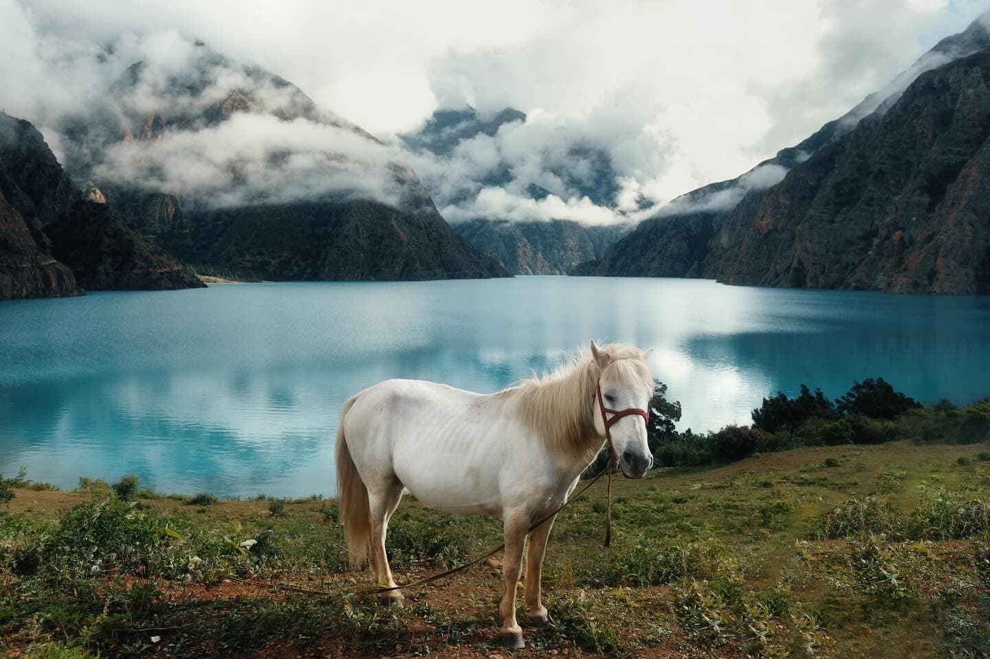
Ringmo, above Phoksundo
Dolpa
“Past the checkpost, mules were the only transport to the lake, and I got to see the Bhote way of life up there.”
A Bon-po village on the landslide dam at the lake's south end, with a seasonal population of about 200; Buddhism and Bon are both practised.
Herb collectors of Dolpa
Dolpa
“In Dunai, people depended on selling yarsagumba and shilajit.”
A Nepal Rastra Bank study put yarsagumba at about 56 percent of a collecting family's income.
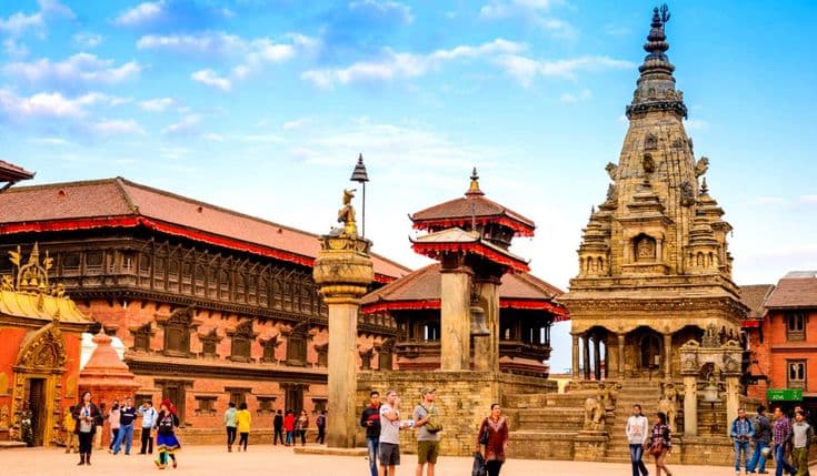
Newar Bhaktapur
Bhaktapur
“Living in Bhaktapur, I learned a lot about Newari culture and sculpture.”
A Malla capital from the 12th century: the Palace of 55 Windows, and Nyatapola, completed in 1702.

The Khas valley of Sinja
Jumla
“Jumla's Khas valley is where the Nepali language took root, and it felt like a foundation stone to me.”
Capital of the Khas Malla empire in the 12th to 14th centuries; UNESCO calls Sinja the language's birthplace.
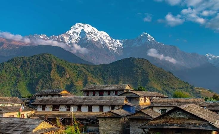
Gurung Ghandruk
Kaski
“The sunrise over the mountain range from Ghandruk was amazing.”
Birthplace of the Annapurna Conservation Area Project, piloted here in 1986.
Travel with Santosh.
The routes I plan are the ones I've ridden.
- 01
I grew up where the road into Karnali starts.
- 02
I've ridden the roads I'll put you on.
- 03
You message me and I answer; there is no sales desk.
- 04
I'll tell you when a route isn't worth it, or when the season is wrong.
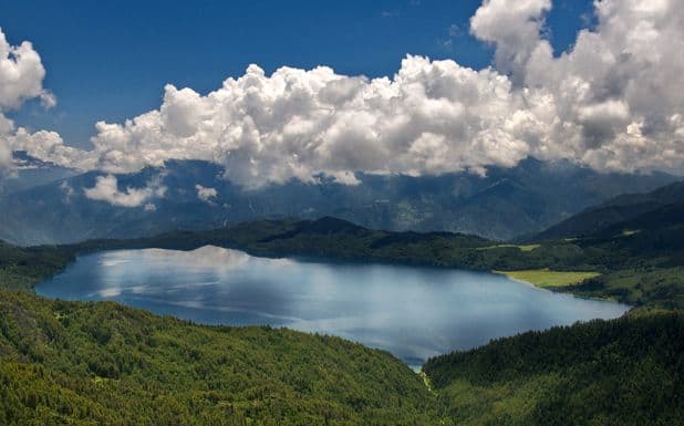

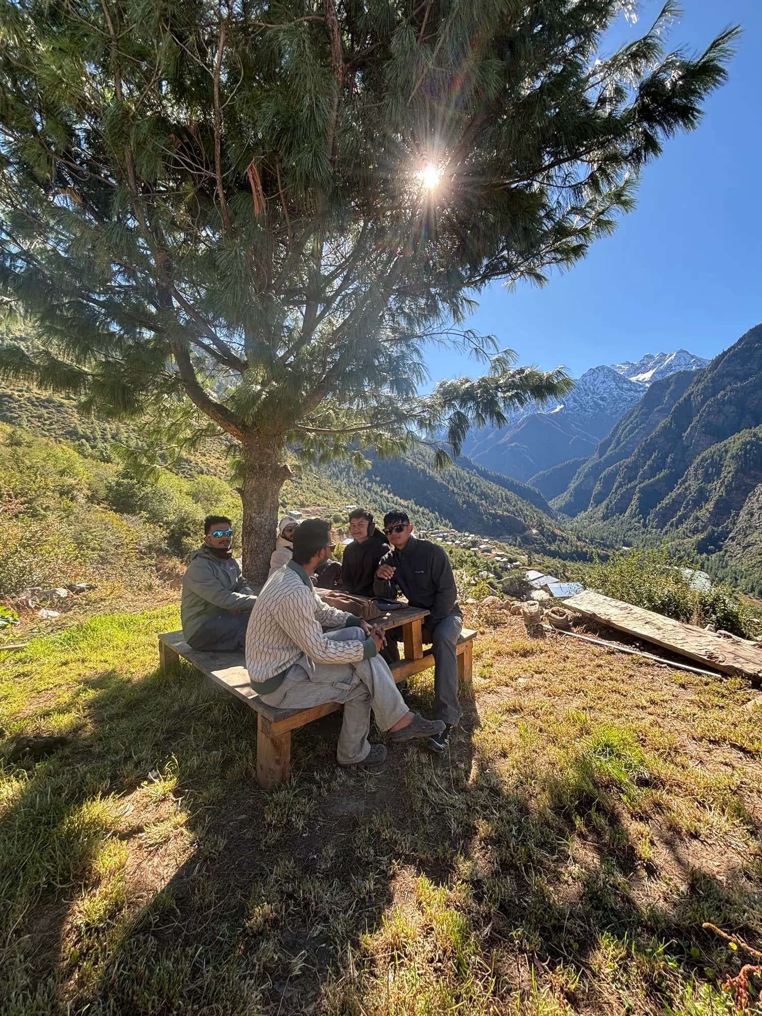
With friends on the Humla trip, October 2025
Get connected with Santosh.
More than travel. Get to know each other, plan a trip together, or build something together.
“Western Nepal changed the way I see the world. I built The West Nepal to share what I've found.”
Get to know Santosh
Say hello, swap stories and routes, or ask about a place you have heard of.
Say namastePlan a trip together
Tell Santosh your dates and what you love, and get an honest route back.
Plan togetherWork together
Stories, films, research or a project in the west of Nepal: start the conversation.
Start a projectJoin the community
The West Nepal is growing into a community of travellers from every walk of life. Share your own journeys.
Join in
Follow the journey
Highest and lowest
Computed from the places above, each with its source below. Nothing typed by hand.
| Record | Place | Height |
|---|---|---|
| Highest point reached | Tilicho Lake · Manang | 4,919-4,949 m |
| Highest pass | Kora La · Mustang | 4,650-4,660 m |
| Highest lake | Tilicho Lake · Manang | 4,919-4,949 m |
| Highest town or village | Lo Manthang · Mustang | 3,840 m |
| Lowest point | Janakpur and Janaki Mandir · Dhanusha | 74-78 m |
Sources for the figures on this page (116 places)
- Birendranagar, The municipality's own document gives about 665 m; Wikipedia's 720 m is the Surkhet Airport climate station. Both are the floor of the Surkhet dun valley.[1][2][3]
- Bulbule Tal, No lake-specific figure is published; the park lies on the Birendranagar valley floor, about 665 m per the municipality and 720 m per Wikipedia.[1][2][3]
- Kakrebihar, No reliable figure for the hilltop was found. Latikoili hill is a low hillock rising from the Surkhet valley floor (665-720 m); its height above the valley is not published.[1][2][3]
- Deuti Bajai Temple, No temple-specific figure; it stands in Birendranagar on the valley floor, about 665 m per the municipality and 720 m per Wikipedia.[1][2][3]
- Panchapuri, No published elevation for Babiyachaur or the municipality was found; a hill municipality in northern Surkhet, outside the valley floor. Low confidence.[1][2][3]
- Bheri River, A river, so elevation is not the meaningful figure. Length about 264 km (Wikipedia's Ghaghara article; WorldAtlas gives the same 164 miles).[1][2][3][4]
- Karnali Bridge, Chisapani, A bridge, so elevation is not the meaningful figure. Total length 500 m, spans 325 m and 175 m (Structurae, Wikipedia); tower 120 m (Wikipedia) or 125 m (Onlinekhabar); completed 1993.[1][2][3]
- Dailekh Panchadham (Panchakoshi), No site elevations are published; the shrines are riverside and low-hill sites below Dailekh bazaar, itself given as 1,402-1,448 m. The meaningful figure here is the Jaljale gas well: 4,013 m deep, reported as Nepal's deepest.[1][2][3][4]
- Mahabu Lekh, About 4,100 m for the main temple per Buddha Air; 4,168 m is Dailekh district's highest point per Wikipedia and is often applied to Mahabu, but no source names the point. Unsurveyed, low confidence, so no chip.[1][2][3]
- Kupinde Daha, A 2025 peer-reviewed bathymetric study gives 1,160 m; hopnepal gives 1,120 m. Wikipedia's 2,990 m conflicts with both and is not used. A mid-hill lake, not alpine.[1][2][3]
- Salyan Khalanga, Wikipedia gives 1,530 m. The Rapti Highway passes about 3 km east of the town at around 1,000 m, the source of a lower figure in some mirrors.[1][2][3]
- Khalanga, Jajarkot, No authoritative figure: a Wikipedia-derived 799 m against a 2013 UN district profile's 2,945 m, implausible for a bazaar just above the Bheri. Treated as unsurveyed.[1][2][3][4]
- Rara Lake, Wikipedia's infobox and the national park article give 2,990 m; the Rara Lake article's geography text, citing Upadhyay, Chalise and Paudel 2009, gives 2,975 m. 2,990 m is the usual figure.[1][2][3]
- Rara National Park, The park's altitude span, 2,800 m to 4,039 m at Chuchemara Peak, per Wikipedia citing Bhuju et al. 2007; the lake surface is 2,990 m. A range, not a disagreement.[1][2][3]
- Murma Top, Nepal Traveller gives 3,627 m and Wikipedia 3,630 m; trekking operators quote up to 3,800 m. About 3,630 m is the figure to print.[1][2][3]
- Talcha Airport, CAAN's airport profile gives 2,720 m; aviation databases and Republica give 2,734-2,735 m. The CAAN figure is preferred.[1][2][3]
- Gamgadhi, Only Wikidata gives a figure, 2,042 m; Wikipedia's infobox leaves elevation blank and no survey figure was found. Approximate.[1][2][3]
- Jumla (Khalanga Bazar), Jumla Airport is 2,347 m, the climate station 2,363 m and a planning document about 2,350 m; Wikipedia's town infobox gives 2,514 m, which looks like a hilltop value. About 2,350 m for the bazaar.[1][2][3]
- Sinja Valley, No official figure: Nepal Traveller gives about 2,600 m and an informal source about 2,500 m; Wikipedia and Wikidata leave it blank.[1][2][3][4]
- Tatopani hot spring, Jumla, No elevation found in any consulted source. The one measured figure is the Tila Nadi spring temperature of 42 degrees Celsius (Ranjit 1994). Low confidence.[1][2][3]
- Manma, Wikipedia, citing Falling Rain, gives 2,033 m; Wikidata gives 1,938 m. No survey figure found.[1][2][3]
- Mid-Hill Highway, A road, so elevation is not the meaningful figure. Length 1,879 km across 26 districts, 84.68 percent built by August 2026; the Karnali Province stretch is 278 km.[1][2][3]
- Dhorpatan Hunting Reserve, The reserve's altitude span, 2,850 m to 5,500 m, per Wikipedia citing Bhuju et al. 2007 and the DNPWC management plan. Dhorpatan village is disputed (3,900 m or 2,900 m) and is not printed.[1][2][3]
- Karnali Highway, A road, so elevation is not the meaningful figure. Surkhet to Jumla 232 km; Surkhet to the Kalikot section about 150 km; Nagma to Gamgadhi 93 km and 9 km on to Talcha. No source gives a Surkhet-Talcha total.[1][2][3][4]
- Shey Phoksundo Lake, Wikipedia's lead gives 3,611.5 m and its infobox 3,589 m; Nepali Times, Buddha Air and film.gov.np use 3,611 m, the figure to print.[1][2][3][4]
- Shey Phoksundo National Park, The park's altitude span, 2,130 m to 6,885 m, per Wikipedia citing Bhuju et al. 2007. A range, not a disagreement.[1][2][3]
- Ringmo, Wikipedia and Nepal Traveller give 3,660 m; TU Graz's architectural survey records 3,640 m. A film board page's 4,200 m is wrong, since the lake beside it is about 3,611 m.[1][2][3]
- Phoksundo (Suligad) Waterfall, Height is the meaningful figure: 167 m (Ramsar description, Wikipedia), 170 m (Nepali Times) or 168 m (Kantipur). No surveyed elevation of the fall itself was found.[1][2][3]
- Suligad, Buddha Air's itinerary lists Suligad at 2,075 m; a French operator gives the Thuli Bheri junction at 2,080 m. Some itineraries print 3,180 m, impossible for a point below Dunai.[1][2][3]
- Dunai, Wikipedia says about 2,000 m without citation; trekking itineraries give 2,140-2,145 m, the figure to print.[1][2][3][4]
- Bheri Corridor, A road, so elevation is not the meaningful figure. 317 km from Botechaur in Surkhet to Marim in Dolpa per the Department of Roads; the Jajarkot-Dunai section is 118 km.[1][2][3]
- Bajura, Karnali Corridor (Pilichaur halt), No published elevation for Pilichaur, the corridor's overnight halt; Martadi, the district headquarters 42 km off the corridor, is 2,030 m.[1][2][3]
- Karnali Corridor, A road, so elevation is not the meaningful figure. Surkhet to Simikot 334 km; Simikot to Hilsa 36 to 38 km; Rupaidiha to Hilsa about 505 km.[1][2][3]
- Kharpunath and the Chuwa Khola bridge, No source gives the temple's elevation; Wikipedia's 2,260 m is the rural municipality's figure. The meaningful figure is the bridge: 48 m (Radio Nepal) or 170 ft (myRepublica), built in 35 to 40 days.[1][2][3]
- Simikot, Town 2,910 m per Wikipedia's infobox; the airport is 2,818 m. Trek operators give 2,950 to 3,000 m for the town.[1][2][3]
- Yari, 3,700 m per Peregrine Treks and 3,663 m per Himalayan Quests, operator itineraries only; Wikipedia has no Yari page.[1][2][3]
- Selima Tso (Selma lake), One source (dangerousroads.org) gives 4,573 m and no survey figure was found; the owner remembers about 4,200 m, so no height is shown.[1][2][3]
- Nara La (Nara Lagna), 4,507 m per dangerousroads.org, 4,530 m in Wikipedia's Humla District text, 4,620 m per most operators. No Department of Survey figure exists online.[1][2][3]
- Hilsa border, 3,640 m per Wikipedia and Spotlight Nepal; trek itineraries give 3,700 to 3,720 m. No survey figure found.[1][2][3]
- Bhimdatta (Mahendranagar), Wikipedia's infobox gives 229 m; the same article's climate table gives 197 m. No government figure found.[1][2][3]
- Dodhara Chandani Bridge, A bridge, so elevation is not the meaningful figure. Length 1,452.96 m in total: four back-to-back suspension bridges, twelve spans, eight pylons of 32.72 m, longest span 225.40 m.[1][2][3]
- Tikapur Park, Tikapur town's elevation, 149 m, from the Department of Hydrology and Meteorology data in Wikipedia's climate table; no separate figure exists for the park.[1][2][3]
- Ghodaghodi Lake, 205 m per Wikipedia, taken from the Ramsar information sheet; the KBA factsheet gives the wider site as 205 to 1,400 m.[1][2][3]
- Bardiya National Park, The park's altitude span, 134 m to 1,573 m, from a 2014 DEM-based study; tour operators commonly quote 152 to 1,441 m. Thakurdwara, the headquarters, is on the Terai plain.[1][2][3][4]
- Dalla Tharu village, No reputable source states the village's elevation; it lies on the Terai plain in the Khata corridor just south of Bardiya National Park, whose lowest ground is 134 to 152 m. Omitted rather than guessed.[1][2][3]
- East-West Highway, A road, so elevation is not the meaningful figure. Length 1,028 km per the Department of Roads; Wikipedia's infobox gives 1,027.67 km.[1][2]
- Lumbini, Wikipedia's infobox gives 150 m; no disagreeing figure found. An archaeological and pilgrimage site rather than a single temple.[1][2][3]
- Butwal, Wikipedia's infobox gives 150 m. No other figure found.[1][2]
- Tansen, Wikipedia's infobox gives 1,350 m; UNESCO's tentative-list entry gives 1,372 m on the southern slope of Shreenagar hill. Wikipedia's 1,067 m is the climate station, not the town.[1][2][3]
- Rani Mahal (Ranighat Palace), No source gives an elevation for the palace; it stands on the Kali Gandaki riverbank well below Tansen (1,350-1,372 m). No Rani Pokhari exists in Palpa; the famous one is Pratap Malla's 1670 tank in Kathmandu.[1][2][3]
- Shashwat Dham (CG Temple), No source gives an elevation; the site is on the Terai plain beside the East-West Highway. The published size is its area, 12 acres.[1][2][3]
- Swargadwari, Three figures: Wikipedia 2,100 m, Nepal Tourism Board 2,200 m, Kathmandu Post quoting the ashram 2,300 m.[1][2][3]
- Devghat Dham, No reputable elevation found; a tour operator's 415 m matches the Chitwan district infobox and looks copied. The meaningful figure is the confluence itself.[1][2][3]
- Manakamana Temple, Wikipedia's temple article says 1,300 m on Kafaldanda hill; the cable-car article gives the top station at 1,302 m and the bottom station at Kurintar at 258 m.[1][2]
- Bharatpur (Narayanghat), Wikipedia's infobox gives 208 m; the Rampur climate station in the same article is 189 m.[1][2][3]
- Chitwan National Park (Sauraha), The park's altitude span, about 100 m in the river valleys to 815 m in the Churia hills, per Wikipedia. A range, not a disagreement.[1][2][3][4]
- Jalbire Waterfall, No elevation published; the meaningful figure is height, about 60 m per Wikipedia, with operators quoting up to 100 m for the whole canyon drop.[1][2][3]
- Riverside Springs Resort and the Barahsinghe brewery, Kurintar, Neither the resort nor the brewery publishes an elevation; 258 m is the Manakamana cable-car bottom station at Kurintar, on the same riverbank (Wikipedia).[1][2][3]
- Kathmandu Durbar Square, City-level, not site-specific: Kathmandu is 1,324 m in Wikipedia's lead and about 1,400 m on average in its geography section.[1][2][3]
- Patan Durbar Square, City-level, not site-specific: Lalitpur is 1,350 m per Wikipedia.[1][2][3]
- Bhaktapur Durbar Square, City-level, not site-specific: Bhaktapur is 1,401 m per Wikipedia's infobox.[1][2][3]
- Swayambhunath, Only a trekking-operator page gives an altitude, 1,336 to 1,400 m; travel guides put the hilltop about 77 m above the valley floor. Approximate.[1][2][3]
- Pashupatinath Temple, City-level, not site-specific: Kathmandu is 1,324 to 1,400 m per Wikipedia. Wikipedia's uncited 817 m for the temple is implausible for the valley floor and is not used.[1][2][3]
- Boudhanath Stupa, City-level, not site-specific: Kathmandu is 1,324 to 1,400 m per Wikipedia. The meaningful figure is the stupa's height, 36 m.[1][2][3]
- Nagarkot, Wikipedia itself gives three figures: 2,175 m in the infobox, 2,195 m in the body and 2,147 m in the climate table. 2,175 m is the usual figure.[1][2][3]
- Dhulikhel, Wikipedia gives 1,550 m; travel sites range from 1,440 to 1,625 m. 1,550 m is the most-repeated figure.[1][2]
- Shivapuri Nagarjun National Park, The park's altitude span, 1,000 m to 2,732 m at Shivapuri Peak, per the Key Biodiversity Areas factsheet and Wikipedia.[1][2][3]
- Chandragiri Hills, The operator and Nepal Traveller give 2,551 m for the summit viewpoint; other travel sites range from 2,520 to 2,579 m. Wikipedia gives no elevation.[1][2][3]
- Lakuri Bhanjyang, PeakVisor gives 1,991 m and the BikeClimbs route profile 1,990.9 m; the two agree.[1][2]
- Kailashnath Mahadev Statue, Sanga, No site elevation found. The meaningful figure is the statue's height: 143 ft, given as 44 m or 43.5 m by Wikipedia.[1][2]
- Pilot Baba Ashram, Suryabinayak, No source gives an elevation; bhaktapur.com gives coordinates 27.640425 N, 85.422573 E. The ashram is 6 km south of Bhaktapur, not near Nagarkot.[1][2][3]
- Telkot, Unresolved: Himalayan Hero gives 1,800 m, a BikeClimbs profile about 1,540 m. No survey figure found; low confidence, so no chip.[1][2][3]
- Chobhar Gorge and Caves, No elevation given by any source. The meaningful figures are the cave length, at least 1,250 m, and the gorge's discharge capacity of about 2,800 cubic metres a second.[1][2][3]
- Taudaha Lake, No sourced elevation found. The area is disputed: Wikipedia's 463 hectares is almost certainly a unit error; a cited study gives about 4.2 hectares and 6.8 m maximum depth.[1][2][3]
- Siddha Pokhari, City-level: Bhaktapur is 1,401 m per Wikipedia. The pond measures 171 m by 73 m and about 3 m deep.[1][2][3]
- Kopan Monastery, No source gives an elevation; it sits on Kopan hill north of Boudhanath in Budhanilkantha Municipality.[1][2]
- Sharminub Monastery, No source gives an elevation. At Ichangu Narayan, Nagarjun Municipality, at the foot of Nagarjun hill on Kathmandu's western edge.[1][2][3]
- Sukute Beach and the Bhote Koshi, A river, so elevation is not the meaningful figure; riverside camps sit around 700 m per one unverified operator figure. The Bhote Koshi falls from 5,600 m at the Zhangzangbo glacier to about 640 m near Balephi, a gradient of 15 m per km.[1][2][3]
- Kalinchowk Bhagwati Temple, Wikipedia and the Kathmandu Post give 3,842 m; The Himalayan Times gives 3,755 m. 3,842 m is the usual figure.[1][2][3]
- Jiri, Wikipedia's climate box gives 1,877 m, Honeyguide 1,946 m, and other guides commonly 1,905 m. No survey figure found.[1][2][3]
- Phewa Lake, 742 m per Wikipedia's infobox, citing Rai (2000). The Lake Cluster article's generic 827 m is not Phewa's.[1][2]
- Begnas Lake, 650 m per Wikipedia's infobox, citing Rai (2000). No conflicting figure found.[1][2]
- Rupa Lake, 600 m per Wikipedia's infobox; its text gives 1,969 ft, a rounding difference only.[1][2]
- Devi's Fall, No consulted source gives an elevation or height for the fall; the Gupteshwor cave entrance opposite is listed at 900 m. The meaningful figures are the tunnel: about 150 m long and 30 m below ground.[1][2][3]
- Gupteshwor Mahadev Cave, 900 m above sea level per showcaves.com only; Wikipedia gives no elevation. Length is the disputed figure: 2,057 m (Gebauer 1986) or 2,950 m (showcaves.com).[1][2][3]
- Mahendra Cave and Bat Cave, Bat Cave 990 m per Wikipedia's infobox; Mahendra Cave about 1,100 m per Wikipedia, uncited.[1][2][3]
- Sarangkot, 1,592 m per the Nepal Tourism Board trade site; 1,600 m per Wikipedia. Both are for the hilltop take-off area.[1][2][3]
- ZipFlyer, Sarangkot to Hemja, Not an elevation entry; the line runs from Sarangkot (1,592-1,600 m) down to Hemja. Length 1,800 m per Nepali Times or 1,850 m in listings; drop about 600 m; speed and gradient vary by source.[1][2][3]
- Ghandruk, 2,012 m per Wikipedia and some operators; 1,940 m is the figure most trekking sites use. No survey source found.[1][2][3]
- Nayapul, 1,070 m per Wikivoyage and 1,010 to 1,070 m per operators, mostly 1,050 m; no government or survey figure. Low confidence, so no chip.[1][2][3]
- Annapurna Base Camp, 4,130 m per Wikipedia's Annapurna Sanctuary infobox and film.gov.np; operators agree. Machhapuchhre Base Camp is about 3,700 m on operator pages only.[1][2][3]
- Machhapuchhre, The summit is 6,993 m per Wikipedia citing Peakbagger, but the peak is unclimbed and was seen from Annapurna Base Camp, not reached, so no elevation is recorded as a point reached.[1][2][3]
- Baglung Bazar and Burtibang, Baglung Bazar 1,020 m per Wikipedia's infobox; its climate station sits at 964 m. Burtibang has no reliable published elevation.[1][2][3]
- Beni, 899 m per Wikipedia, uncited. No second figure found.[1][2][3]
- Lete, 2,384 m per Wikipedia's climate-station header; Wikivoyage lists Kalopani and Lete at 2,535 m. The Kali Gandaki riverbed at the deepest point nearby is about 2,520 m.[1][2][3]
- Jomsom, Wikipedia gives 2,743 m in its infobox and 2,741 m in its climate table; Jomsom Airport is 2,736 m; Wikivoyage lists 2,720 m.[1][2][3]
- Muktinath Temple, 3,749 m per the Nepal Tourism Board's Annapurna page; 3,800 m per its Muktinath page, Wikipedia's lead and Wikivoyage; Wikipedia's infobox 3,762 m. The 3,710 m on operator sites appears in no reference source.[1][2][3]
- Lo Manthang, 3,840 m per Wikipedia's infobox and a Nepal Tourism Board page; another NTB page says loosely 4,000 m. Upper Mustang's settlements span 2,800 to 3,900 m.[1][2][3]
- Kora La, 4,660 m per Wikipedia citing National Geographic; 4,650 m per the Kathmandu Post of 30 October 2024. The 4,560 and 4,620 m figures seen elsewhere appear in no consulted source.[1][2][3]
- Besisahar, 760 m per Wikipedia's infobox and Wikivoyage; they agree.[1][2][3]
- Tal, 1,665 m per Honeyguide; 1,700 m per Wikivoyage and trek reports. Wikipedia has no article.[1][2][3]
- Bhratang apple farm, 2,850 m per Wikivoyage; 2,900 m per Honeyguide. No Wikipedia article and no survey figure.[1][2][3]
- Manang village, 3,519 m for the village and 3,540 m for the valley per film.gov.np; 3,540 m per Wikivoyage; the Nepal Tourism Board says 3,550 m.[1][2][3]
- Gangapurna Lake, 3,540 m per The Himalayan Times of 8 October 2018. Wikipedia gives no elevation; web figures of 3,440 and 3,820 m are unreliable.[1][2][3]
- Tilicho Base Camp, 4,100 m per Wikivoyage; 4,150 m per most trekking operators, some 4,200 m. No survey or government figure found.[1][2][3]
- Tilicho Lake, 4,919 m per Wikipedia, the Nepal Tourism Board, the Kathmandu Post and The Himalayan Times; Wikipedia notes another source gives 4,949 m; Wikivoyage 4,920 m.[1][2][3]
- Janakpur and Janaki Mandir, Wikipedia's Janakpur infobox gives 74 m, the Janaki Mandir infobox 78 m. A flat Terai city, so elevation is not a meaningful travel figure.[1][2][3]
- Koshi Barrage, A barrage on the Terai floodplain, so elevation is omitted; the adjoining reserve is 75 to 81 m. The meaningful figures are 1,150 m long, 10 m wide, 56 gates.[1][2][3]
- BP Highway, A road, so elevation is omitted; no reliable highest-point figure was found. Length 158 km per Wikipedia's route section or 160 km per its infobox and JICA.[1][2]
- Bardibas, Unreliable: German Wikipedia 215 m, an English mirror 254 m, PeakVisor about 227 m; the current English article states no elevation. No chip.[1][2][3]
- Kanyam tea garden, Wikipedia's Kanyam infobox gives 1,570 m, uncited; the Kanyam Tea Estate weather station in the Phikkal article is listed at 1,678 m.[1][2][3]
- Fikkal, Approximately 1,500 m per Wikipedia's Phikkal Bazar article; the Suryodaya Municipality infobox gives 1,565 m for the municipality as a whole.[1][2][3]
- Mai Pokhari, About 2,100 m per Wikipedia; 2,121 m per the Kathmandu Post in 2019.[1][2][3]
- Shree Antu, The view tower is 2,328 m per Wikipedia, Nepal Traveller and the Kathmandu Post; one operator's 1,977 m probably refers to the village.[1][2][3]
- Pashupatinagar border, 2,000 m per Wikipedia's infobox, uncited. No second elevation source found.[1][2][3]
- Mechi Bridge, Kakarbhitta, A bridge, so elevation is omitted; Kakarbhitta town is 142 m. The new six-lane bridge is reported as 575 m by the Kathmandu Post, 583 m by Wikipedia and up to 690 m elsewhere.[1][2][3]
Last updated 31 October 2026