
Surkhet is where the map changes. South of it lie the Terai plains, the east-west highway and airports with regular flights. North of it lies the Karnali: single mountain roads, weather-dependent airstrips, and districts where a hundred kilometres can take two days. Birendranagar, the town at the centre of the Surkhet valley, is the capital of Karnali Province and the last place on the route north where everything works the way a traveller expects it to.
That makes Surkhet the most-passed-through and least-examined district in the province. Almost every overland journey into the Karnali starts here, and almost nobody gives the valley itself more than a night. The valley is worth more than that. It is a wide, warm dun basin with a twelfth-century ruin on a hillock in the middle of it, a lake park on the edge of town, and a set of onward routes that make it the natural planning hub for the whole region.
Why every Karnali journey starts in Surkhet
Geography did this, not policy. The Surkhet valley is an inner Terai dun, a flat-floored basin sitting between the low Siwalik hills to the south and the higher Mahabharat range to the north, at an elevation of only a few hundred metres. It is one of the few pieces of level, buildable ground anywhere along the southern edge of the Karnali hills, and it happens to sit exactly where a road can leave the plains and start climbing.
The Karnali Highway begins here. So does most of the administrative apparatus of the province, since Birendranagar was designated the provincial capital when Nepal reorganised into seven provinces. There is an airport with connections to Kathmandu and Nepalgunj, hospitals, banks, and the supply chain that keeps the mountain districts stocked. If you are assembling a trip through Karnali, this is where you buy what you forgot.
Kakrebihar and the older Surkhet
On a wooded hillock a short distance from Birendranagar sit the remains of Kakrebihar, a temple and monastery complex generally dated to around the twelfth century. Carved stone recovered from the site shows both Hindu and Buddhist iconography, which places it in the same religious world as the Khas kingdoms that were consolidating power in the Karnali at the time. Restoration and excavation have been intermittent, and much of what has been found is displayed locally rather than in Kathmandu.
The site does two useful things for a visitor. It demolishes the idea that Surkhet is a purely modern administrative town, and it makes the point that this valley was on a significant route long before the highway existed. It is also a pleasant hour: shaded, quiet, and easy to reach from town without arranging anything.
What to do in and around Birendranagar
Bulbule Tal, a small lake and park on the edge of the town, is where Birendranagar goes in the evening, and it is a good place to spend the hour before dinner watching a provincial capital behave like a large village. The Deuti Bajai temple is the main local shrine and busy on festival days. Beyond that the town is not a sightseeing destination and does not pretend to be.
The valley rim is more interesting than the valley floor. Roads and tracks climb to viewpoints on the surrounding hills, and on a clear morning after rain the northern horizon shows snow. Surkhet also hosts one of Nepal’s Vipassana meditation centres, which draws people who never intended to visit the district at all; our guide to Vipassana in Surkhet covers how those courses work.
Onward routes: what leaves Surkhet and how long it takes
This is the practical reason to read a Surkhet guide. Every serious Karnali itinerary is built out of the connections below, and getting the sequencing right saves days. Times are approximate and vary hugely with road condition, season and vehicle, so treat them as planning estimates rather than schedules.
| Destination | Mode | Approximate journey | Why you would go |
|---|---|---|---|
| Nepalgunj | Road | Around half a day | Nearest major airport, Indian border crossing, mountain flight connections |
| Kathmandu | Flight or road | Short flight, or overnight by bus | Main national connection in and out of the province |
| Dailekh | Road | Several hours | Dullu inscriptions and the Panchakoshi temple circuit |
| Manma, Kalikot | Road | Most of a day | Staging point on the Karnali Highway heading north |
| Jumla | Road | A long day to two days | Gateway to Rara, Sinja and the upper Karnali |
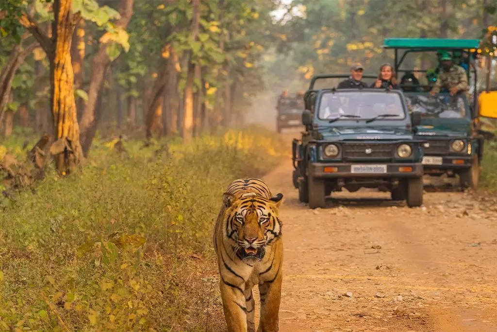
| Bardiya National Park | Road | Around half a day | Tiger and rhino country, easiest wildlife add-on to a Karnali trip |
Two planning notes follow from that table. First, if your itinerary includes both mountains and wildlife, do the wildlife on the way out rather than the way in, because mountain flights and roads slip and the tail of a trip absorbs delay better than the head. Second, Nepalgunj rather than Surkhet is the right airport for onward flights to Juphal, Simikot and Jumla, so build the connection in deliberately. Our route breakdown for the whole region is at how to get to west Nepal.
Climate, seasons and when to come
Surkhet is low and it gets hot. April through June is uncomfortable on the valley floor, with temperatures well above what anyone arriving from the hills expects. The monsoon brings heavy rain and the usual consequences for the highway north, including landslide closures that can strand travellers in the town for days. October to March is the sensible window, and the winter months are mild and clear.
Note the mismatch with the mountains. The best trekking season for Dolpa is the summer, and the best season for Surkhet is the winter, so a well-planned trip treats the valley as a transit point in one direction and does not linger. If you are combining regions, our ten-day Karnali circuit itinerary shows one workable sequence.
Practical information for travellers
Birendranagar has the widest range of accommodation in Karnali Province, from basic lodges to mid-range hotels with reliable power and hot water. It also has functioning banks and ATMs, which is worth emphasising: north of here, cash availability becomes unreliable fast, and drawing what you need for the entire mountain leg before leaving is standard practice.
Buses and shared jeeps for the mountain districts leave early, often before dawn, and seats on the popular routes go quickly in season. Booking the previous evening is normal. For anything involving restricted areas further north, permits are arranged in Kathmandu or Nepalgunj rather than here. See the destination page for Surkhet for what is worth an extra day.
FAQ
Is Surkhet the capital of Karnali Province?
Yes. Birendranagar, the main town in the Surkhet valley, serves as the provincial capital and holds the administrative offices, the airport and the main hospitals for the province.
How do you get to Surkhet from Kathmandu?
By air to the Surkhet airport, or by road via the east-west highway and Nepalgunj. Flights are quickest; the bus is an overnight journey.
What is there to see in Surkhet?
Kakrebihar, a twelfth-century temple and monastery ruin on a hillock near town, is the main historic site. Bulbule Tal park, the Deuti Bajai temple and the surrounding valley rim viewpoints fill out a day.
How long does it take to drive from Surkhet to Jumla?
Plan on a long day at minimum and two days in poor conditions. The Karnali Highway is unsealed for much of the route and monsoon landslides regularly add unplanned delays.
When is the best time to visit Surkhet?
October to March. The valley floor is very hot in late spring and the monsoon disrupts the road north, while the winter months are mild, dry and clear.