Western Nepal holds roughly a third of the country's Himalaya and a tiny fraction of its trekkers. While Everest and Annapurna absorb the great majority of Nepal's trekking traffic, the trails through Karnali and Sudurpashchim stay quiet enough that you can walk for days between foreign faces. That is the appeal, and it is also the thing to plan around: fewer trekkers means fewer lodges, fewer rescue options, and logistics that reward preparation.
This guide covers what actually differs about trekking here — the three distinct mountain regions, how the routes compare, what permits cost, and when to come. Each route links through to its full itinerary.
The three trekking worlds of Western Nepal
It helps to stop thinking of “Western Nepal” as one place. The trekking here divides into three regions that differ in altitude, culture, paperwork and cost, and choosing between them is most of the planning decision.
1. The Karnali mid-hills — Rara, Khaptad, Rukum
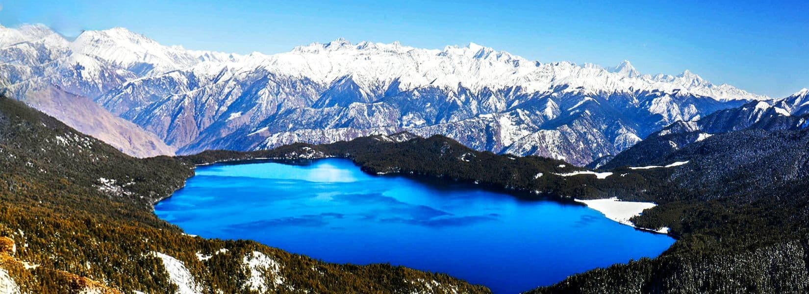
Green ridges between roughly 2,000 and 3,700 metres, forested in blue pine, oak and rhododendron, dotted with Khas villages. This is the gentlest introduction to the region: no restricted-area permit, moderate altitude, and a real chance of walking with no acclimatisation problems at all. Rarais the headline — Nepal's largest lake, sitting in a national park where the water turns from green to deep blue as the light moves. Khaptad is a rolling plateau of open meadow that feels more like an upland moor than the Himalaya, and carries genuine spiritual weight for Nepali pilgrims.
Best for: first-time visitors to Western Nepal, trekkers with 7–10 days, anyone who wants Himalayan scenery without a 5,000-metre pass.
2. The trans-Himalaya — Dolpa and Humla
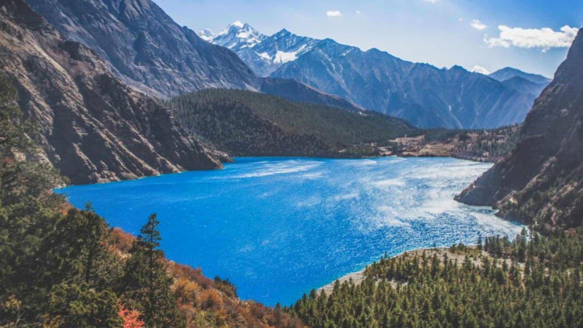
Cross the main Himalayan range and the landscape inverts: the green stops, and you walk into a high, dry, Tibetan-plateau world of ochre cliffs, barley terraces and mud-brick gompas. Shey Phoksundo and Humla's Limi Valley are the two great routes, and both are serious undertakings — two to three weeks, passes over 4,900 metres, and a restricted-area permit that dominates the budget.
These are the most culturally intact treks in Nepal. The Tibetan Buddhist communities in upper Dolpa and Limi have been shaped by the salt trade routes rather than by tourism, and it shows.
Best for: experienced trekkers with three weeks and a real budget, photographers, anyone who has done Everest or Annapurna and wants the opposite experience.
3. The Far West — Api, Saipal and Darchula
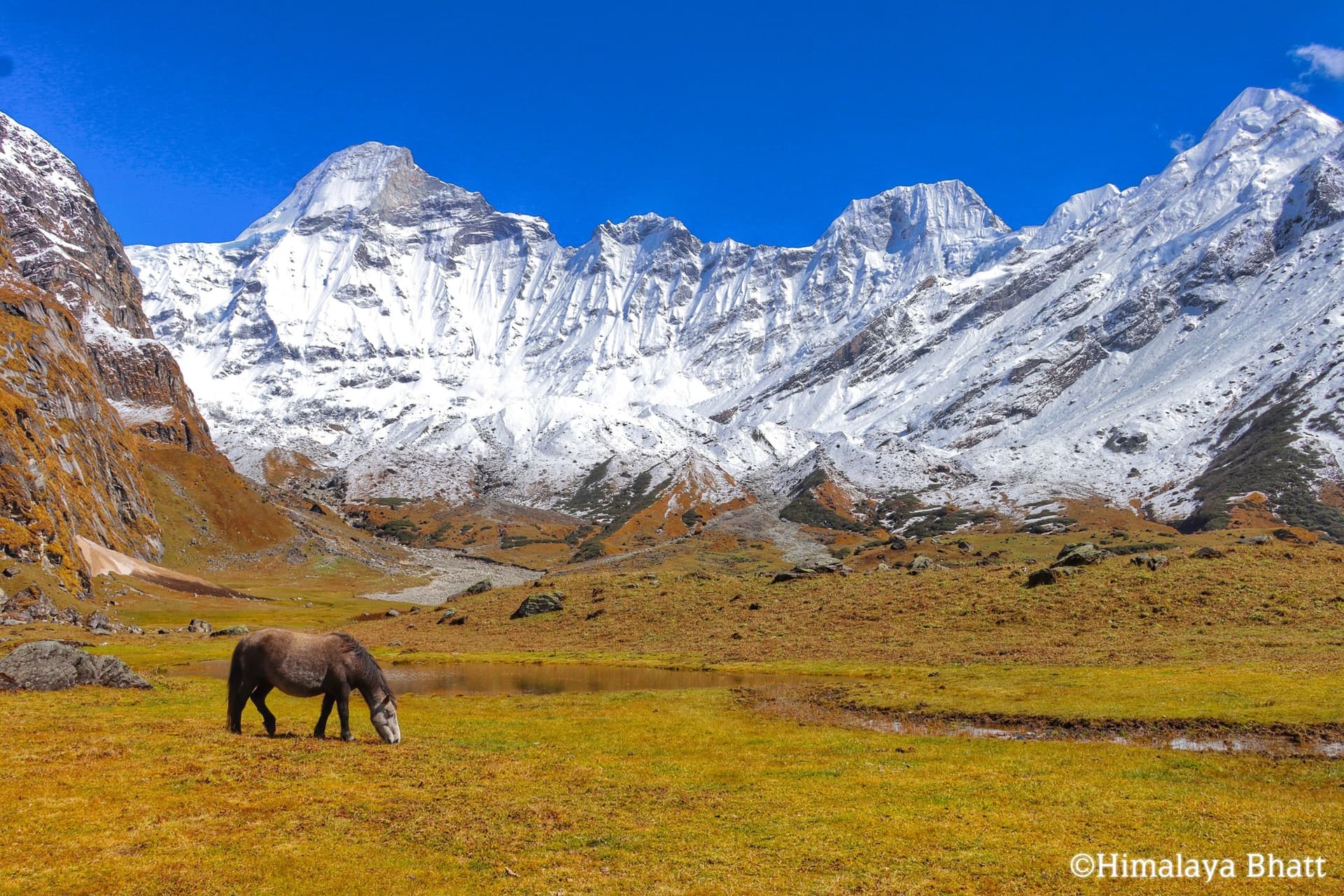
Nepal's least-visited Himalaya, tucked into the corner where Nepal meets India and Tibet. Api (7,132 m) and Saipal (7,031 m) are big, steep, glaciated mountains that almost nobody photographs. The trekking is strenuous, the trails are working village paths rather than tourist infrastructure, and camping is usually necessary.
Best for: trekkers who actively want the absence of other trekkers and accept rougher conditions to get it. See the Api–Saipal Himalaya guide for the full picture.
Compare the routes
| Route | High point | Days | Grade | Season | Permit |
|---|---|---|---|---|---|
| Rara Lake | 3,000–3,700 m | 7–10 | Moderate | Apr–Jun, Sep–Nov | Park entry |
| Khaptad | ~3,200 m | 7–9 | Moderate | Mar–Jun, Sep–Nov | Park entry |
| Rukum–Rolpa Circuit | ~3,200 m | 7–10 | Moderate | Mar–Jun, Sep–Nov | None |
| Dhorpatan | 3,000–3,900 m | 9–12 | Challenging | Mar–Jun, Sep–Nov | Reserve entry |
| Shey Phoksundo / Dolpa | Over 5,000 m | 14–18 | Challenging | May–Oct | Restricted area |
| Humla Limi Valley | Over 4,900 m | 16–20 | Challenging | May–Oct | Restricted area |
| Api Base Camp | 4,000 m+ | 10–14 | Strenuous | Apr–Jun, Sep–Oct | Conservation area |
| Saipal Base Camp | 4,000 m+ | 14–18 | Strenuous | May–Oct | Conservation area |
High points are banded rather than exact, and permit rules and fees are revised periodically by the Department of National Parks and Wildlife Conservation and the Department of Immigration. Confirm current figures before you commit — or ask us and we will check.
Permits: the part that decides your budget
Western Nepal contains some of Nepal's restricted areas, and the permit regime is the single biggest cost difference between routes. Broadly, there are three tiers.
No permit or park entry only. Rukum, Rolpa and much of the Karnali mid-hills need nothing beyond a TIMS card where applicable. Rara and Khaptad need a national park entry fee. This tier is cheap.
Conservation area. Api Nampa and the surrounding conservation areas charge an entry fee that is higher than a park fee but far below a restricted-area permit.
Restricted area. Upper Dolpa, Humla and parts of Mugu require a restricted-area permit issued per person per week, and it is expensive — this is typically the largest single line in a Dolpa or Humla budget. Restricted-area permits also legally require a registered agency, a licensed guide, and a minimum group size, so independent solo trekking is not an option in these zones. The full breakdown is in our restricted area permits guide.
When to go
The standard Nepal advice — October–November and March–May — holds for the mid-hills and the Far West, but it is wrong for Dolpa and Humla.
Because those regions sit in the Himalayan rain shadow, the monsoon that shuts down the rest of Nepal barely reaches them. June to September, the worst months almost everywhere else, are among the best months to be in upper Dolpa or Limi. That inversion is genuinely useful: it lets you build a Himalayan trek in a season when Everest and Annapurna are wet, leeched and clouded in.
Autumn gives the clearest air and most stable weather. Spring brings rhododendron through the mid-hills and warmer nights. Winter closes the high passes and makes Rara bitterly cold, though Bardiya and the Terai are at their best. Season-by-season detail is in the best time to visit guide, and cost varies with it — see trekking costs by season.
Getting to the trailheads
Nearly every Western Nepal trek starts with a flight from Kathmandu to Nepalgunj, then a second, much smaller flight into the hills — Jumla for Rara, Juphal for Dolpa, Simikot for Humla. Those mountain legs are weather-dependent and cancellations are routine, which is why a realistic itinerary carries two spare days at each end. Treat a same-day international connection after a mountain flight as a mistake, not a risk.
Road access has improved substantially and now reaches places that were a multi-day walk a decade ago, but the roads are rough and slow. Full options in how to get to West Nepal.
Altitude, lodging and food
Do not assume the teahouse infrastructure of the Annapurna or Everest trails. Rara, Khaptad and Rukum have basic lodges and homestays. Dolpa, Humla and the Far West are largely camping treks with a supported crew, which is a large part of why they cost what they do. Food is simple and repetitive — dal bhat, potatoes, noodles, tsampa higher up.
Altitude is the real risk on the trans-Himalayan and Far West routes. Several cross passes near or above 5,000 metres, often with limited options to descend quickly and helicopter evacuation that can be hours away or grounded by weather. Build acclimatisation days in and know the symptoms before you go — our altitude guide covers prevention and the point at which you must descend.
Still deciding?
If you have never trekked in Nepal, start with Rara. If you have done the classics and want something that feels genuinely remote, go to Dolpa or Humla. If you want a mountain almost nobody has photographed, go to Api. And if you are weighing this region against the famous ones, we wrote the honest comparison: West Nepal vs Everest and Annapurna.