
Until the 1960s the most valuable cargo crossing the Nepal Himalaya was not gold, musk or wool. It was salt. Caravans of yak, crossbred dzo, sheep and goats carried it south from the brine lakes of the Tibetan plateau, over passes above five thousand metres, down into the middle hills, and returned north loaded with grain. The exchange ran for centuries. It paid for the monasteries of Dolpo, the trading houses of Thak Khola and the survival of villages in Humla and Mugu that could never have fed themselves from their own fields.
Then, within about a single generation, it stopped. Understanding why explains a great deal about why the high border districts of Nepal look the way they do today.
Why Salt Moved South and Grain Moved North
The logic is geography. The Tibetan plateau has salt in abundance, deposited in shallow lakes that dry out each summer and can be scraped and bagged by pastoralists. What it cannot do at four thousand five hundred metres is grow rice, maize or much wheat. The Nepali middle hills are the mirror image: no salt at all, but terraces producing rice, maize, millet, barley and buckwheat in quantity.
Between the two sat a narrow band of Tibetan-speaking Nepali communities living at three to four thousand metres in Humla, Mugu, Dolpo, Mustang, Manang, Rasuwa and the far eastern valleys. They could not live on their own harvest either. What they had was position, animals, pasture rights, language and the family connections to work both sides. They became the brokers, and the trade defined their year.
The Routes and the Passes
There was never one salt road. There were dozens, each tied to a particular pass, a particular market town on the Tibetan side and a particular set of villages below.
| Corridor | Nepali district | Main pass or crossing | Tibetan market | Status today |
|---|---|---|---|---|
| Karnali headwaters | Humla | Nara La and Hilsa | Purang, also called Taklakot | Open border point; road on the Tibetan side |
| Mugu Karnali | Mugu | High passes north of Mugu village | Purang area | Largely dormant; local movement only |
| Dolpo | Dolpa | Passes above Shey, Charka and Tinje | Northern plateau settlements | Small seasonal caravans continue |
| Kali Gandaki and Thak Khola | Mustang | Kore La above Lo Manthang | Southern Ngari markets | Road built; trade in modern goods |
| Trishuli headwaters | Rasuwa | Rasuwagadhi | Kyirong | Major modern trade crossing |
| Arun and Tamor | Sankhuwasabha and Taplejung | Kimathanka and Tipta La | Eastern plateau markets | Limited; poor road access on both sides |
The Karnali corridor
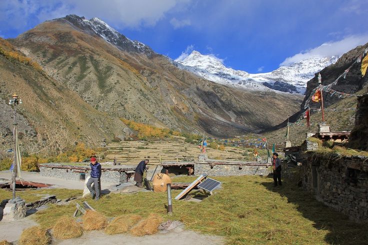
Humla was the westernmost link. Traders from Limi, Yari and the upper Humla Karnali crossed to Purang, exchanged grain and rice for salt and wool, and moved the salt south to Simikot, then on to Jumla, Kalikot and eventually the Terai markets. It was slow, and the whole system depended on grain carried up from lower districts in the first place. Limi valley households still hold grazing agreements across the border that predate any modern demarcation, and this guide to Humla and Limi describes what remains of that world.
Dolpo
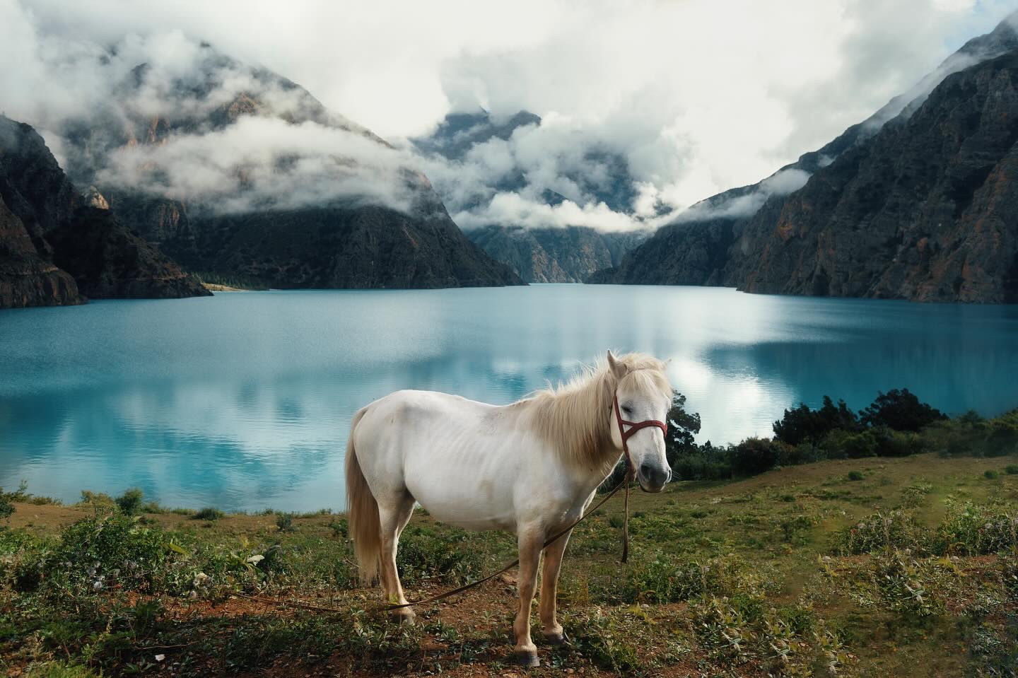
Dolpo ran the most complicated version of the system, because Dolpo villages sat too high to grow enough grain and too far north for easy access to the middle hills. A Dolpo household might spend the summer moving salt down from the plateau, the autumn exchanging it for grain in Tichurong and the Bheri valleys, and the winter grazing animals wherever pasture and permission could be found. The anthropological literature on this, particularly the work done in Dolpo in the 1960s and 1970s, remains the clearest published account of how a trans-Himalayan trading economy actually functioned. The route passes close to Shey Phoksundo, and the pilgrimage circuit around Shey Gompa follows old trading tracks.
Thak Khola and Mustang
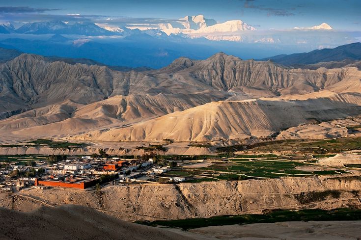
The Kali Gandaki is the deepest gorge on earth and, more usefully, the lowest and easiest north-south corridor through the Nepal Himalaya. That made Thak Khola the most commercially successful of all the salt routes. Thakali families based around Tukuche did not merely trade salt; in the nineteenth century they held the government contract on the salt trade for the region, and used the revenue to build the tall stone trading houses that still line the villages of the upper valley. Upper Mustang and the walled town of Lo Manthang sit at the top of the same corridor, which is why a small kingdom in a rain shadow could afford fifteenth-century monastery painting of that quality.
How a Caravan Actually Worked
Yak and dzo carried the heaviest loads but need good pasture and cannot go far below about three thousand metres without suffering. Sheep and goats carried perhaps five to ten kilograms each in small woollen saddlebags, moved slowly and grazed as they went, which made them ideal for long descents into the middle hills. A single household might move several hundred animals in a season.
Exchange was rarely a cash transaction. It ran on fixed ratios of salt to grain, which shifted with distance from the border, the season and the harvest. Relationships mattered more than prices. Traders maintained long-term partnerships with specific households on both sides of the range, often formalised as fictive kinship and inherited across generations. Those bonds carried credit, hospitality and information as well as goods.
The calendar was dictated by snow and monsoon. Passes opened in early summer and closed in autumn. Salt came south before the high snow, grain went north immediately after the hill harvest, and animals wintered low. Whole families moved with the cycle, which is why so many high villages are half-empty for part of the year and why the trail networks that trekkers now use were built and maintained by people carrying salt.
Why the Trade Collapsed
Two things happened at once. From 1959 the political situation in Tibet changed and border movement came under much tighter state control on the northern side, with trade increasingly channelled through official points rather than through the informal network of passes and partnerships. Free movement by individual herding households became difficult where it had been routine.
At the same time, cheap iodised sea salt from India began arriving by rail and road into the Nepali Terai. Once roads reached the hill bazaars, Indian salt was simply cheaper than salt carried on a goat for three weeks. Public health policy accelerated the change. Iodine deficiency was widespread in the hills, causing goitre and worse, and from the 1970s the government promoted iodised salt distribution nationally. Tibetan rock salt, which is not iodised, was actively discouraged.
The economic result was severe for the northern districts. A trading system that had underpinned entire valleys lost its purpose within about twenty years, and the response was migration, a shift into herding and, later, into tourism, medicinal herb collection and remittance work.
What Survives
Trade across the range did not end; it changed shape. Trucks now bring Chinese manufactured goods through Rasuwagadhi, Hilsa and Tatopani. Small caravans still cross in Dolpo and Mustang in season, carrying different cargo. Herders in Limi still take animals across for grazing under long-standing arrangements. And the physical legacy is everywhere: mule tracks, ruined caravanserais, mani walls raised by traders for safe passage, chorten at the top of every pass, and the trading-house architecture of Tukuche and Marpha.
Practical Information for Travellers
Most of the salt routes lie inside restricted areas. Upper Mustang, upper Dolpo and Humla all require special permits, a registered agency and a minimum group size, and the rules change from time to time. Do not rely on figures quoted online; check current requirements before booking, and read this guide to restricted area permits for Dolpa, Humla and Mugu first.
Season is the opposite of the rest of Nepal. These valleys sit in the Himalayan rain shadow, so June to September, the monsoon months elsewhere, are often the best time to walk them. Access is usually by air: Nepalgunj to Simikot for Humla, Nepalgunj to Juphal for Dolpo, Pokhara or Jomsom for Mustang. Flights are weather-dependent and cancellations are normal, so build several spare days into any trip. Altitude is the real constraint; most of these routes stay above four thousand metres for days at a time and demand a proper acclimatisation plan.
FAQ
What was the trans Himalayan salt trade?
A centuries-old exchange in which salt from Tibetan plateau lakes was carried south over Himalayan passes by pack animals and traded for grain grown in the Nepali middle hills.
Which Nepali regions depended on the salt trade?
Mainly the high border districts: Humla, Mugu, Dolpa, Mustang, Manang, Rasuwa and the upper Arun and Tamor valleys, along with the middle-hill markets that supplied the grain.
Why did the salt trade decline?
Tighter control of border movement from 1959 combined with cheap iodised sea salt arriving from India by road. Public health campaigns promoting iodised salt also discouraged the untreated Tibetan product.
Can you still see salt caravans in Nepal?
Small caravans still move in Dolpo, Mustang and Humla during the trading season, though the cargo today is usually grain, household goods and Chinese imports rather than salt.
Do you need a permit to trek the old salt routes?
Yes for most of them. Upper Mustang, upper Dolpo and Humla are restricted areas requiring a special permit arranged through a registered agency, usually with a minimum group size.