
Every district headquarters in Nepal can be reached by road except one. Simikot, the administrative centre of Humla, sits at roughly 2,950 m in the far north-west of the country and has never been connected to the national road network. Everything that arrives there and is not grown locally arrives by aircraft from Nepalgunj or Surkhet, or on the back of a mule from the Tibetan border. Rice is flown in. Cement is flown in. That single logistical fact shapes the price of everything, the diet of everyone, and the pace of any journey you make in the district.
Humla is also the district where the Karnali river system begins its Nepali course, where Tibetan Buddhist and Hindu hill worlds sit within a day of each other, and where the classic pilgrimage route to Mount Kailash crosses out of Nepal. It is, by most measures, the least accessible district in the country, and the reason people go.
Where Humla is and how the land is arranged
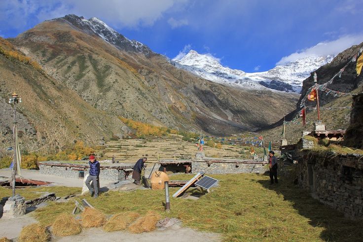
Humla occupies the north-western corner of Karnali Province, bordering the Tibet Autonomous Region of China to the north and west, Mugu to the east and Bajura and Bajhang to the south. The Humla Karnali river runs through the middle of it, a fast, deep-cut river that gives the district its shape: a main trunk valley with steep tributary valleys hanging above it, and very little flat ground anywhere.
Elevation runs from roughly 1,500 m at the lowest river points to well over 6,000 m on the northern ridges. The change over that span is total. The lower and southern valleys are Hindu, Nepali-speaking, terraced and farmed by Thakuri, Chhetri and occupational-caste communities. The upper valleys, north and west toward the border, are culturally Tibetan, Buddhist, and organised around yak, barley, salt trade and monasteries. The district is one of the clearest places in Nepal to see the cultural transition from the Hindu hills to the Tibetan plateau happen inside a single administrative unit.
Rainfall is low by Nepali standards, since the main Himalayan chain sits between Humla and the monsoon. The landscape reads as arid: juniper, birch, blue pine on shaded slopes, and long brown hillsides that look Tibetan rather than Nepali. Winters are long and hard, and the high passes carry snow for months.
Simikot, the Limi Valley and the route to the border
Simikot is the hub for everything. It has the airstrip, the district offices, the hospital, the police, the shops and the permit checks. Almost every itinerary in the district starts and ends there. From Simikot the main trail heads north-west along the Humla Karnali toward the border, passing the monastery at Yalbang, which belongs to the Nyingma tradition and is the largest religious institution in the district.
Further up, the trail climbs out of the river valley over Nara La and drops to Hilsa on the border. Hilsa is not a town in any conventional sense: it is a crossing point, a scatter of buildings and a bridge, and it exists because it is the shortest route from Nepal to Mount Kailash and Lake Manasarovar. Nepali and Indian pilgrims have used the Simikot to Hilsa line for a very long time, and in recent decades helicopter shuttles have made it a busy seasonal corridor.
The Limi Valley branches away north-east, a high side valley with three villages, Til, Halji and Jang, that are among the most culturally intact Tibetan settlements in Nepal. Halji holds Rinchenling monastery, an old foundation with wall paintings that specialists rate very highly. Limi is reached over high passes, is snowbound for a large part of the year, and historically traded and grazed across the border rather than southward, which is why the culture there points north.
| Place | Approximate elevation | What it is |
|---|---|---|
| Simikot | 2,950 m | District headquarters, airstrip, permits, last reliable supplies |
| Yalbang | 3,000 m | Namkha Khyung Dzong monastery on the Karnali trail |
| Muchu and Yari | 3,600 to 3,900 m | Last Nepali villages before the border pass |
| Nara La | 4,600 m | Pass between the Karnali valley and the border |
| Hilsa | 3,700 m | Border crossing to Purang in Tibet, gateway to Kailash |
| Halji | 3,700 m | Limi village, Rinchenling monastery |
| Til and Jang | 3,900 to 4,000 m | The other two Limi settlements, barley and yak country |
People, livelihood and the annual rhythm
Humla has one of the smallest populations of any Nepali district and one of the most difficult food situations. Local grain production does not cover the year in most of the upper valleys, and subsidised rice flown or carried in has been a fixture of district life for decades. Households manage the gap with a mix of livestock, seasonal migration, trade over the border, and the summer harvest of yarsagumba in the high pastures, which for many families is the single largest cash event of the year.
Trade with Tibet is old and still functional. Salt and wool came south, grain and manufactured goods go north, and the modern version runs on Chinese consumer goods carried over the same passes. Border closures, which have happened for public health and political reasons, hit Humla harder than they hit almost anywhere else in Nepal, because the alternative supply line is an aircraft.
The religious calendar reflects the split geography. The Buddhist north observes Losar and the monastic festivals at Yalbang and Halji, with masked dances and long ritual cycles that draw the whole valley. The Hindu south keeps the standard hill calendar of Dashain, Tihar and local temple fairs, and the deuda song-and-dance tradition of the far west is alive in the lower villages.
Practical information for travelling in Humla
Access begins with a flight to Simikot, almost always from Nepalgunj, sometimes via Surkhet. The strip is short, high and weather-dependent, and cancellations are normal rather than exceptional. Build several spare days into any Humla itinerary, at both ends. A road is under construction from the border southward and sections of track now exist, but it is not a reliable through route and should not be treated as one when planning.
Northern Humla, including the Limi Valley and the border corridor, is a restricted area. Permits must be arranged in advance through a registered agency, a solo traveller cannot obtain one, and a licensed guide is required. Checks happen at Simikot and again on the trail. The framework is explained in the overview of restricted area permits, and the route detail is set out in the Limi Valley guide.
Go in the shoulder seasons. Late spring, from around May, and early autumn, from September into October, offer the most stable passes and the clearest air. Midsummer overlaps the yarsagumba harvest, when villages empty and porters are unavailable. Winter closes the high routes entirely.
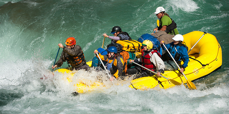
Carry everything you expect to need. Lodges in the district are basic where they exist and absent where they do not, and camping support is the norm on the Limi circuit. Altitude is a genuine concern, since Simikot itself is near 3,000 m and the passes go far above that, so read the acclimatisation rules before you fly in rather than after. Downstream, the same water system produces the whitewater of the Karnali river, and travellers with time sometimes pair a Humla trek with the river or with the high country around Limi itself.
FAQ
How do you get to Humla district?
By air to Simikot, usually from Nepalgunj and occasionally via Surkhet. There is no through road from the rest of Nepal, so flights and, from the north, the Hilsa border crossing are the only practical ways in.
Do I need a permit for Humla?
Yes for the northern part of the district, including the Limi Valley and the corridor to Hilsa, which is a restricted area requiring an agency-arranged permit and a licensed guide. Solo permits are not issued. Confirm current requirements before travelling.
When is the best time to visit Humla?
Late spring and early autumn. The passes are clear, the light is good and the trails are usable. Midsummer coincides with the yarsagumba harvest and monsoon flight disruption, and winter closes the high country.
Is Humla the starting point for the Kailash pilgrimage?
It is one of them. The Simikot to Hilsa route is the shortest overland approach from Nepal to Mount Kailash and Lake Manasarovar, and it is used heavily by pilgrims in season, subject to the border being open.
What is the Limi Valley like?
A high, dry side valley with three Tibetan Buddhist villages, old monasteries, yak herding and very little infrastructure. It is snowbound for much of the year and is one of the least-visited inhabited valleys in Nepal.