
Dolpa is the largest district in Nepal by area and one of the least populated. It covers close to eight thousand square kilometres of trans-Himalayan upland, and the people who live on all that ground would not fill a mid-sized Kathmandu neighbourhood. Almost none of it is served by a metalled road. For most visitors, reaching Dolpa still means a small aircraft onto a hillside airstrip followed by several days on foot.
That combination — vast, high and barely connected — explains everything else about the district. It is why a Tibetan Buddhist and Bon culture survived here in a form that faded further east decades ago. It is why the region became the setting for one of the best known books ever written about the Himalaya, and later for a Nepali-language film that reached an international audience. It is also why Dolpa does not work as a weekend addition to an Annapurna trip. The district asks for time and it does not negotiate.
Where is Dolpa and why does it feel so remote
Dolpa occupies the northwestern corner of Karnali Province. Tibet lies along its northern rim. Mugu and Jumla sit to the west, Jajarkot and Rukum to the south, and Myagdi and Mustang to the east. The line that matters is not political, though. It is the main Himalayan chain, which runs through the southern half of the district and blocks the monsoon before it can cross. North of that wall the country turns brown, dry and enormous: bare ridges, juniper scrub, and villages of flat-roofed stone houses that look far more Tibetan than Nepali.
The elevation range is extraordinary. Southern valleys along the Thuli Bheri drop to warm terraced farmland where rice and citrus grow. The Kanjiroba massif in the centre of the district rises to just short of 6,900 m. Between those extremes most of the inhabited country sits somewhere between 2,500 m and 4,300 m, and the trails linking one valley to the next cross passes above 5,000 m. There is no low route through Dolpa. Anyone travelling between the main settlements crosses high ground repeatedly, which is why itineraries here are counted in weeks rather than days.
Lower Dolpa and Upper Dolpo are two different journeys
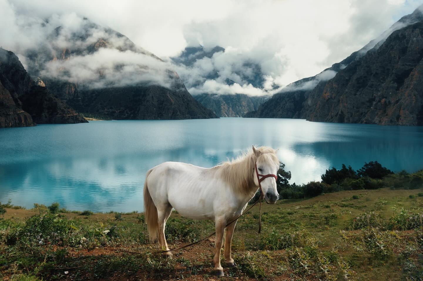
Travellers use the name loosely, which causes real confusion when planning. Lower Dolpa means the southern and central part of the district: the Juphal airstrip, the district headquarters at Dunai, the Suli Gad gorge and Phoksundo Lake. This is the shorter trip. A fit walker can fly in, reach the lake, spend a day there and fly out again inside a fortnight, and much of the route stays below 4,000 m.
Upper Dolpo is the country beyond the high passes north of the lake: Shey Gompa, Saldang, Namgung, Tinje and the settlements strung along the Tibetan frontier. This is a genuinely committing expedition. Getting in requires crossing at least one pass above 5,000 m, and every day after that is spent at altitude with no realistic way to shortcut out. Three weeks is a sensible minimum and four is more comfortable. The two zones also carry different permit categories, which is the practical reason the distinction matters more than any scenic one. Our overview of the northwestern restricted zones covers that paperwork in detail at restricted area permits for Dolpa, Humla and Mugu.
Bon, Buddhism and the old salt road
Dolpo has always looked north. For centuries the valleys were part of a Tibetan cultural and economic sphere rather than a Nepali one, and the household economy rested on a simple exchange: salt carried down from the Tibetan lakes, traded against grain grown in the middle hills. Yak and sheep caravans made the crossing every year. That trade shaped the settlement pattern, the seasonal calendar and the social hierarchy of the whole region.
It also carried religion. Dolpo holds some of the most intact Bon communities anywhere, alongside Nyingma Buddhist monasteries, and in many villages the two traditions sit side by side without much fuss. Crystal Mountain near Shey Gompa is circumambulated as a pilgrimage in the same way Mount Kailash is, and the ritual calendar in the upper valleys still runs on a Tibetan reckoning rather than the Nepali one used in Kathmandu.
The salt trade collapsed in the second half of the twentieth century, undercut by cheap iodised Indian salt arriving by road from the south and constrained by the closing of the northern border. What replaced it, for better and worse, is yarsagumba: the caterpillar fungus collected on the high pastures in late spring and sold into the Chinese medicinal market. In collection season entire villages move uphill, schools thin out, and cash flows into households that previously had almost none.
Shey Phoksundo National Park
Most of northern Dolpa lies inside Shey Phoksundo National Park, the largest national park in Nepal. It was created to protect trans-Himalayan habitat that is poorly represented elsewhere in the country: dry alpine steppe, juniper and birch forest, and the deep glacial lake that gives the park half its name. Phoksundo itself is startling in person. The water is an intense mineral blue, the shoreline is nearly vertical in places, and the outflow drops as one of the highest waterfalls in Nepal.
The wildlife list is the classic high-altitude one: snow leopard, blue sheep, Himalayan wolf, musk deer and Himalayan black bear at lower elevations. Sightings of the cats are rare and largely a matter of luck and patience, though camera-trap work in the park has confirmed a meaningful resident population. For a wider look at the district beyond the lake, see our piece on the parts of Dolpa most itineraries skip, and the destination page for Shey Phoksundo Lake.
The Dolpo year: festivals, harvest and collection season
Because the upper valleys run on a Tibetan calendar, the biggest celebration is Losar, the new year, marked in the depth of winter with masked dance, archery and household visiting. Monastery festivals fall through the warmer months and vary from gompa to gompa. The Shey festival at Crystal Mountain is the most famous of them, held on a long cycle rather than annually, which means catching it takes planning years ahead rather than weeks.
The agricultural year is compressed into a short window. Barley, buckwheat, potato and mustard go in once the ground thaws and come out before the first serious snow. Between those two points falls the yarsagumba season, and it distorts everything: guides, porters and pack animals become scarce and expensive in late spring precisely because the local labour force has better things to do.
Getting to Dolpa: flights, permits and walking days
The standard approach is a flight from Nepalgunj to Juphal, a short airstrip cut into a hillside above the Thuli Bheri. Flights are weather-dependent and cancellations are normal rather than exceptional, so any Dolpa itinerary needs spare days at both ends. From Juphal it is a short descent to Dunai, and from Dunai the trail follows the Suli Gad north towards the lake. Road construction has been pushing further into the southern part of the district for years, and rough vehicle access now reaches places that were multi-day walks a decade ago, but conditions change season to season and no one should plan around it.
Both Lower and Upper Dolpo are restricted areas. That means travelling through a registered Nepali trekking agency with a licensed guide rather than independently, and it means permits are arranged in Kathmandu or Nepalgunj before departure rather than on arrival. Because the district lies in the rain shadow, the season is unusual for Nepal: the monsoon months that wash out trekking elsewhere are perfectly workable here, and the practical window runs from late spring through to October.
| Local unit | Type | What it covers |
|---|---|---|
| Thuli Bheri | Municipality | Contains Dunai, the district headquarters, and the Juphal airstrip approach |
| Tripurasundari | Municipality | Tripurakot and the middle Thuli Bheri valley |
| She Phoksundo | Rural municipality | Phoksundo Lake, Ringmo village and the park core |
| Dolpo Buddha | Rural municipality | Upper Dolpo settlements north of the passes, including the Saldang area |
| Chharka Tangsong | Rural municipality | The far northeast, on the old walking route towards Mustang |
| Kaike | Rural municipality | Named for the Kaike language, spoken in only a handful of villages |
| Jagadulla | Rural municipality | Southern valleys draining towards the Bheri |
| Mudkechula | Rural municipality | The southeastern corner, towards the Rukum and Myagdi borders |
Once you are inside the district, the honest advice is to slow down. Dolpa punishes tight scheduling. Weather closes passes, flights slip by days, and pack animals are not always where they were promised. Travellers who build in slack come home talking about the villages. Travellers who do not come home talking about the airport. The wider planning picture for the region is covered in our guide to Dolpa as a destination.
FAQ
How long does a trek in Dolpa take?
A Lower Dolpa trip to Phoksundo Lake and back generally needs around two weeks including buffer days for flights. Upper Dolpo needs three to four weeks because the route crosses several high passes with no quick exit.
What is the best time to visit Dolpa?
Late spring through October. Because the district sits in the Himalayan rain shadow, the monsoon that closes trails elsewhere in Nepal has limited effect here, and the summer months are among the most reliable.
Can you trek Dolpa independently without a guide?
No. Both Lower and Upper Dolpo are restricted areas, which means arranging permits through a registered Nepali agency and travelling with a licensed guide. Independent trekking is not permitted.
How do you get to Dolpa from Kathmandu?
The usual route is a flight to Nepalgunj, then a second short flight to the Juphal airstrip. Both legs are weather-dependent, so allow spare days on either side of the trek.
Is Dolpa suitable for a first trek in Nepal?
Rarely. The altitude, the remoteness and the lack of evacuation options make it a poor first choice. Most people arrive here after Everest, Annapurna or Manaslu, and that experience is genuinely useful.