
Ask a Nepali where they are from and the answer is usually a district. Not a province, not a city, not a region: a district. Jumla. Solukhumbu. Kailali. It is the unit that appears on a citizenship certificate, the unit that has a police headquarters and a hospital and an airstrip, and the unit that determines which office issues which document. For travellers it is also the most useful mental map of the country, because trekking permits, road logistics and weather patterns all resolve at district level long before they resolve at province level.
There are 77 of them. That number is recent, and the arrangement above them is more recent still.
Where the district map came from
Before the middle of the twentieth century the country was administered through a patchwork of older units inherited from the Shah and Rana periods, layered onto principalities that had been absorbed during the eighteenth-century unification. The modern grid arrived with the Panchayat reorganisation of the early 1960s, which divided Nepal into 14 zones and 75 districts. The zones ran in strips from the plains up to the Tibetan border, an arrangement designed as much to knit the lowlands to the hills as to administer them.
That structure lasted more than fifty years and shaped how the country thinks about itself. Vehicle plates, regional cricket, school textbooks and the phrase your district office all date from it. Then the 2015 constitution abolished the zones entirely, replaced them with 7 provinces, and rearranged the layer below into 753 local units: 6 metropolitan cities, 11 sub-metropolitan cities, 276 municipalities and 460 rural municipalities. Two districts were split in the process, taking the count from 75 to 77. Nawalparasi became Nawalpur and Parasi, and Rukum was divided into Rukum East and Rukum West, which now sit in different provinces.
The result is a genuinely three-tier system: province, district, local unit. Politically the province and the local unit have the power. The district survived as an administrative and judicial layer, and in daily life it survived as identity, which is why almost nobody says they are from Bagmati Province.
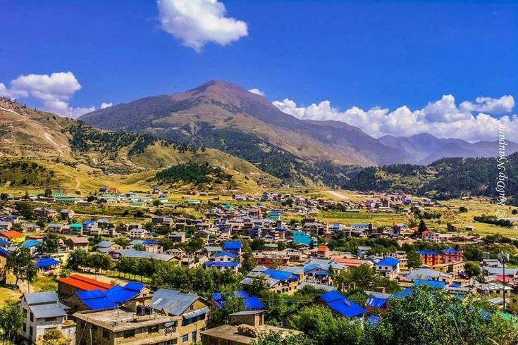
The seven provinces and how the districts split between them
Every district belongs to exactly one province. The distribution is uneven because it follows population and terrain rather than area, which is why Karnali covers a vast expanse of mountain with relatively few districts while Madhesh packs eight into a thin, dense strip of plain.
| Province | Districts | Capital | What it covers |
|---|---|---|---|
| Koshi | 14 | Biratnagar | Eastern hills and plains, Kanchenjunga, Ilam, Everest approaches from the east |
| Madhesh | 8 | Janakpur | Entirely Tarai, the most densely settled province, Mithila cultural region |
| Bagmati | 13 | Hetauda | Kathmandu Valley, Langtang, Chitwan, the central hills |
| Gandaki | 11 | Pokhara | Annapurna, Manaslu, Mustang, the lake country around Pokhara |
| Lumbini | 12 | Deukhuri | Buddha birthplace, Dang and Banke plains, Rukum East |
| Karnali | 10 | Birendranagar | Largest province by area, Rara, Dolpa, Humla, Jumla |
| Sudurpashchim | 9 | Godawari | Far west, Khaptad, Api, Shuklaphanta, the Doti and Baitadi hills |
Two districts are worth knowing as bookends. Dolpa in Karnali is the largest district by area in Nepal, an expanse of trans-Himalayan plateau bigger than several provinces of neighbouring countries, with a population that would fit comfortably into one Kathmandu neighbourhood. Bhaktapur in Bagmati is the smallest, a compact valley district that you can drive across in under an hour and that contains one of the finest medieval urban ensembles in South Asia.
The three-band geography behind the boundaries
Nepal is conventionally read in three horizontal bands, and most districts belong clearly to one of them. The Tarai is the flat, hot, fertile southern strip along the Indian border, where roughly half the population now lives and where the main east-west highway runs. The hills, or Pahad, are the middle band between about 700 m and 3,000 m, where the terraced landscape of the standard Nepal photograph comes from and where most district headquarters sit. The Himal is the high band, running from around 3,000 m to the summit ridge, thinly populated and Buddhist in culture across much of its length.
Several districts contain all three bands, and those are the interesting ones. A district like Sankhuwasabha or Bajhang can begin in subtropical forest and end on a glacier, which means a single district office may be responsible for rice paddies and yak pasture in the same fiscal year. It also means altitude, not distance, is the variable that matters when planning movement between two points in the same district.
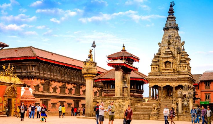
Which districts a traveller actually deals with
Most visitors interact with a surprisingly small number. Kathmandu, Lalitpur and Bhaktapur cover the valley. Kaski covers Pokhara and the start of the Annapurna trails. Chitwan and Bardiya cover the two most-visited national parks. Solukhumbu covers the Everest region, Manang and Mustang cover the north side of the Annapurna range, and Taplejung covers Kanchenjunga.
The west is where district knowledge starts to pay for itself, because the names are less familiar and the logistics are less forgiving. Mugu holds Rara Lake. Dolpa holds Phoksundo and the trans-Himalayan valleys beyond it. Humla holds Simikot and the route to the Tibetan border. Jumla is the historic centre of the Khas Malla world and the road and air gateway to the whole northern Karnali. Surkhet, in the low hills, is the provincial capital and the point where the paved network gives out. Bajura, Achham, Doti, Bajhang, Darchula and Baitadi make up the far-western hills where Khaptad National Park and the Api range sit.
Districts also matter for paperwork. Restricted-area permits are issued for specific areas within named districts, are checked at police posts inside those districts, and are not transferable to the district next door. A trek that crosses a district boundary can therefore cross a permit boundary without the map showing anything at all, which is the single most common planning error in western Nepal. The practical detail is covered in the guide to restricted area permits.
Practical information for planning by district
Three habits make the district map useful rather than decorative. First, plan movement between district headquarters, because those are where flights land, where jeeps depart, where fuel exists and where a bank or a pharmacy can be found. Second, check whether your route stays inside one district or crosses into another, since that determines permits, checkpoints and often which road authority maintains the surface you are counting on. Third, treat district names as your search terms when looking for current road conditions, because Nepali news and local government notices report closures, landslides and bridge failures by district rather than by trail.
Finally, remember that district headquarters and district name are often different words. Jumla district is administered from Khalanga, Mugu from Gamgadhi, Humla from Simikot, Kaski from Pokhara, Surkhet from Birendranagar. Booking a flight to the district name rather than the town name is a good way to end up somewhere unhelpful. For an overview of how those gateways connect, the guide to getting to west Nepal maps the flights and road heads that link them.
FAQ
How many districts does Nepal have?
Nepal has 77 districts, distributed across 7 provinces. The count rose from 75 after the 2015 constitution, when Nawalparasi was split into Nawalpur and Parasi and Rukum was split into Rukum East and Rukum West.
What happened to the 14 zones of Nepal?
They were abolished by the 2015 constitution and replaced by 7 provinces. Zone names such as Bagmati, Gandaki, Lumbini and Karnali survive as province names, but the boundaries are not the same and the old zonal administration no longer exists.
Which is the largest district in Nepal?
Dolpa in Karnali Province is the largest by area, a mostly trans-Himalayan district with a very small population. Bhaktapur in the Kathmandu Valley is the smallest by area.
Do I need to know districts to plan a trip to Nepal?
It helps considerably. Flights, jeep routes, permits, checkpoints, weather reports and road-closure notices are all organised by district, so knowing which districts your route passes through is more useful than knowing the province.
Is the district headquarters always the biggest town in the district?
Usually but not always, and it frequently has a different name from the district itself. Mugu is run from Gamgadhi, Humla from Simikot, Jumla from Khalanga and Kaski from Pokhara, so always confirm the town name before booking transport.