
Once a year, on the full moon of Shrawan, several thousand people walk uphill through cloud to a bare stone shrine on an open grass ridge at roughly 4,200 metres. There is no temple building, no ticket window and no road. Pilgrims sleep on the grass, light fires, sing through the night and come back down the next day. That shrine is Badimalika, and for most Nepalis it is the one thing they know about Bajura.
Bajura is a hill and high-mountain district in Sudurpashchim Province, in the north-eastern corner of the far west. Its headquarters is Martadi. It shares boundaries with Bajhang to the west, Humla and Mugu to the north and east, Kalikot across the Karnali to the south-east, and Achham and Doti to the south. It has never appeared on a standard Nepal itinerary. That is exactly the reason to look at it properly.
Where Bajura sits and how the land is arranged
Bajura reads as three horizontal bands. The lowest is river country: the Karnali cutting a hot, dry gorge along the eastern boundary, and the Budhiganga draining the centre of the district. Settlements down there are small and the slopes are steep, with rice grown wherever a terrace can be cut and held. The middle band is where most people actually live, and where Martadi and the market town of Kolti sit. Above that comes summer pasture, birch and rhododendron, then rock and snow on the ridges running north towards the Himalaya. Distances on a map mean very little in this terrain. A village two ridges away can be a full day of walking, most of it vertical.
A short history of Bajura and the Khas hills
Bajura’s history is the history of the western Khas world. From roughly the twelfth to the fourteenth century this whole region answered to the Khas Malla kingdom, whose winter seat lay at Sinja in what is now Jumla. When that kingdom broke apart, the hills fragmented into a scatter of small principalities, and the territory that became Bajura passed through the hands of local rulers until the expanding Gorkhali state absorbed the far west in the late eighteenth century. For the two centuries that followed it was administered from a distance, first inside the old Seti zone and later as a district in its own right. Motorable roads arrived very late and are still incomplete. Almost everything that feels remote about Bajura today follows directly from that history of being governed from somewhere else.
Badimalika: the shrine that defines the district
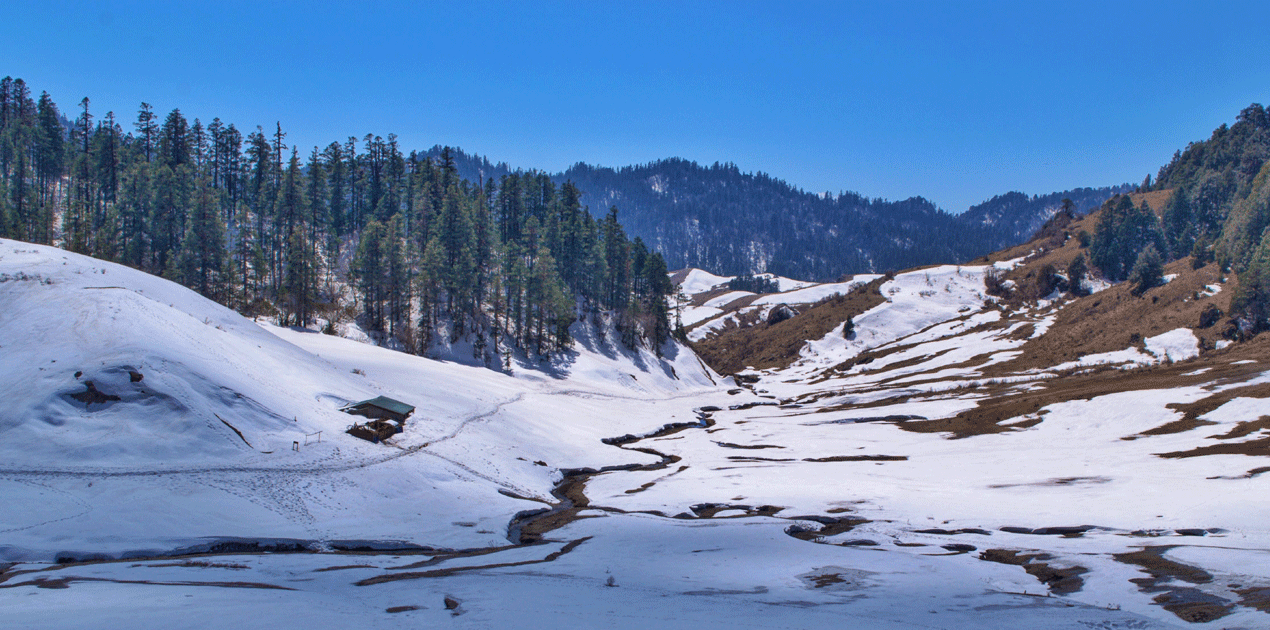
Badimalika is one of the great goddess seats of western Nepal, and devotees rank it alongside the major shakti shrines of the subcontinent. The goddess is Malika, a form of Bhagawati. The seat itself is not a building but an open alpine meadow with a low stone enclosure, and no priesthood lives there year round because snow closes the ridge for months. The main gathering falls on Janai Purnima, the Shrawan full moon in July or August, when people converge from Bajura, Bajhang, Achham, Doti and Kalikot, and a good number cross from the Indian hills as well. Most walk in over two to three days from the Martadi side or up from Achham. The full site notes are on the Badimalika Temple page.
Budhinanda Lake
Below the shrine lies Budhinanda, a small high lake that gives its name to one of the district municipalities. Pilgrims bathe there before the final climb to the ridge. In clear weather it holds a still reflection of the surrounding slopes, and in bad weather it vanishes into fog within minutes. Treat it as an alpine lake rather than a scenic stop. There is no shelter, no shop and no dependable phone signal, and the weather at that height changes far faster than most visitors expect.
Festivals in Bajura and when they happen
The Bajura year is organised around a handful of fixed gatherings. Dates follow the lunar calendar, so the Gregorian windows below shift by a couple of weeks each year. If you are travelling specifically for a festival, confirm the date locally before you commit to a walk-in.
| Festival | Nepali month | Usual Gregorian window | Where it is strongest | What happens |
|---|---|---|---|---|
| Badimalika Mela, on Janai Purnima | Shrawan | July or August | The Badimalika ridge | Overnight pilgrimage, offerings, singing until dawn |
| Gaura Parva | Bhadra | August or September | The whole district | Women fast for Gaura, deuda circles run for days |
| Dashain | Ashwin | September or October | The whole district | Family gatherings, bamboo swings, shrine offerings |
| Tihar | Kartik | October or November | Market towns | Oil lamps, deusi and bhailo singing groups |
| Maghe Sankranti | Magh | Mid January | River confluences | Cold-water bathing, sesame and yam eaten together |
| Shivaratri | Falgun | February or March | Local Shiva shrines | Night vigils and fire circles |
Deuda, Masta gods and the sound of the far west
The defining cultural form of Bajura is deuda: a linked-arm circle dance in which two groups trade sung couplets back and forth, sometimes for hours. The lyrics are improvised as often as inherited, and a good session is closer to a public argument in verse than to a performance. It is not staged for visitors. If you hear it, it is because a wedding, a fair or a festival is under way.
Alongside mainstream Hinduism, Bajura keeps the Masta tradition that runs through the whole Karnali and far-western belt: local territorial deities, served by dhami oracles who speak while possessed and settle disputes as much as they bless. Households across the district maintain a relationship with a particular Masta. The everyday language is Doteli and its neighbouring Bajhangi dialects, all part of the western Khas group that Nepali itself grew out of, so most travellers with functional Nepali will follow the gist and miss the jokes.
One social note worth stating plainly. Menstrual seclusion, known as chhaupadi, has historically been strong across the far-western hills. It is now prohibited by law and actively campaigned against, but visitors may still encounter it in remote wards. It is a live local reform issue rather than a curiosity, and it is best treated with the same discretion you would want applied to your own community.
Other places to walk in Bajura
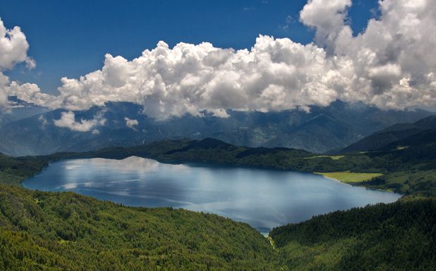
South of the district, the grassland plateau of Khaptad National Park is shared between Bajura, Bajhang, Achham and Doti, and it is the easiest high-country walking in the far west: rolling meadow rather than relentless climbing. In the north, the pastures above Gaumul and the Himali area open onto genuine alpine country with almost no trekking infrastructure. On the eastern boundary the Karnali runs through a gorge that is dramatic, hot and largely trackless. Travellers extending a trip usually push on north-east towards Mugu and Rara Lake, which is the nearest thing the region has to a headline attraction.
Practical information for travellers
Getting to Bajura
There are two realistic approaches. The first is by air to Kolti, the district airstrip, on a small aircraft from Nepalgunj, which is weather-dependent and cancels often. The second is overland: fly or drive to Dhangadhi or Nepalgunj, then take the long road north through Achham or Doti to Martadi. Expect a full day or more of rough road on the final stretch, and expect the schedule to be a suggestion rather than a timetable. Build slack into any itinerary that includes Bajura.
Where to sleep and what to eat
There is no lodge circuit. Martadi and Kolti have basic guesthouses aimed at government staff and traders. Everywhere else you are looking at homestay arrangements made on the day, a tent, or the floor of a school. Food is dal bhat, and in the north it becomes barley, potato and buckwheat as often as rice. Carry a filter or purification tablets, carry cash because bank branches are thin and card payment is effectively absent, and carry more spare battery capacity than you think you need.
Season, permits and what to carry
No special trekking permit is required for Bajura, which sits outside the restricted-area system, though you should carry identification and register where asked. The best windows are April to early June and late September to November. The monsoon turns hill trails into mud and triggers landslides that close roads for days. Winter closes the high ridges entirely. If you are heading for the Badimalika ridge, take a four-season sleeping bag and a windproof layer even in July, because the meadow is cold and exposed after dark at any time of year.
FAQ
When is the best time to visit Bajura?
April to early June and late September to November give the most stable weather and open trails. July and August are only worth it if you are travelling specifically for the Badimalika pilgrimage and are prepared for mud, leeches and possible road closures.
How do I reach Badimalika temple?
The usual approach is a two to three day walk from Martadi in Bajura, with an alternative route climbing from the Achham side. There is no road to the shrine and no accommodation on the ridge, so you either camp or join the pilgrimage crowd on the festival night.
Do I need a permit to trek in Bajura?
Bajura is not a restricted area, so no special trekking permit is needed. A national park entry fee applies if your route enters Khaptad National Park, and you should carry a passport or identity document for checkpoints.
Is Bajura suitable for a first trip to Nepal?
Not really. Transport is unreliable, accommodation is minimal and English is rarely spoken outside the district headquarters. It rewards travellers who already know Nepal, have functional Nepali or a good local guide, and can absorb a lost day without stress.
Can I combine Bajura with Rara Lake?
Yes, and many people do. The overland link north-east into Mugu is long and rough, but combining the Badimalika ridge with Rara makes a coherent two-week far-western loop for anyone with time and patience.