
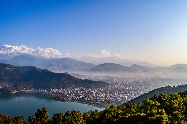
Kaski packs an unusual amount of vertical range into a small district. From the surface of Phewa Lake at roughly 800 metres, the ground rises to Machhapuchhre at 6,993 metres and on to Annapurna I at 8,091 metres on the northern boundary. That is close to seven and a half vertical kilometres in a horizontal distance a strong walker could cover in a few days. Nowhere else in Nepal presents the high Himalaya so abruptly from a place with hot showers and espresso.
The district sits in Gandaki Province, with Pokhara as both district headquarters and provincial capital. It is the second city of Nepal by most measures that matter to a visitor, and it is the base for the largest trekking region in the country.
Where Kaski sits, from lake to eight-thousander
Kaski is arranged around the Pokhara valley, a broad basin of old lake sediment and river terraces that the Seti Gandaki cuts through in a series of narrow slot gorges. The Seti is the odd feature here: in places it runs a few metres wide and many metres deep, hidden right in the middle of the city, and you can walk over it without realising it is below you.
North of the valley the land steps up quickly through the Annapurna foothills to the main Himalayan wall. Machhapuchhre, the fishtail peak that dominates the Pokhara skyline, is closed to climbing and remains formally unclimbed. Behind it sits the Annapurna massif, whose highest summit was the first eight-thousander ever climbed, in 1950. Almost all of the high country falls inside the Annapurna Conservation Area, established in 1986 and the largest protected area in Nepal.
A short history: Kaskikot and the Shah line
Before unification, Kaski was one of the Chaubise principalities, the loose group of twenty-four small kingdoms scattered across the Gandaki hills. Its fort sat at Kaskikot on the ridge above the modern city, and the ruins are still there for anyone willing to walk up. The connection worth knowing is dynastic: the ruling house of Kaski is the ancestral line from which the Shah kings of Gorkha descended, and it was a descendant of that house who took Gorkha in the sixteenth century, setting in motion the process that eventually produced modern Nepal.
Pokhara itself grew as a trading town on the route between the Terai and the Tibetan plateau, with Newar merchant families settling in what is now the Old Bazaar. The trade route mattered far more than tourism until the second half of the twentieth century. The lakeside district that visitors now think of as Pokhara is a recent creation built on trekking, and the Old Bazaar in the north of the city still looks and feels like the older town it is.
What to actually do in Pokhara
Around Phewa Lake
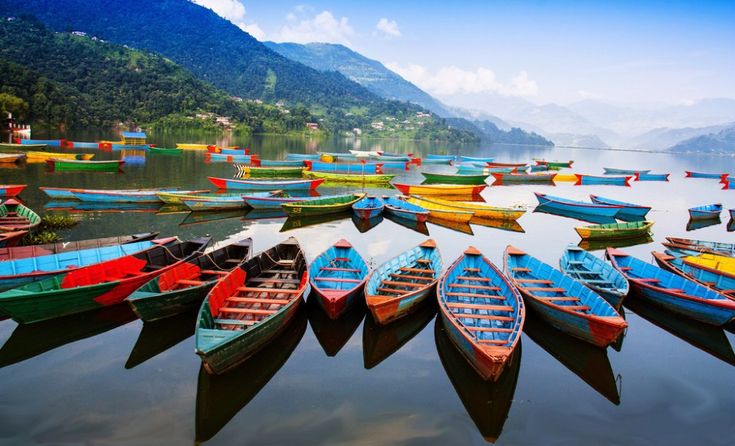
Phewa Lake is the centre of gravity. Hire a rowing boat, cross to the Tal Barahi temple on its small island, and continue to the far shore for the climb to the World Peace Pagoda on the southern ridge. The walk up takes under an hour and the view back across the water to the Annapurnas is the postcard image of Nepal. The lakeside strip is dense with restaurants and gear shops, which is either convenient or wearying depending on your tolerance for tourist infrastructure.
Sarangkot and the ridge
Sarangkot on the northern ridge is the standard sunrise viewpoint and the main paragliding launch site in Nepal. Flights run most mornings in season and land near the lake. If you prefer walking to flying, the ridge continues west towards Naudanda and Kaskikot and makes an easy half-day with the mountains in view the whole way.
In the city itself
Bindhyabasini Temple in the Old Bazaar is the principal Hindu shrine of the valley. The International Mountain Museum is genuinely good on Himalayan climbing history. Gupteshwor Mahadev cave and the Davis Falls sinkhole opposite it are on every tour itinerary and are worth an hour. Three Tibetan settlements around the city, established after 1959, run carpet workshops and monasteries that are open to visitors. Broader valley notes are on the Pokhara Valley page.
The lakes of the Pokhara valley
Phewa is the famous one, but the valley holds a cluster of lakes that were collectively designated a Ramsar site of international importance in 2016. Begnas is the second largest and the most rewarding for a day trip: quieter, greener, ringed by terraced farmland and with a fraction of the traffic. Rupa lies just over the ridge from Begnas and is smaller and quieter still. Several minor lakes and wetlands complete the group, and together they support a substantial resident and migratory bird population.
Treks that start in Kaski
Kaski is the gateway to the Annapurna region, and the range of options is unusually wide: you can do a single overnight or a three-week circuit from the same trailhead town. Every route below requires an Annapurna Conservation Area entry permit and the standard trekker registration card, both obtainable in Pokhara.
| Trek | Typical days | Highest point | Effort | Best months |
|---|---|---|---|---|
| Australian Camp and Dhampus | 1 to 2 | Around 2,100 metres | Easy | Most of the year outside heavy monsoon |
| Ghandruk loop | 2 to 3 | Around 2,000 metres | Easy | October to May |
| Poon Hill | 4 to 5 | 3,210 metres | Moderate | October to April |
| Mardi Himal | 5 to 6 | Around 4,500 metres at the upper viewpoint | Moderate | October to November, March to May |
| Annapurna Base Camp | 7 to 11 | 4,130 metres | Moderate to hard | October to November, March to May |
| Annapurna Circuit | 12 to 18 | 5,416 metres at Thorong La | Hard | October to November, March to May |
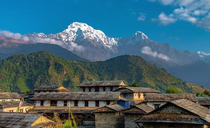
The most popular short option is the walk up to Ghandruk, a large Gurung village with stone houses, slate roofs and a direct view of Annapurna South. It works as a two-night trip and is the standard introduction to Nepali trekking for people who do not want to commit two weeks. At the other end, Annapurna Base Camp puts you inside a glacial amphitheatre ringed by peaks and is the classic Kaski trek.
People and festivals in Kaski
Gurung and Magar communities dominate the hill villages north and west of the valley, alongside Brahmin, Chhetri, Newar and Dalit populations in the towns. The Gurung new year, Lhosar, falls in the winter months and is the most visible community festival in the hill villages. Dashain and Tihar are observed across the district. The Pokhara street festival at the turn of the Gregorian year has become a fixture in the city, and Fewa Lake hosts boat races and religious observances at several points in the calendar.
Kaski also has a strong Gurkha connection. Recruitment and pension administration for the British and Indian armies has run through Pokhara for generations, and remittance and pension income remain a visible part of the economy in the surrounding hills.
Practical information for travellers
Getting there
Pokhara has an international airport opened in 2023 alongside daily short flights from Kathmandu that take under half an hour. By road it is a six to eight hour drive from Kathmandu on the Prithvi Highway, longer in the monsoon or during festival traffic. Tourist buses run every morning and are comfortable enough.
When to go
October and November give the clearest mountain views of the year. March to May is warm with hazier air and rhododendron in flower at altitude. The monsoon between June and September brings heavy rain, and this corner of Nepal is among the wettest in the country, with the hills above Pokhara recording some of the highest annual rainfall totals nationally. December to February is cold at altitude but often crisp and clear in the valley.
Where to base yourself
Lakeside is the default and has the widest range of accommodation, food and trekking services. The southern end of Lakeside is quieter. Begnas suits travellers who want the valley without the tourist strip. The Old Bazaar has a handful of heritage guesthouses and a completely different atmosphere from the lake.
FAQ
How many days do I need in Kaski?
Two to three days covers Pokhara itself, the lakes and Sarangkot. Add three to five days for a short trek such as Ghandruk or Poon Hill, or ten days and up for Annapurna Base Camp or the full circuit.
What permits do I need for trekking from Pokhara?
An Annapurna Conservation Area Project entry permit and a Trekkers Information Management System card. Both are issued in Pokhara and Kathmandu, and you need passport photos and your passport to apply.
When are the mountain views clearest from Pokhara?
October and November, after the monsoon has washed the haze out of the air. December and January are also clear but colder. Pre-monsoon months from March to May are warmer with softer, hazier light.
Is Begnas Lake worth visiting if I have already seen Phewa?
Yes, if you want quiet. Begnas is greener, far less developed and about forty minutes from Lakeside by road, and it makes an easy half-day escape from the busier side of the valley.
Can I trek from Pokhara without a guide?
Rules on independent trekking in Nepal have shifted in recent years and are enforced inconsistently across regions. Check the current requirement with the Nepal Tourism Board or a Pokhara agency before you plan a solo route, particularly for the higher circuits.