
Almost every traveller heading for the far west passes through Kailali or Kanchanpur and almost none of them stop. These are the two Terai districts of Sudurpashchim, flat, hot, agricultural and largely treated as transit: the airport, the bus park, the road junction on the way to the hills. That is a mistake. Between them they hold a national park with one of the largest swamp deer populations anywhere, a Ramsar wetland complex, the point where the Karnali splits into braided channels, and the cultural heartland of the Rana Tharu.
Two districts, one landscape
Kailali and Kanchanpur sit side by side along the Indian border, bounded to the north by the Siwalik hills and the inner Terai valleys, and to the south by the plain that continues into Uttar Pradesh and Uttarakhand. Kailali is the larger and busier of the two, with Dhangadhi as its headquarters and the main airport for the whole far-western region. Kanchanpur is the westernmost district in Nepal, with its headquarters at Bhimdatta, still universally called Mahendranagar, and the Mahakali river forming its western boundary with India.
Both districts were malarial forest within living memory. Large-scale eradication in the mid twentieth century opened them to settlement, and hill families moved down in numbers, reshaping land ownership and the demographic balance in ways that still carry political weight. Understanding that history explains a great deal about how the far-western Terai is organised today.
Kanchanpur: Shuklaphanta and the Mahakali plain
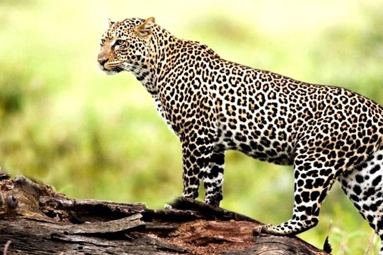
Shuklaphanta National Park is the reason to plan a stop rather than a transit. It was managed as a wildlife reserve for decades before being upgraded to national park status in 2017. Its defining feature is the phanta itself, a vast open grassland that supports one of the largest concentrations of swamp deer in the world, an animal that has disappeared from most of its former range. Tigers use the park, and it is also one of the more reliable places in Nepal for Bengal florican, hispid hare and a long list of grassland birds that are hard to find anywhere else.
Shuklaphanta is quieter than Chitwan and considerably quieter than most people expect. There is no crowd of jeeps, the lodge scene is small, and a morning drive across the grassland at first light can feel like having a national park to yourself. That is its main selling point and also its main limitation: services are basic, so book through an operator who actually works the park rather than assuming you can arrange everything on arrival.
Kailali: Dhangadhi, the Karnali and Ghodaghodi
Dhangadhi is the largest city in the far west and functions as the regional hub for everything: flights, hospitals, wholesale trade and the jumping-off point for road journeys north into Doti, Achham, Bajhang and Bajura. It is not a sightseeing city, but it is a comfortable place to reset before or after a hill trip.
The natural highlight in Kailali is the Ghodaghodi Lake complex, a cluster of connected lakes and marshes in the Siwalik foothills designated as a Ramsar site of international importance. It is an easy stop directly off the east-west highway, good for waterbirds, and locally significant as a Tharu religious site. Further east, at Chisapani on the Kailali and Bardiya boundary, the Karnali emerges from the hills, passes under a long cable-stayed bridge and fans out into braided channels across the plain. This is the takeout point for expeditions on the Karnali river, Nepal’s longest, and one of the classic multi-day whitewater trips in the country.
How the two districts compare
| Feature | Kailali | Kanchanpur |
|---|---|---|
| District headquarters | Dhangadhi | Bhimdatta, widely called Mahendranagar |
| Main protected or listed site | Ghodaghodi Lake complex, a Ramsar site | Shuklaphanta National Park |
| Defining river | The Karnali, braiding out at Chisapani | The Mahakali, forming the border with India |
| Air access | Dhangadhi airport, daily flights from Kathmandu | Uses Dhangadhi, roughly two hours away by road |
| Main land border crossing | Not the principal crossing point | Gaddachauki, opposite Banbasa in India |
| Signature community | Dangaura and Rana Tharu, plus hill migrants | Rana Tharu heartland |
| Best months to visit | October to March | October to March |
Tharu culture in the far-western Terai
The indigenous people of both districts are Tharu, and the far west is specifically Rana Tharu country, a group distinct in language, dress and architecture from the Dangaura Tharu of Dang and Bardiya. Rana Tharu houses are long, low and built of mud and thatch, with interior walls decorated in relief work. Women wear heavy silver jewellery and brightly patterned clothing that is immediately recognisable, and Holi in the Rana Tharu villages of Kanchanpur is one of the more distinctive celebrations in Nepal.
Maghi, in mid January, is the Tharu new year and the biggest festival of the calendar, marked by feasting, dancing and the annual reordering of village leadership. Atwari in Bhadra involves a demanding fast associated with Bhima. For a fuller treatment of Tharu society, history and how to visit village communities respectfully, see the Tharu culture guide.
One piece of recent history matters here. The kamaiya system of bonded agricultural labour, which tied Tharu families to landlords across the western Terai, was formally abolished in 2000. Resettlement and land rights for freed kamaiya households remain unresolved in parts of Kailali and Kanchanpur, and it is a live local issue rather than a closed historical chapter.
Wildlife and when to see it
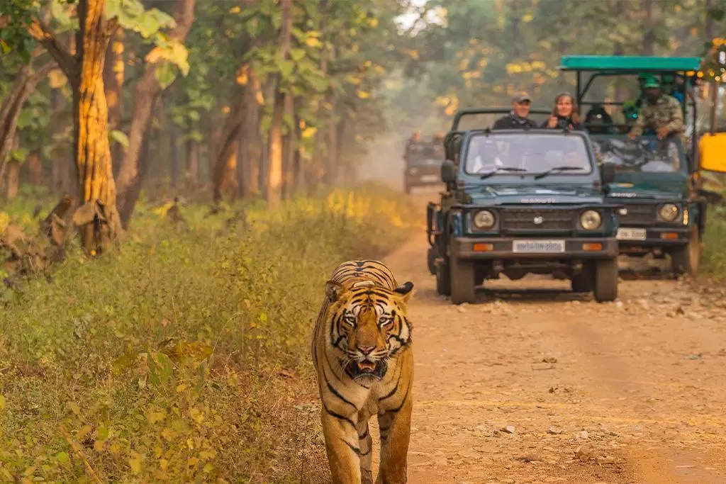
The season for both districts is October to March. October and November give clear air and comfortable temperatures. December and January are cool, misty in the early morning and excellent for birds. February and March bring rising heat but also the annual grassland burning and cutting, which drops the sightlines dramatically and makes it the best window for tigers and swamp deer. April and May are punishing on the plain, often well over forty degrees. The monsoon from June to September floods low ground and closes park tracks.
Travellers with a week to spend usually pair Shuklaphanta with Bardiya National Park to the east, which has better lodge infrastructure and a stronger reputation for tiger sightings, and treat Ghodaghodi as a half-day stop between them.
Practical information for travellers
Getting there
Dhangadhi airport takes daily flights from Kathmandu and is by far the fastest way in. Overland, the east-west highway connects both districts to Nepalgunj, Butwal and eventually Kathmandu, but the bus journey from the capital is long and usually overnight. Local buses and jeeps link Dhangadhi, Attariya, Mahendranagar and the park gates.
Where to stay
Dhangadhi and Mahendranagar both have functional mid-range hotels. Shuklaphanta has a small number of lodges near the park boundary. Accommodation near Ghodaghodi is minimal, so treat it as a day stop from Dhangadhi rather than a base.
Border crossing
Gaddachauki in Kanchanpur, opposite Banbasa, is the main crossing into India from the far west and is open to foreign nationals with the correct visa arrangements. It links onward to Uttarakhand and is the natural route if you are combining Nepal with the Kumaon hills.
FAQ
What is the best time to visit Kailali and Kanchanpur?
October to March. February and March give the best wildlife visibility because the tall grass has been cut or burned, while December and January are cooler and better for birdwatching. April to September is hot, wet or both.
Is Shuklaphanta better than Chitwan or Bardiya?
It is quieter than either and better for grassland species such as swamp deer and Bengal florican. Bardiya has stronger lodge infrastructure and a better reputation for tigers. If you want solitude, choose Shuklaphanta; if you want a first Terai safari with reliable logistics, choose Bardiya.
How do I get to Dhangadhi from Kathmandu?
Daily flights take about an hour. By road it is a long haul on the east-west highway, usually run as an overnight bus, so the flight is worth it unless you are deliberately travelling slowly.
Who are the Rana Tharu?
The Rana Tharu are the indigenous community of the far-western Terai, concentrated in Kanchanpur and western Kailali. They are distinct from the Dangaura Tharu further east in language, dress, jewellery and house design, and their Holi and Maghi celebrations are among the most distinctive in Nepal.
Can I cross into India from Kanchanpur?
Yes. Gaddachauki, opposite Banbasa, is the main far-western crossing and connects onward into Uttarakhand. Check current visa and entry requirements before travelling, as rules differ by nationality.