
Banke is a Tarai district in Lumbini Province, on the Indian border in western Nepal. Its headquarters is Nepalgunj, the largest city in the region and the airport that every flight into the Karnali mountains departs from. The district also holds Bageshwori temple and Banke National Park, gazetted in 2010 as a companion to Bardiya next door.
Almost every traveller heading into western Nepal passes through Banke, and almost none of them look at it. Nepalgunj is treated as a corridor: land, overnight, take the morning flight to Simikot, Juphal or Jumla. That is a defensible way to use the district, but it misses the fact that Nepalgunj is one of the most genuinely interesting cities in Nepal to walk around, and that the national park an hour east of it is emptier than any of the famous ones.
Where is Banke?
Banke sits on the southern edge of Lumbini Province, sharing its whole southern boundary with the Indian state of Uttar Pradesh. Bardiya lies west across the district line, Dang to the east, and Salyan and Surkhet climb away to the north. The district covers roughly 2,337 square kilometres, most of it flat Tarai farmland, with the ground rising into the Siwalik hills and the Churia forest belt along the northern edge.
That northern strip matters more than its size suggests. It is where the national park sits, it is what the east-west highway climbs through on the way to Surkhet, and it is the reason a district that reads as pure plain on a map has an elevation range of well over a thousand metres.
Nepalgunj: what the city is actually like
Nepalgunj is a border trading city and it feels like one. The bazaar runs on Indian goods coming north and Nepali produce and labour going south, the streets are full of rickshaws rather than taxis, and the population mix is unlike anywhere in the hills: a large Muslim community with mosques through the older quarters, Awadhi and Urdu heard alongside Nepali, and a commercial culture that starts early and shuts in the middle of the afternoon heat.
For a traveller the practical value is enormous. Nepalgunj airport is the hub for the entire Karnali: flights to Simikot in Humla, Juphal for Dolpa, Jumla, Bajura and Bajhang all leave from here, and there is no other airport in Nepal that does that job. The city also has the last full-service hospitals, the last reliable bank branches and the last shops selling anything technical before the mountains. Anyone assembling a Karnali trip buys the forgotten items here. Our regional access guide covers the connections in detail at how to get to west Nepal.
The Jamunaha border crossing
The crossing south of Nepalgunj is usually called Jamunaha on the Nepali side and Rupaidiha on the Indian side, in Bahraich district of Uttar Pradesh. It is around six kilometres from the centre of Nepalgunj and rickshaws run there constantly. For Nepali and Indian citizens it is an open border used daily for shopping, work and family visits, and the traffic is heavy from early morning.
Foreign nationals can cross here, and the immigration posts on both sides handle third-country travellers, but this is a working freight and local crossing rather than a tourist one. Arrive during office hours, have your paperwork in order, and check current visa arrangements before you plan around it, because rules differ by nationality and change without much notice. On the Indian side the onward road runs to Bahraich and Lucknow.
Bageshwori temple
Bageshwori is the principal temple of Nepalgunj and one of the significant Shakti shrines of the western Tarai. It stands in the middle of the city beside a pond, and it draws worshippers from across the district and from the Indian side of the border. The complex holds a Shiva shrine alongside the goddess, and there is a large standing Shiva figure that has become the visual shorthand for the city.
Dashain is the peak of the year here, and Tuesdays and Saturdays are the busy days in any ordinary week. It takes half an hour to visit and it is the one place in Nepalgunj that everybody will tell you to see, which for once is good advice: the temple is where the city puts its social life on display.
Banke National Park
Banke National Park was gazetted in 2010, covering around 550 square kilometres of sal forest, grassland and river country in the Churia hills along the northern edge of the district. It was created specifically as a companion to Bardiya immediately to the west, and the two parks plus their buffer zones form a single continuous protected block that also connects across the border to Suhelwa Wildlife Sanctuary in India. The point of it is not scenery. It is a corridor: tigers, elephants and other wide-ranging animals need far more ground than one park provides, and Banke supplies the eastern half of it.
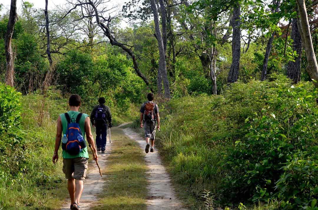
For visitors this means something different from Chitwan or even Bardiya. Tourism infrastructure is thin, sightings are not the point, and the experience is closer to walking in a large forest than to a wildlife spectacle. Tigers are present and recorded on camera traps, elephants move through, and the bird list is long. The main road access is off the east-west highway near Kohalpur, and the Rapti river forms much of the eastern boundary. Our fuller treatment is at the Banke National Park guide, and the neighbouring park is covered at Bardiya National Park and its tigers.
Banke district at a glance
| Fact | Detail |
|---|---|
| Province | Lumbini Province |
| District headquarters | Nepalgunj |
| Area | About 2,337 square kilometres |
| Elevation range | Roughly 150 m on the plain to about 1,250 m in the Churia hills |
| Protected area | Banke National Park, gazetted 2010, around 550 square kilometres |
| Border crossing | Jamunaha, opposite Rupaidiha in Uttar Pradesh, about 6 km from Nepalgunj |
| Journey time from Kathmandu | About one hour by air, or twelve to fifteen hours by night bus |
Kohalpur and the junction that runs western Nepal
Fifteen kilometres north of Nepalgunj, Kohalpur is where the east-west Mahendra Highway meets the road climbing north to Surkhet and the Karnali. It is a junction town rather than a place with any character of its own, and it exists because of the turning. Every jeep and bus heading for Surkhet, Jumla, Dailekh or Rukum passes through it, and a good share of them stop to eat.
The practical value is knowing it is there. If you are travelling north and arrive in Nepalgunj too late for a direct connection, Kohalpur is where the onward traffic actually originates, and getting yourself fifteen kilometres up the road the night before can save half a morning. It is also the point where the landscape changes: south of it is flat farmland, north of it the road starts climbing into the Churia and the temperature drops noticeably within the hour.
North of the junction, the highway to Surkhet runs through the eastern edge of Banke National Park, which is the easiest way most travellers see the park at all. The Surkhet valley beyond it is the gateway to Karnali Province and is covered in our Surkhet district guide.
How to get to Banke and when to come
Nepalgunj has the busiest airport in western Nepal and takes several flights a day from Kathmandu, taking around an hour. By road it is a long haul on the Mahendra Highway, usually run overnight, and buses arrive early in the morning. From Surkhet, the capital of Karnali Province, it is roughly half a day south. The onward mountain flights leave in the morning because the weather closes in later, so an overnight in Nepalgunj is almost always part of a Karnali itinerary rather than an optional extra.
The season is October to March, and the reason is heat. Nepalgunj is regularly among the hottest places in Nepal, and from April to June the afternoon temperature makes any daytime activity unpleasant. The monsoon brings heavy rain and flooding on low ground. Winter is mild, clear and the right time for the national park, though December and January mornings can be thick with fog, which delays the mountain flights that are the whole reason many people are in the district. Build a spare day in.
Where to stay and practical notes
Nepalgunj has the widest range of accommodation in western Nepal outside Pokhara: airport-adjacent hotels aimed at trekking groups in transit, mid-range business hotels in the city, and cheap lodges near the bus park. Air conditioning is worth paying for outside the winter months. Around Banke National Park the options are limited to a small number of homestays and community lodges near the buffer zone, so most visitors do the park as a day trip or stay on the Bardiya side.
Cash and connectivity are both reliable here and both degrade quickly once you head north, so treat Nepalgunj as the resupply point. Food runs to Tarai and north Indian cooking rather than hill dal bhat, and it is better than most travellers expect. Our wider planning notes for the region are at travel costs by season and the 77 districts of Nepal explained.
Frequently Asked Questions
Where is Banke district in Nepal?
Banke is in the southern part of Lumbini Province, on the border with Uttar Pradesh in India. Bardiya lies to the west, Dang to the east, and Salyan and Surkhet to the north. Its headquarters is Nepalgunj.
Why do so many trips go through Nepalgunj?
Nepalgunj airport is the only hub serving the Karnali mountain airstrips. Flights to Simikot, Juphal, Jumla, Bajura and Bajhang all leave from here, so any trip to Humla, Dolpa or Jumla routes through the city.
Can foreigners cross the border at Jamunaha?
Yes. The crossing at Jamunaha, opposite Rupaidiha in Bahraich district, is staffed for third-country nationals. It is a working local and freight crossing rather than a tourist one, so arrive in office hours and check current visa requirements for your nationality first.
What is Bageshwori temple?
It is the main temple of Nepalgunj and a significant Shakti shrine of the western Tarai, standing beside a pond in the centre of the city. It draws worshippers from across the district and from the Indian side of the border, and it is busiest during Dashain.
Is Banke National Park worth visiting?
It suits travellers who want forest and solitude rather than guaranteed sightings. Gazetted in 2010 as a corridor park linking Bardiya to protected land in India, it has thin visitor infrastructure, and most people combine it with a longer stay in Bardiya.
When is the best time to visit Banke?
October to March. Nepalgunj is one of the hottest places in Nepal from April to June, and the monsoon floods low ground. Note that December and January fog can delay the morning mountain flights.
How long does it take to reach Nepalgunj from Kathmandu?
Around an hour by air, with several flights a day, or twelve to fifteen hours by night bus on the Mahendra Highway depending on road conditions.
