
The Kathmandu Valley holds three districts, not one. Kathmandu, Lalitpur and Bhaktapur all sit inside a single bowl of land about 25 kilometres wide at roughly 1,300 metres above sea level, and all three belong to Bagmati Province. Visitors treat the whole bowl as one destination and call it Kathmandu. Nepalis do not. Each district has its own administration, its own historic capital and its own accent of Nepal Bhasa, the Newar language spoken across the valley.
The split is not administrative trivia. It explains why a valley this small has three separate royal palace squares within about twelve kilometres of each other, why the seven UNESCO monument zones are scattered rather than clustered, and why choosing where to sleep changes how much of your trip you spend in traffic.
How many districts are in the Kathmandu Valley?
Three. Kathmandu district, with the capital as its headquarters. Lalitpur district, headquartered at Lalitpur, the city almost everyone still calls Patan. And Bhaktapur district, headquartered at Bhaktapur, the smallest district in Nepal by area.
Districts that people sometimes assume are in the valley are not. Nuwakot, Dhading, Kavrepalanchok and Makwanpur all sit outside the rim. The rim itself is the boundary: once you cross the hills at Nagarkot, Chandragiri or Shivapuri, you have left the valley and usually the district too. That rim is also why the valley behaves like a single weather system, holding winter fog and dry-season haze that no district can escape on its own.
Below district level, Nepal is organised into municipalities and rural municipalities. Kathmandu district contains Kathmandu Metropolitan City plus a set of further municipalities including Budhanilkantha, Tokha, Kirtipur, Chandragiri and Tarakeshwar. Lalitpur district contains Lalitpur Metropolitan City, Godawari and Mahalaxmi, plus rural municipalities in the southern hills. Bhaktapur district contains four: Bhaktapur, Madhyapur Thimi, Changunarayan and Suryabinayak.
Why the valley has three capitals instead of one
From roughly the fifteenth century until 1769, the valley was not one kingdom. It was three, each ruled by a branch of the Malla dynasty: Kantipur, which is now Kathmandu; Lalitpur, which is Patan; and Bhadgaun, which is Bhaktapur. They fought, traded, intermarried and competed, and the competition was largely architectural. When one king built a palace courtyard or a taller pagoda, the next king built a better one. That rivalry is the reason the valley is dense with monuments rather than merely rich in them.
Prithvi Narayan Shah of Gorkha took all three cities in 1769 and made Kathmandu the capital of a unified Nepal. The kingdoms ended. The three cities did not merge. Their guthi associations, festival calendars, chariot routes and craft specialisations survived, and the modern district boundaries follow those old kingdoms closely enough that the map still reads as three states pressed together.
Where the seven UNESCO monument zones sit
Nepal has a single World Heritage Site called the Kathmandu Valley, and it is made of seven separate monument zones spread across the three districts. Knowing which zone falls in which district is the fastest way to plan an efficient day rather than a day of crossing the valley twice.
| Monument zone | District | What it is | Best paired with |
|---|---|---|---|
| Kathmandu Durbar Square | Kathmandu | Hanuman Dhoka palace, Taleju temple, the Kumari house | Swayambhunath, on foot or a short ride west |
| Swayambhunath | Kathmandu | Hilltop stupa above the western valley | Kathmandu Durbar Square |
| Boudhanath | Kathmandu | One of the largest stupas in South Asia, centre of Tibetan Buddhist life | Pashupatinath, roughly two kilometres away |
| Pashupatinath | Kathmandu | The principal Shiva temple complex on the Bagmati | Boudhanath |
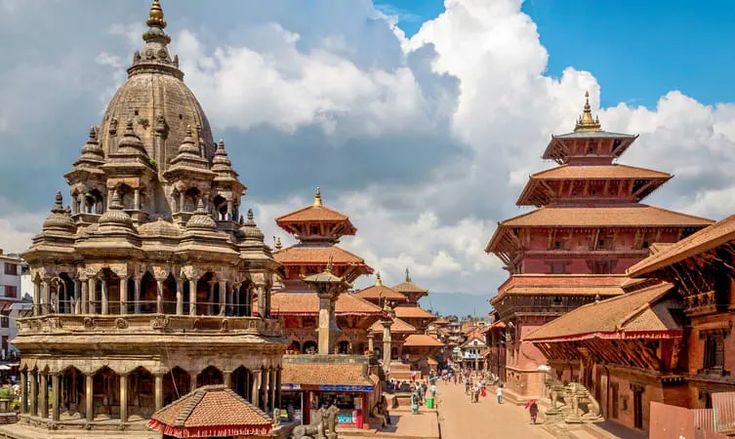
| Patan Durbar Square | Lalitpur | Malla palace with the valley’s best museum and metalwork quarters | Bungamati and Khokana to the south |
| Bhaktapur Durbar Square | Bhaktapur | The largest surviving royal city fabric, four linked squares | Changu Narayan, then Nagarkot |
| Changu Narayan | Bhaktapur | Hilltop Vishnu temple with the oldest dated inscription in Nepal | Bhaktapur below, Nagarkot above |
Four zones fall in Kathmandu district, one in Lalitpur, two in Bhaktapur. That distribution is why most itineraries spend two days in Kathmandu district and one long day east.
Kathmandu district: the capital and the noise around it
Kathmandu district is the busiest and the least legible. It holds the national government, the international airport, Thamel, and the largest share of the valley population. It also holds four of the seven monument zones. The old core around Asan and Indra Chowk is still a working market of spice traders, cloth merchants and brass sellers, and it rewards walking far more than driving.
North of the ring road the district climbs quickly. Budhanilkantha sits below Shivapuri Nagarjun National Park, which supplies much of the valley water and offers day hikes that start about half an hour from the city centre. West of the centre, the hilltop stupa of Swayambhunath gives the clearest single view of how the valley is laid out, which makes it a useful first stop rather than a last one. On the eastern side of the district the riverside complex at Pashupatinath and the stupa at Boudhanath sit close enough together to combine in a single morning.
Lalitpur district: Patan, the craft towns and the southern hills
Lalitpur is the quieter half of the metropolitan area, separated from Kathmandu by the Bagmati river rather than by any visible edge. The old city of Patan is compact, and its palace square is the most concentrated of the three. Bronze casting and repousse metalwork have been the district trade for centuries, and the workshops behind Patan Durbar Square still supply statues to monasteries across the Himalaya.
South of the city the district changes character entirely. Bungamati and Khokana are farming and oil-pressing villages that kept their Newar street plan. Godavari holds the national botanical garden at the foot of Phulchowki, the highest point on the valley rim and the best birding hill within reach of the capital. Further south the district falls away into steep, thinly settled country most visitors never see.
Bhaktapur district: the smallest district in Nepal
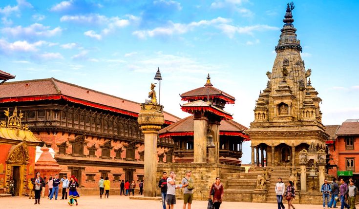
Bhaktapur is the smallest district in the country by area and the easiest to understand. It is essentially one medieval city, one satellite pottery town, one temple hill and one ridge viewpoint.
The city itself has the most intact historic fabric of the three royal capitals, partly because it was poorer for longer and partly because vehicle access to the core has been restricted. Four linked squares run east to west, and the pottery square is still a working yard rather than a display. Bhaktapur Durbar Square is the western end of that sequence, not the whole of it, which is the single most common planning mistake visitors make here.
North of the city, the hilltop temple of Changu Narayan carries a fifth-century Licchavi inscription, the oldest dated stone record in Nepal. East of it, the ridge at Nagarkot is the standard sunrise viewpoint for the valley, with a Himalayan skyline on clear mornings between October and December. Thimi, between Kathmandu and Bhaktapur, makes masks and papier mache and stages one of the loudest festival processions in the valley.
Which district should you stay in?
Stay in Kathmandu district if this is a short trip, if you have an early flight, or if you want restaurants and trekking gear within walking distance. Stay in Lalitpur if you want the same access with less noise and are willing to accept the river crossing at rush hour. Stay in Bhaktapur if the heritage is the point of the trip, and accept that you will be forty-five minutes to ninety minutes from the airport depending on traffic.
Public buses and microbuses link all three district headquarters constantly and cheaply. Ride-hailing apps work valley-wide. The only real variable is time of day: the Kathmandu to Bhaktapur run can double in the evening peak, and no route around it is faster.
FAQ
Is Kathmandu a city or a district?
Both. Kathmandu is a district, and Kathmandu Metropolitan City is the largest local unit inside it. The district also contains several other municipalities, so a place can be in Kathmandu district without being in Kathmandu city.
Which district is Patan in?
Patan is in Lalitpur district and is officially called Lalitpur. Both names are in daily use. Locals also use the Newar name Yala.
How long does it take to travel between the three districts?
Kathmandu to Patan is fifteen to forty minutes depending on traffic. Kathmandu to Bhaktapur is usually forty-five to ninety minutes. Distances are short, but the valley road network is the constraint, not the kilometres.
Can you see all seven UNESCO monument zones in one day?
Technically yes, and it is a bad idea. Two zones sit in Bhaktapur district and one requires a hill road. Three days is a realistic pace, with Kathmandu district on days one and two and Bhaktapur district on day three.
Which district has the best preserved old city?
Bhaktapur, by a clear margin. Its core has more surviving traditional buildings and less vehicle traffic than the old centres of Kathmandu or Patan, and the streets between the four squares are still residential rather than commercial.