
Machapuchare is a 6,993 metre peak in the Annapurna Himal of central Nepal, and it is closed to climbing because it is held sacred to Shiva. Only one expedition has ever been given permission to attempt it, a British party led by Jimmy Roberts in 1957, and that team stopped short of the summit by prior agreement. No climbing permit has been issued since, which makes the Fishtail one of the most photographed mountains on earth and one of the very few high Himalayan peaks with no recognised ascent.
Where is Machapuchare and how high is it?
The peak stands on a spur that runs south from the main Annapurna ridge near Annapurna III, in Kaski District, Gandaki Province. At 6,993 metres it is nowhere near the biggest mountain in the range. What it has instead is position. The spur pushes out of the massif toward the middle hills, so nothing stands in front of it. From the Pokhara valley, roughly 25 kilometres to the south, it rises straight out of a low green foreground with no intervening summit to break the line.
That isolation is also why it looks so severe. The ridges are narrow, the faces are fluted with ice that reloads after every storm, and the top is a genuine rock and ice spire rather than a snow dome. The Nepali name machhapuchhre means fish tail, and it refers to a twin summit separated by a shallow notch. The cleft reads most clearly from the east and northeast; from most Pokhara viewpoints the mountain resolves into a single blade and the fishtail has to be taken on trust.
Machapuchare also does a piece of geographical work. It forms the eastern gatepost of the Annapurna Sanctuary, the glacial amphitheatre at the head of the Modi Khola. Hiunchuli, 6,441 metres, forms the western one. The narrow gap between them is the only walking entrance to the basin, which is why the trail to Annapurna Base Camp squeezes through a single gorge rather than approaching from any direction it likes.
Why is Machapuchare closed to climbing?
Because it is treated as a seat of Shiva, and the Nepali state has honoured that. The mountain does not appear on the lists of peaks opened for expeditions by the Department of Tourism, and it is not among the peaks administered for climbing by the Nepal Mountaineering Association. It has stayed off those lists continuously since 1957.
The sanctity is local, not an administrative abstraction handed down from Kathmandu. The Gurung villages of the Modi Khola valley — Ghandruk, Chhomrong, Landruk — hold the Sanctuary and the peaks that ring it as the ground of resident deities, and the basin has long carried customary rules about what may be carried into it and how visitors should behave once inside. Guides from those villages will tell you plainly that the mountain is not a climbing objective, and they will say it without hedging.
There is a second, quieter reason the closure has held. Machapuchare is technically brutal for its height. The summit ridges are corniced, the flutings shed constantly and there is no easy line. A mountain with sacred status and no straightforward route attracts far less lobbying to reopen it than one with an obvious ridge. The result is a peak that has been left alone for close to seventy years, which is now part of its appeal.
Has anyone ever reached the summit of Machapuchare?
Not lawfully, and not to any recognised standard. The 1957 British expedition was led by Lieutenant Colonel James Owen Merion Roberts, usually called Jimmy Roberts, the army officer who went on to found Nepal’s first trekking company and is widely credited with inventing commercial trekking as a business. Wilfrid Noyce and A. D. M. Cox pushed the route to a high point on the summit ridge and then turned around a short distance below the top. Published accounts differ on the exact margin, putting it somewhere between roughly fifty and a hundred and fifty vertical metres.
They stopped because they had undertaken not to tread on the summit itself. That undertaking, made before the expedition set out, is the whole reason the mountain has its modern reputation. Deteriorating snow conditions on the final ridge are also part of the record, so it was not a purely ceremonial decision, but the promise was real and it was kept.
An unverified claim of a solo ascent by a New Zealand climber in the 1980s circulates in mountaineering circles. It has never been substantiated, it was never sanctioned, and no authority recognises it. For every practical purpose Machapuchare remains unclimbed.
Where are the best places to see Machapuchare?
The mountain rewards altitude, but it does not require much of it. Some of the best views are from places you can reach in an afternoon from Pokhara, and the closest legal head-on view is not from the Annapurna Base Camp trail at all but from the Mardi Himal ridge that runs directly south of the peak.
| Viewpoint | Approx. elevation | Access | What you get |
|---|---|---|---|
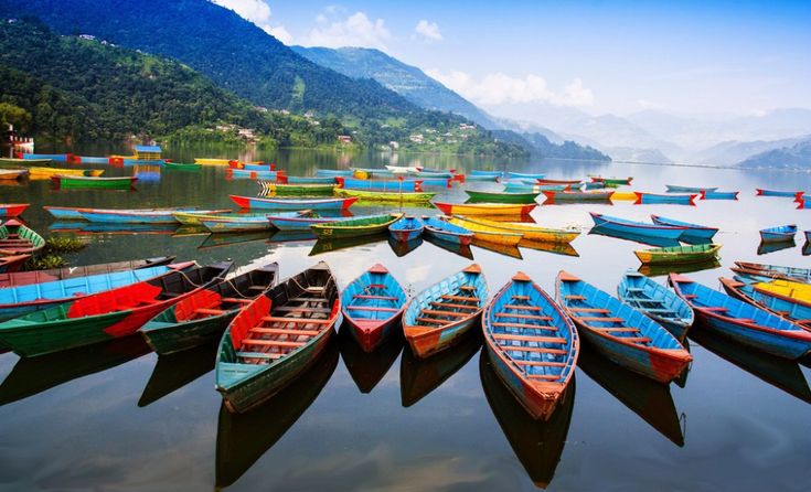
| Phewa Tal, Pokhara | 800 m | Lakeside, no walking | Full Annapurna skyline with the Fishtail as its centrepiece, best at first light |
| Sarangkot | 1,590 m | 30 to 40 min drive, short walk | Sunrise across the whole range; the standard Pokhara dawn trip |
| Australian Camp | 2,060 m | Drive to Kande, 1 to 2 hr walk | Overnight-friendly ridge view; easiest way to wake up under the mountain |
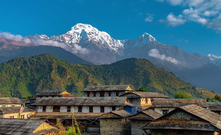
| Ghandruk | 1,940 m | Drive plus short trek | Gurung village setting with Annapurna South and the Fishtail together |
| Poon Hill | 3,210 m | 3 to 4 day loop from Nayapul | Wide panorama from Dhaulagiri to Machapuchare |
| Mardi Himal View Point | about 4,200 m | 4 to 5 day trek from Kande | The closest permitted view, almost directly beneath the south face |
| Machapuchare Base Camp | 3,700 m | Annapurna Sanctuary trail | Inside the gorge, looking up the flank at very close range |
| Annapurna Base Camp | 4,130 m | 1 to 2 hr above MBC | The Fishtail seen from within the Sanctuary bowl at dawn |
How do you trek to Machapuchare Base Camp?
Machapuchare Base Camp, universally shortened to MBC, is a cluster of lodges at about 3,700 metres in the gorge below the mountain. It is not a climbing base camp in any working sense, since nobody climbs the peak. It is a staging post on the Annapurna Sanctuary trail, and almost everyone who sleeps there is walking to Annapurna Base Camp an hour or two higher.
The standard approach starts with a drive from Pokhara to Nayapul, Kimche or Siwai, then climbs through Ghandruk and Chhomrong before dropping into the Modi Khola and following it north through Bamboo, Dovan and Deurali. From Chhomrong onward the valley narrows into a single steep-sided corridor and the walking becomes relentless staircase work, up and down, on stone steps. Most itineraries take seven to twelve days round trip depending on where the road drops you and how many acclimatisation nights you build in.
Two hazards deserve naming. The stretch between Deurali and MBC is a known avalanche path in winter and spring, and it has killed trekkers; check conditions locally and do not push through in heavy fresh snow. Second, the altitude gain above Chhomrong is quick, and MBC at 3,700 metres catches people who have flown into Pokhara only days earlier. Sleep low, walk high, and give yourself an extra night if the headache does not clear.
An Annapurna Conservation Area entry permit is required, along with current trekker registration, and the rules on guides have changed more than once in recent years. Confirm what applies before you travel rather than at the checkpost.
What does the mountain mean to the people who live below it?
The valley below Machapuchare is Gurung country, and the relationship there is not the reverent-at-a-distance version that appears in expedition memoirs. It is practical. The mountain sets the weather. It marks the boundary of the high grazing. It appears in household shrines and in the orientation of village life, and the Sanctuary behind it is understood as a place with its own rules rather than as scenery.
That matters for how you behave on the trail. Cairns, prayer flags and small shrines along the Modi Khola are not decorative. The Sanctuary has a history of restrictions on what is brought inside it, and lodge owners at Chhomrong and Deurali will tell you what applies now. Ask rather than assume, walk clockwise around chortens and mani walls, and do not fly a drone over the peak.
The wider point is that Machapuchare is the clearest example in Nepal of a mountain whose value has been protected by leaving it alone. Every other headline peak in the country has a route history, a fatality list and a permit price. This one has a skyline, a promise kept in 1957, and a valley full of people who see no reason to change any of it. Standing on Poon Hill at dawn with Dhaulagiri to the west and the Fishtail to the east, you get the argument for both approaches in a single panorama.
FAQ
How high is Machapuchare?
Machapuchare is 6,993 metres, about 22,943 feet. That places it well below the eight-thousanders of the Annapurna and Dhaulagiri massifs, but its position on a southern spur with no foreground makes it look considerably bigger than its elevation suggests.
Can you get a permit to climb Machapuchare?
No. The mountain is not on the list of peaks opened for expeditions and no climbing permit has been issued since the single sanctioned attempt in 1957. Trekking to Machapuchare Base Camp at 3,700 metres is permitted and is a normal part of the Annapurna Sanctuary route.
Why is Machapuchare called the Fishtail?
The Nepali name machhapuchhre means fish tail and describes the twin summit divided by a notch. The two tops are most obvious from the east and northeast. From Pokhara and most southern viewpoints the peak looks like a single sharp spire.
How long does the trek to Machapuchare Base Camp take?
Most itineraries run seven to twelve days round trip from Pokhara, depending on the road head used and the number of acclimatisation nights. Almost everyone continues from MBC to Annapurna Base Camp at 4,130 metres, which adds only an hour or two of walking.
What is the closest legal viewpoint to Machapuchare?
The Mardi Himal upper viewpoint at roughly 4,200 metres sits on the ridge directly south of the peak and gives the closest head-on view available to trekkers. It is a four to five day trek from Kande and considerably quieter than the Sanctuary trail.