
Fourteen mountains on earth rise above 8,000 metres. Eight of them stand in Nepal or along its borders. No other country comes close, and the reason is geometric rather than patriotic: Nepal occupies the central, highest arc of the Himalayan chain, where the collision between two continents pushed the crust higher than anywhere else.
The eight are Everest, Kangchenjunga, Lhotse, Makalu, Cho Oyu, Dhaulagiri I, Manaslu and Annapurna I. Three of them, Dhaulagiri, Manaslu and Annapurna, lie entirely inside Nepal. The rest sit on the border with Tibet or, in the case of Kangchenjunga, with India. Every one of them was climbed for the first time within a single extraordinary decade between 1950 and 1960.
The Eight Peaks of Nepal Above 8,000 Metres, Ranked by Height
| Peak | Height | First ascent | First summiteers | Where it stands |
|---|---|---|---|---|
| Everest, or Sagarmatha | 8,849 m | 1953 | Edmund Hillary and Tenzing Norgay | Solukhumbu, on the Nepal-Tibet border |
| Kangchenjunga | 8,586 m | 1955 | George Band and Joe Brown | Taplejung, on the Nepal-India border |
| Lhotse | 8,516 m | 1956 | Ernst Reiss and Fritz Luchsinger | Solukhumbu, joined to Everest by the South Col |
| Makalu | 8,485 m | 1955 | Lionel Terray and Jean Couzy | Sankhuwasabha, east of the Khumbu |
| Cho Oyu | 8,188 m | 1954 | Herbert Tichy, Sepp Joechler and Pasang Dawa Lama | Solukhumbu, on the Nepal-Tibet border |
| Dhaulagiri I | 8,167 m | 1960 | A Swiss-Austrian team led by Max Eiselin | Myagdi, entirely within Nepal |
| Manaslu | 8,163 m | 1956 | Toshio Imanishi and Gyalzen Norbu | Gorkha, entirely within Nepal |
| Annapurna I | 8,091 m | 1950 | Maurice Herzog and Louis Lachenal | Myagdi and Kaski, entirely within Nepal |
Everest, 8,849 Metres
The highest point on the planet carries three names that each say something different. Sagarmatha is the Nepali name, coined in the twentieth century. Chomolungma is the older Tibetan name used on the northern side. Everest is the surveyor name, applied by the Survey of India in the nineteenth century after the peak was calculated to be the highest in the world from hundreds of kilometres away.
The summit elevation of 8,849 metres comes from a joint Nepali and Chinese survey published in 2020, which settled decades of argument over whether the snow cap should be included. Hillary and Tenzing reached the top on 29 May 1953 by the South Col route from Nepal, which remains the standard line. The full climbing history of Everest is a separate story and a long one.
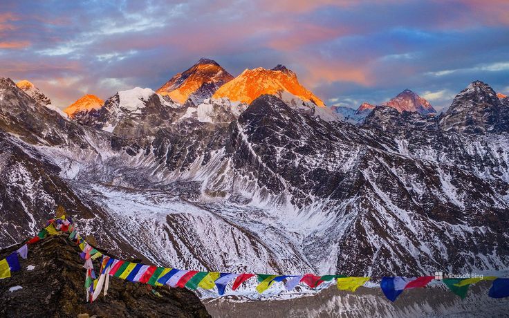
Kangchenjunga, Lhotse and Makalu
Kangchenjunga was believed to be the highest mountain in the world until the survey work of the 1850s demoted it to third. The name is usually translated as the five treasures of the great snow, a reference to its five summits. It sits in Nepal’s far east on the border with Sikkim, and the first ascent party in 1955 stopped a few metres short of the true summit out of respect for the deity of the mountain, a courtesy most later expeditions have kept. The approach through Taplejung to Kangchenjunga base camp is one of the longest and least crowded treks in the country.
Lhotse is the fourth highest mountain and the most commonly overlooked, because it shares the South Col and much of the climbing route with Everest and is visually swallowed by its neighbour. It is a serious peak in its own right, with a south face that has defeated some of the strongest alpinists alive.
Makalu, fifth highest, stands isolated east of the Khumbu and takes its name from Mahakala. Its pyramid shape and its remoteness make it one of the harder eight-thousanders, and the Makalu Barun valley below it is among the least disturbed protected areas in Nepal.
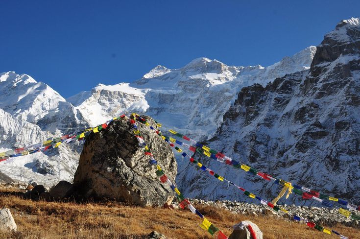
Cho Oyu, Dhaulagiri I and Manaslu
Cho Oyu, the turquoise goddess, sits west of Everest on the Tibet border and has a reputation as the most straightforward of the eight-thousanders by its standard route. That reputation has killed people. Straightforward at 8,188 metres still means thin air, crevasses and weather that changes in an hour.
Dhaulagiri I means white mountain, and like Kangchenjunga it briefly held a title: it was thought to be the world’s highest for roughly thirty years in the early nineteenth century. It was the last of the eight Nepali giants to be climbed, in 1960. Across the Kali Gandaki from it stands Annapurna, and the gorge between the two is one of the deepest anywhere on earth.
Manaslu takes its name from a Sanskrit root meaning intellect or soul. It was first climbed by a Japanese expedition in 1956, and the connection between Japanese mountaineering and this mountain has lasted ever since. The Manaslu Circuit that loops around it through Gorkha district is the best trekking introduction to a big eight-thousander, quieter than Annapurna and technically manageable.
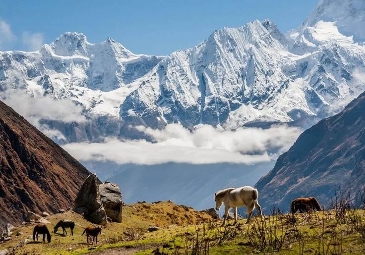
Annapurna I, the First and the Deadliest
Annapurna I is the lowest of the eight and by a wide margin the most dangerous. It was also the first eight-thousander ever climbed, by a French expedition in June 1950, three years before Everest. Maurice Herzog and Louis Lachenal reached the summit and paid heavily for it on the descent, with severe frostbite and amputations.
Since then the mountain has kept one of the worst ratios of deaths to summits in high altitude climbing, mostly because of avalanche exposure on its main faces. None of that touches the trekking routes. The trails to Annapurna Base Camp and around the Annapurna Circuit are among the safest and most walked in Nepal, and they get you inside a sanctuary ringed by peaks without any climbing at all.
How to See the Eight-Thousanders Without Climbing
You do not need a summit to stand under these mountains. Every one of the eight has a trekking approach that brings you within sight of the wall itself. The Everest Base Camp trail delivers Everest, Lhotse and Nuptse from the Khumbu. The Annapurna Sanctuary puts you in an amphitheatre under Annapurna I. The Manaslu Circuit and the Dhaulagiri approaches from Myagdi both work. Kangchenjunga and Makalu demand more time and more self-sufficiency, which is precisely why they stay empty.
If crowds are the problem you are trying to solve, the far west is the answer. Our comparison of west Nepal against the Everest and Annapurna regions lays out the trade: lower peaks, harder logistics, almost nobody else on the trail.
Permits, Seasons and Practical Information
Trekking near the eight-thousanders requires permits that vary by region. Most areas need a TIMS card plus a national park or conservation area entry permit. Manaslu and a handful of other zones are restricted areas requiring a registered agency, a licensed guide and a minimum group size. Fees change from season to season, so confirm the current position with an agency.
Two seasons work. Spring, from March to May, brings warmer air, rhododendron forest in flower and the main climbing window on the big peaks. Autumn, from late September to November, gives the clearest mountain views of the year and the most stable weather. Winter closes high passes. The monsoon shuts down visibility everywhere except the rain-shadow valleys of Mustang and Dolpo, which is exactly when those areas are at their best.
FAQ
How many 8,000m peaks are in Nepal?
Eight of the world’s fourteen: Everest, Kangchenjunga, Lhotse, Makalu, Cho Oyu, Dhaulagiri I, Manaslu and Annapurna I. Three of those are entirely inside Nepal and the rest sit on the Tibetan or Indian border.
Which 8,000m peak was climbed first?
Annapurna I, in June 1950, by a French expedition. It was the first eight-thousander anywhere in the world to be summited, three years before Everest.
Which is the most dangerous eight-thousander in Nepal?
Annapurna I, despite being the lowest of the eight. Its avalanche-prone faces have given it one of the worst death-to-summit ratios in high altitude mountaineering.
Can trekkers get close to the 8,000m peaks without climbing?
Yes. Everest Base Camp, the Annapurna Sanctuary, the Manaslu Circuit and the Kangchenjunga approach all put walkers directly beneath the faces of eight-thousanders with no technical climbing involved.
What permits do you need to trek near the 8,000m peaks?
Usually a TIMS card plus a national park or conservation area permit. Restricted zones such as Manaslu additionally require a registered agency, a licensed guide and a minimum group size, so arrange those in advance.