
The rock at the summit of Everest is limestone, and it formed on the floor of a sea. That single fact explains more about Himalayan geology than any diagram. The highest ground on earth used to be a seabed, and the force that lifted it is still working today.
Nepal is unusually good for reading geology because the country is narrow and steep. Drive north from the Tarai to the Tibetan border and you cross the entire structure of a continental collision in under two hundred kilometres, passing through five distinct geological belts stacked one behind the other like roof tiles. Very few places on the planet let you do that in a day.
An Ocean Came First: The Tethys Sea
Around 150 million years ago there was no Himalaya, no Nepal and no India in its current position. The Indian landmass was attached to the southern supercontinent of Gondwana, far to the south, near Antarctica and Africa. Between India and the Asian continent lay a wide ocean that geologists call the Tethys.
The Tethys did what oceans do. For tens of millions of years it accumulated sediment on its floor: mud, sand, and thick beds of carbonate built from the shells and skeletons of marine animals. Ammonites lived and died in it. Those sediments hardened into limestone and shale, and they are the raw material for the top of the range today.
Then India broke away and headed north. It moved fast by continental standards, crossing thousands of kilometres of ocean over roughly a hundred million years. The Tethys floor was consumed ahead of it, subducting beneath the Asian plate.
When India Hit Asia
Around 50 to 55 million years ago the ocean ran out and the two continental masses met. Neither could sink. Continental crust is too light and too buoyant to subduct cleanly, so instead of one plate diving under the other, the crust crumpled, stacked and thickened.
The thickening is the key mechanism. Where normal continental crust is roughly 35 kilometres thick, the crust beneath Tibet and the Himalaya is around twice that. That doubled slab is what holds the mountains up, in the same way that a floating iceberg stands high because of the mass beneath the waterline. The peaks are the visible fraction of a much larger structure.
The collision did not stop. India is still driving north into Asia at a few centimetres a year, and a significant portion of that movement is absorbed across the Himalayan front. The range is not a finished landform. It is an active machine, and Nepal sits on top of the working parts.
The Five Geological Belts You Cross Driving North
The crumpling produced a stack of slices, each thrust over the one to the south along a major fault. Those slices are why Nepali landscape changes so abruptly. The transitions are not gradual; they are fault lines you can often see from the road.
| Belt | Typical elevation | Dominant rock | Where you cross it | Northern boundary fault |
|---|---|---|---|---|
| Tarai, the Gangetic plain | 60 to 300 m | River gravel, sand and silt, still accumulating | Lumbini, Chitwan, Bardiya, Shuklaphanta | Main Frontal Thrust |
| Siwalik or Churia hills | 300 to 1,500 m | Young sandstone, mudstone and conglomerate | Butwal to Tansen road, Dang and Surkhet valleys | Main Boundary Thrust |
| Lesser Himalaya | 1,000 to 3,000 m | Slate, phyllite, quartzite and limestone | Kathmandu Valley rim, Mahabharat range, Dailekh hills | Main Central Thrust |
| Higher Himalaya | 3,000 m to 8,849 m | Gneiss, schist, migmatite and granite | Everest, Annapurna, Dhaulagiri, Api and Saipal | South Tibetan Detachment |
| Tibetan Tethys Himalaya | 3,500 to 6,500 m | Marine limestone, shale and fossil beds | Upper Mustang, Dolpo, upper Manang, Nar Phu | Northern edge of the range |
The Siwaliks are the youngest and softest of the five, built from debris eroded off the rising mountains and then lifted in turn by the advancing thrust front. They are also the most landslide-prone, which is why the highway sections that cross them fail so often in the monsoon.
The Higher Himalaya slice is the metamorphic core: rock that was buried deep, cooked under heat and pressure, and then driven upward and southward along the Main Central Thrust. Almost every famous summit in Nepal is cut from it. The exception is instructive. The very top of Everest is Tethyan marine limestone, sitting above the metamorphic rock on the far side of the South Tibetan Detachment. The roof of the world is capped with old seafloor.
Why There Are Marine Fossils at 4,000 Metres
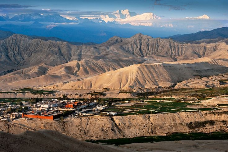
North of the main crest the Tethys sediments survive in bulk, which is why Upper Mustang and Dolpo look nothing like the rest of Nepal. The colours are ochre, grey and rust rather than green, the landforms are eroded badlands, and the rock is full of fossils.
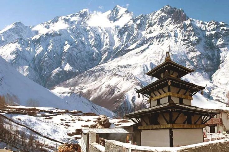
The best known are the shaligrams of the Kali Gandaki, black ammonite fossils washed out of Jurassic marine beds and collected from the riverbed. In Hindu tradition a shaligram is an aniconic form of Vishnu, and pilgrims have carried them out of this valley for centuries. The geology and the theology arrive at the same conclusion from different directions: these stones came from somewhere else entirely. The pilgrimage to Muktinath sits in the middle of that fossil country.
Why Nepal Has Earthquakes
Everything above adds up to seismic risk. The Indian plate keeps pushing north, the Himalayan thrust faults keep locking and then slipping, and the energy released has to go somewhere. Nepal sits directly on the interface.
The two events that define modern Nepali memory are the Nepal-Bihar earthquake of 1934, which devastated the Kathmandu Valley and the eastern Tarai, and the Gorkha earthquake of 25 April 2015, magnitude 7.8, which killed roughly nine thousand people, flattened villages across the central hills and damaged the Kathmandu Valley monument zones. The 2015 rupture released only part of the accumulated strain along the central Himalaya, which is why seismologists continue to treat western Nepal in particular as an area of significant unreleased stress.
For a traveller this is a matter of preparation rather than avoidance. Know your building, know your exits, and take local guidance seriously in the mountains, where the immediate hazard from a quake is usually rockfall and landslide rather than collapse.
Why the Rivers Are Older Than the Mountains
One detail confuses almost everyone on their first visit. Nepal’s three great river systems, the Koshi, the Gandaki and the Karnali, do not begin on the southern slope of the Himalaya. They start north of the main range, on the Tibetan plateau, and cut straight through the highest mountains on earth to reach the plains.
The explanation is timing. Those rivers were flowing before the mountains reached their present height. As the range rose, the rivers cut down through it at a comparable rate, holding their course like a saw against a slowly lifted plank. Geologists call these antecedent drainages. The Kali Gandaki gorge between Dhaulagiri and Annapurna is the most spectacular result, with two eight-thousanders standing on either side of a river that predates both. The Karnali in the west does the same thing on a longer, wilder scale.
Where to See the Geology for Yourself
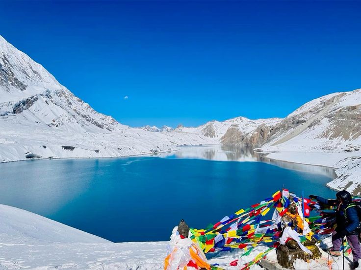
Four places do the job better than any textbook. The Kali Gandaki between Kagbeni and Jomsom, for the fossil beds and the antecedent gorge. Upper Mustang and Dolpo, for the Tethys sediments and the badland erosion of the rain shadow. The Tilicho Lake basin above Manang, for a moraine-dammed lake and glacial landforms at close range. And the Churia foothills anywhere between Butwal and Surkhet, for young sandstone folded and tilted almost vertically along the road cuts.
The rain shadow of Shey Phoksundo in Dolpa closes the picture. The Himalaya does not only build height; it blocks the monsoon, which is why one side of the range is forested and the other is desert within a walking day of each other.
FAQ
How were the Himalayas formed?
By the collision of the Indian and Eurasian plates roughly 50 to 55 million years ago. The ocean between them closed, neither continental mass could sink, and the crust thickened and stacked along a series of thrust faults to build the range.
Are the Himalayas still growing?
Yes. India continues to push north at a few centimetres a year and a portion of that is absorbed across the range, so uplift is ongoing. Erosion removes a great deal of that gain, so net height change is far smaller than the uplift rate.
Why are there marine fossils high in the Himalaya?
Because the rock was once the floor of the Tethys ocean. Ammonite and other marine fossils are common in the Tibetan Tethys belt north of the main crest, especially the shaligram stones of the Kali Gandaki valley.
Why does Nepal have so many earthquakes?
Because it sits directly on the boundary where the Indian plate is being driven beneath Asia. Strain builds on locked thrust faults and releases in large earthquakes, as in 1934 and in the magnitude 7.8 Gorkha earthquake of 2015.
Where can travellers see Himalayan geology most clearly?
The Kali Gandaki gorge and Upper Mustang for marine fossils and the rain shadow, Tilicho and the high glacial basins for erosion in progress, and the Churia road cuts between Butwal and Surkhet for tilted young sandstone.