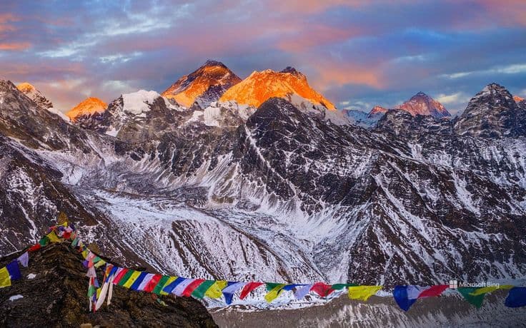
The Barun valley is the glacial trough beneath the south face of Makalu, the fifth highest mountain in the world at 8,485 m, in Sankhuwasabha district in eastern Nepal. It lies inside Makalu Barun National Park, established in 1992, which covers 1,500 square kilometres and spans an elevation range from about 435 m on the Arun river to the summit of Makalu itself. The standard approach flies to Tumlingtar and walks in over the Shipton La.
That elevation range is the thing worth holding on to. A single protected area running from lowland forest at 435 m to an 8,000 m summit contains, in one continuous sweep, almost every habitat Nepal has. There is nowhere else in the country where you can walk from subtropical forest to glacier without leaving a park boundary.
Makalu Barun National Park in numbers
| Feature | Detail |
|---|---|
| Established | 1992 |
| Core park area | 1,500 sq km |
| Buffer zone | 830 sq km, added later |
| Elevation range | About 435 m to 8,485 m |
| District | Sankhuwasabha, with part in Solukhumbu |
| Northern boundary | The Tibetan border, adjoining Qomolangma National Nature Preserve |
| Main river | The Arun, fed by the Barun Khola |
| Nearest airstrip | Tumlingtar, about 45 minutes from Kathmandu |
The park adjoins Sagarmatha National Park to the west and the Tibetan protected area to the north, which makes this corner of the Himalaya one of the largest contiguous blocks of protected mountain habitat anywhere.
The Arun and why the valley is so deep
The Arun is one of the three main rivers of the Koshi system, alongside the Sun Koshi and the Tamur. It is older than the mountains it cuts through: it rises on the Tibetan plateau as the Phung Chu and has been sawing downwards through the rising Himalaya for millions of years, which is why it crosses the main range rather than heading around it. The result is a gorge of extraordinary depth.
You will see the Arun valley described as the deepest in the world. That superlative is contested and depends entirely on how the measurement is defined, so it is better treated as local promotion than as a fact. What is not in doubt is that the relief is severe, that the walk from the river at Num up to Seduwa on the far side climbs relentlessly, and that the temperature and vegetation change completely as you do it.
The Barun Khola joins the Arun from the west, draining the Barun glacier below Makalu. That side valley is the destination. Our overview of the Koshi, Gandaki and Karnali systems puts the Arun in the context of the wider drainage, and how the Himalayas formed explains why an antecedent river like this exists at all.
The trek to Makalu base camp
The route is well established without being busy, and the profile is unusual: it goes up, comes down, and goes up again.
From Tumlingtar a road runs north to Num, on a spur above the Arun. From Num the trail drops steeply to the river, crosses on a suspension bridge, and climbs just as steeply to Seduwa. That single day is the one people remember, for the wrong reasons. From Seduwa the trail climbs through villages and forest to Tashigaon, the last permanent settlement, at around 2,100 m.
Above Tashigaon the character changes. The trail climbs hard through rhododendron and then above the treeline to the Shipton La at around 4,200 m, actually a series of passes rather than one, then descends into the Barun valley at Yangle Kharka. From there the walking follows the valley floor northwest past Langmale to Makalu base camp at around 4,870 m, under the south face.
| Stage | Approximate elevation | Notes |
|---|---|---|
| Tumlingtar | about 400 m | Airstrip, 45 min flight from Kathmandu |
| Num | about 1,500 m | Road head above the Arun |
| Seduwa | about 1,500 m | Reached by dropping to the river and climbing back out |
| Tashigaon | about 2,100 m | Last permanent village |
| Shipton La | about 4,200 m | A series of passes, not one |
| Yangle Kharka | about 3,600 m | In the Barun valley proper |
| Makalu base camp | about 4,870 m | Below the south face |
Budget roughly eighteen to twenty days round trip from Tumlingtar including acclimatisation and weather days. Lodges exist as far as Tashigaon and there are simple seasonal lodges and huts in the Barun above it, but they are basic and they close outside the main seasons. Many parties still carry tents as a backstop.
The upper Barun
Beyond Yangle Kharka the valley opens into the stretch that makes the whole walk worthwhile. The Barun Khola runs over a wide gravel floor between walls that rise several thousand metres on either side, waterfalls come off the rim in numbers after any rain, and the Barun glacier fills the head of it under the south face of Makalu.
The scale is hard to convey from a description. The south face of Makalu rises roughly 3,000 m from the valley floor in one sweep, and there is a stretch of the approach where it fills the view ahead for hours without appearing to get closer. Baruntse, Chamlang and Peak 6 stand around the same basin.
The upper valley is also grazing country in summer. The kharkas, the seasonal herding camps that give places like Yangle and Langmale their names, are used by families from Tashigaon and below who bring animals up when the snow clears. In spring and autumn, the trekking seasons, they are mostly empty stone shelters.
Makalu as a climbing objective
Makalu was first climbed in 1955 by a French expedition led by Jean Franco, and it has a reputation as one of the harder 8,000 m peaks. The standard route follows the northwest ridge and the French couloir from a base camp in the upper Barun, and the summit pyramid involves genuine technical climbing at altitude rather than the snow plodding that gets people up some of the others.
Expedition numbers are a fraction of Everest's and success rates are considerably lower. For trekkers the practical consequence is that base camp in April and May has a small climbing presence rather than a village of tents, and outside those weeks it is empty.
Wildlife and forest
The altitude range is what makes the biology here interesting. Lower elevations hold sal and subtropical broadleaf forest; the middle band is oak, chestnut and some of the best rhododendron forest in Nepal, with around 25 rhododendron species recorded in the park; above that comes birch and fir, then juniper, alpine meadow and rock.
Red panda occur in the temperate bamboo understorey and are one of the genuine draws, though seeing one takes patience and luck. Snow leopard, Himalayan black bear, musk deer and Himalayan tahr are all present. The bird list is long and includes the impeyan pheasant, Nepal's national bird, which is far more visible than any of the mammals.
The rhododendron display in April and early May is the reason many people choose spring over autumn here, and the forest between Seduwa and Tashigaon is where to see it. The park's full species picture is in our Makalu Barun National Park guide.
Permits, seasons and practicalities
You need a national park entry permit and the local entry permit issued for the area. It is not a restricted zone in the sense that Upper Dolpo and Humla are, so the paperwork is straightforward, but a guide is strongly advisable because the route above Tashigaon is exposed, weather-dependent and remote.
The seasons are the standard eastern Nepal ones and they are firm: mid-March to late May, and mid-September to late November. The monsoon makes the Num to Seduwa section miserable and the passes dangerous. Winter closes the Shipton La with snow, and the lodges in the Barun empty out.
The villages on the way in are worth paying attention to rather than walking through. The lower Arun valley is largely Rai country, with Kulung and other Kirati communities farming the slopes either side of the river, and the settlements higher up towards Tashigaon shift towards Sherpa. That change happens over a couple of days' walking and shows in the houses, the fields and what you are given to eat. Lodges below Tashigaon are family homes taking guests rather than purpose-built trekking lodges, and the food is whatever the household is cooking.
Two altitude points. The climb from Tashigaon to the passes gains height very fast, and this is the most common place for parties to run into trouble. Build in an acclimatisation day at Khongma below the passes and do not treat it as optional. Second, base camp at around 4,870 m is high enough that a rushed schedule will spoil the trip regardless of fitness.
The glaciers in this valley are visibly retreating, as they are across the range; our piece on Nepal's glaciers and climate change covers what is being measured. For a comparison with a busier and far more developed trekking region, see our Annapurna Conservation Area guide.
Frequently Asked Questions
Where is the Barun valley?
In Sankhuwasabha district in eastern Nepal, inside Makalu Barun National Park. It is the glacial valley below the south face of Makalu, drained by the Barun Khola into the Arun river.
How high is Makalu?
8,485 m, which makes it the fifth highest mountain in the world. It stands on the Nepal and Tibet border, about 20 km southeast of Everest.
How long is the Makalu base camp trek?
Roughly eighteen to twenty days round trip from Tumlingtar, including acclimatisation and spare days for weather. Base camp sits at around 4,870 m.
How do you get to Makalu Barun National Park?
Fly Kathmandu to Tumlingtar, about 45 minutes, then take a jeep north to Num. From Num the trail drops to the Arun, crosses it and climbs to Seduwa, which is the start of the walk proper.
What is the elevation range of Makalu Barun National Park?
About 435 m on the Arun river to 8,485 m at the summit of Makalu. That is the widest altitude range of any protected area in Nepal, and it is why the park contains almost every habitat type the country has.
Is the Arun the deepest valley in the world?
It is often claimed to be, but the superlative is contested and depends on how the measurement is defined. The relief is genuinely severe, which is the part worth relying on. Treat the ranking itself as promotion rather than fact.
Do you need a permit for the Barun valley?
Yes, a Makalu Barun National Park entry permit and the local area permit. It is not a restricted area in the way Upper Dolpo and Humla are, so the process is simple, but a guide is strongly advisable above Tashigaon.
When is the best time to trek to Makalu base camp?
Mid-March to late May and mid-September to late November. Spring is better for the rhododendron forest between Seduwa and Tashigaon; autumn gives clearer mountain views. The monsoon and winter both make the passes serious.