
Stand on the bridge at Kagbeni and you are looking at a river that was there before the mountains were. The Kali Gandaki does not flow around the Himalaya. It cuts through it, between Dhaulagiri at 8,167 m and Annapurna I at 8,091 m, in a trench so deep that the measurement from summit to riverbed makes it a serious candidate for the deepest gorge on the planet. The river did not carve that after the range rose. It was already running south, and it kept cutting as the range came up underneath it.
Nepal is drained by three great river systems, west to east: the Karnali, the Gandaki and the Koshi. All three rise beyond the main Himalayan chain, mostly on the Tibetan plateau, and all three are antecedent, meaning older than the barrier they cross. Between them they carry the snowmelt and monsoon runoff of almost the entire country into the Ganges, and they set the geography of everything else in Nepal: where the roads go, where the towns sit, where the hydropower gets built and where the floods land.
Rivers older than the mountains they cross
The antecedent drainage of Nepal is one of the classic pieces of evidence for how the Himalaya formed. As the Indian plate drove into Asia and the range rose, the rivers already flowing south from the Tibetan side maintained their courses by cutting down at roughly the rate the rock rose. The result is a set of transverse gorges, the Kali Gandaki and the Arun being the most spectacular, where a river runs straight through the highest mountains on earth instead of sensibly going around them.
That history explains a lot about the country. The gorges have always been the trade routes, which is why the salt roads from Tibet came down the Kali Gandaki through Mustang and down the Arun and the Humla Karnali. It also explains why Nepal is so difficult to travel east to west and comparatively easy north to south: the grain of the country runs with the rivers.
The Koshi: seven rivers and one floodplain
The Koshi is known as the Sapta Koshi, the seven Koshis, for the tributaries that combine in the eastern hills: the Indrawati, Sun Koshi, Tama Koshi, Likhu, Dudh Koshi, Arun and Tamor. Its catchment includes Everest, Lhotse, Makalu, Cho Oyu and Kanchenjunga, which means the Koshi drains more of the world highest ground than any other river in Nepal. The Arun is remarkable in its own right, rising deep inside Tibet as the Phung Chu and entering Nepal through a gorge that is one of the deepest and least visited in the Himalaya.
Below the hills the Koshi becomes a different animal. It emerges onto the Terai carrying an enormous sediment load, drops it, raises its own bed, and shifts course. Over recorded history the channel has migrated far to the west across the Bihar plain, which earned the river the name Sorrow of Bihar. A barrage was built near the border in the early 1960s under a treaty with India to control it, and the embankments have failed more than once, most notoriously in 2008 when a breach upstream of the barrage sent the river out across districts it had not occupied in generations.
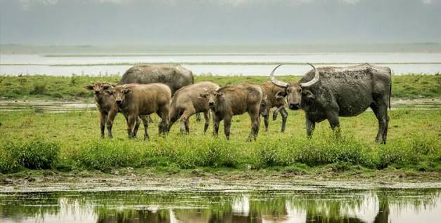
The one good side effect of that instability is habitat. Koshi Tappu Wildlife Reserve, a Ramsar site of braided channels, sandbanks and grassland between the embankments, holds the last wild water buffalo population in Nepal and is the best bird site in the country, with waterfowl and waders arriving in numbers through the winter.
The Gandaki: the deepest gorge and the sacred stones
The Gandaki, or Sapta Gandaki, gathers the Kali Gandaki, Trishuli, Budhi Gandaki, Marsyangdi, Seti, Madi and Daraudi. Its catchment is the central Himalaya: Manaslu, Annapurna, Dhaulagiri. The Kali Gandaki is the spine of the system and the most culturally loaded river in Nepal after the Bagmati.
Its riverbed above Kagbeni yields shaligram, black ammonite fossils from the Tethys Sea that once lay where the mountains now stand. Hindus regard shaligram as aniconic forms of Vishnu, and they are collected, worshipped in household shrines and carried across South Asia. The temple at Muktinath, above the gorge at over 3,700 m, is one of the very few shrines in the subcontinent sacred to Hindus and Buddhists alike, and its pilgrim traffic follows the river up from the plains.
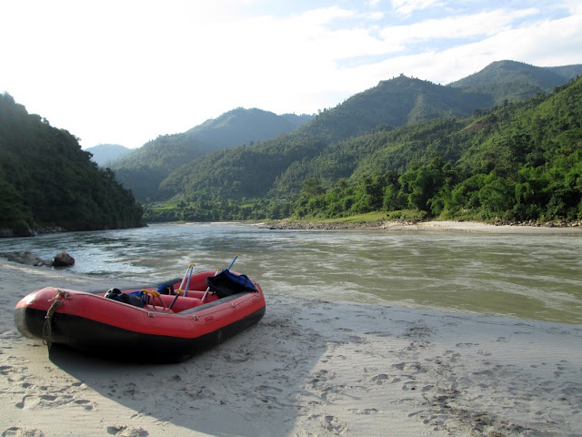
The Trishuli, meanwhile, is the most travelled river in Nepal simply because the Kathmandu to Pokhara highway runs alongside it for hours. That accessibility made it the country introductory whitewater run, and a large share of first-time rafting in Nepal happens on the Trishuli for exactly that reason.
The Karnali: the longest and the least dammed
The Karnali is the longest river in Nepal and the one that has changed least. It rises near Mount Kailash on the Tibetan plateau, enters through Humla, and gathers the Mugu Karnali, the Tila, the West Seti and the Bheri before breaking out of the hills at Chisapani and running past Bardiya National Park into India, where it takes the name Ghaghara and eventually joins the Ganges.
What makes it unusual is that it remains essentially free flowing along its main stem. Large storage projects have been proposed on the Karnali and on the West Seti for decades without being built, which has left one of the great Himalayan rivers substantially intact. Ecologically that matters: the Karnali still supports golden mahseer runs and one of the few remaining Nepali populations of the Ganges river dolphin, a freshwater cetacean that cannot pass a barrage. It is also the premier multi-day expedition rafting river in the country, and a Karnali river trip in the post-monsoon months remains one of the best wilderness journeys available anywhere in the Himalaya.
How the three systems compare
| System | Headwaters | Principal tributaries | Leaves the hills near | Known for |
|---|---|---|---|---|
| Koshi | Tibetan plateau north of Everest and Kanchenjunga | Sun Koshi, Tama Koshi, Dudh Koshi, Arun, Tamor, Indrawati, Likhu | Chatara and the Koshi Barrage, Sunsari | Sediment, floods on the Bihar plain, Koshi Tappu wetlands |
| Gandaki | Mustang plateau, north of Annapurna and Manaslu | Kali Gandaki, Trishuli, Marsyangdi, Budhi Gandaki, Seti, Madi, Daraudi | Devghat and Triveni, Nawalparasi | Kali Gandaki gorge, shaligram fossils, Muktinath |
| Karnali | Mount Kailash region and the Humla highlands | Humla Karnali, Mugu Karnali, Tila, Bheri, West Seti | Chisapani, on the edge of Bardiya | Longest river in Nepal, largely free flowing, dolphins and mahseer |
| Mahakali | Api and Nampa massif in the far west | Chameliya, Surnaya | The far western border with India | Boundary river, treaty water, Sudurpashchim irrigation |
| Bagmati | Shivapuri hills inside Nepal | Bishnumati, Manohara, Dhobi Khola | Southern Terai, Rautahat and Sarlahi | The only major river rising entirely within Nepal, sacred through Kathmandu |
The Bagmati is included for contrast. It is the exception that proves the pattern: because it rises in the Kathmandu hills rather than beyond the Himalaya, it has no glacial input and behaves completely differently, flooding hard in the monsoon and running low and heavily polluted the rest of the year.
Life along the rivers
The riverine ecology of Nepal is chronically overlooked next to its mountains. The Ganges river dolphin survives in small numbers in the Karnali and Koshi systems and is one of the most endangered mammals in the country. Gharial, the narrow-snouted fish-eating crocodile, hold on in the Narayani and Rapti within Chitwan and are the subject of a long-running breeding and release programme. Golden mahseer, the great migratory sport fish of South Asia, run up the larger tributaries and are a good indicator of whether a river is still connected end to end.
Human life along the rivers is just as distinct. Tharu communities have farmed and fished the western floodplains for centuries and carry a well-documented historical resistance to lowland malaria. Raji and Bote households along the Karnali and Narayani built their livelihoods on fishing and ferrying. Upstream, the trans-Himalayan valleys of Mustang and Humla developed as trade societies precisely because the rivers cut usable corridors through the range.
Practical notes for travellers
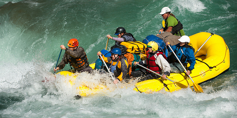
Rafting and kayaking seasons follow the monsoon. The best water is generally from late September through November, once the rivers have dropped from monsoon peak but still carry volume, with a second window from March into May. Monsoon flows from June to August are dangerous on most rivers and reduce visibility for wildlife along the banks. The Trishuli suits a day trip from Kathmandu or Pokhara. The Sun Koshi is a long river journey of a week or more through the eastern hills. The Karnali is the committing wilderness option and needs a proper outfitter, spare days and a tolerance for being genuinely out of contact.
For wildlife, the river systems are best approached from the reserves: Koshi Tappu for birds and wild buffalo in the east, Chitwan on the Narayani and Rapti in the centre, Bardiya on the Karnali in the west. Water levels drop through the winter and early spring, which concentrates animals on the remaining channels and makes viewing considerably easier.
FAQ
What are the three main river systems of Nepal?
The Koshi in the east, the Gandaki in the centre and the Karnali in the west. Between them they drain almost the entire country, and all three eventually feed the Ganges.
Which is the longest river in Nepal?
The Karnali. It rises near Mount Kailash on the Tibetan plateau, runs the length of western Nepal, and is known as the Ghaghara once it crosses into India.
Why is the Kali Gandaki gorge called the deepest in the world?
Because the river runs between Dhaulagiri and Annapurna I, both above 8,000 m, while the riverbed sits far below. Measured from summit to river, the vertical relief exceeds that of any other river gorge, though other definitions of depth give different winners.
Are Nepal rivers safe to raft?
With a licensed operator, in season and with proper safety kayaks, yes. Avoid monsoon high water, check that guides carry current certification, and treat multi-day expeditions on the Karnali or Sun Koshi as serious undertakings rather than day trips.
Why is the Koshi called the Sorrow of Bihar?
Because it deposits so much Himalayan sediment on the plain that it raises its own bed and changes course, flooding large areas of Bihar. Embankments and a barrage were built to contain it, and both have failed at times.