
Makalu Barun National Park protects roughly 1,500 square kilometres of eastern Nepal in Sankhuwasabha and Solukhumbu districts, rising from the Arun river at about 435 metres to the summit of Makalu at 8,485 metres. Established in 1992 with an adjoining buffer zone, it is the only protected area on earth that spans more than eight vertical kilometres inside one boundary. That range packs subtropical river forest, temperate oak, rhododendron cloud forest, alpine pasture and permanent ice into a single park.
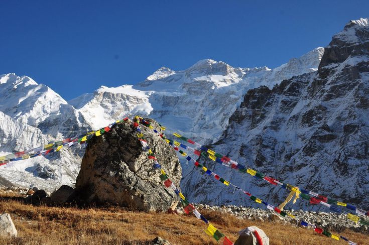
Where is Makalu Barun National Park?
The park lies in eastern Nepal, immediately east of Sagarmatha National Park and immediately west of the Arun valley. Its northern boundary is the Tibetan frontier, where it adjoins the Qomolangma National Nature Preserve on the Chinese side. Together with Sagarmatha and the Tibetan reserve, it forms one of the largest contiguous protected landscapes in the high Himalaya.
Access starts at Tumlingtar airstrip in the Arun valley, or overland from Hile and Khandbari. From there a road runs to Num and Seduwa, and the walking begins. The classic route climbs over the Shipton La and drops into the Barun valley, reaching Makalu base camp in roughly seven to nine days from the road head. Anyone comparing eastern options should also read the Kanchenjunga Base Camp route, which crosses similar forest belts further east.
Why does the elevation range matter so much?
Biodiversity in the Himalaya is mostly a function of vertical range and rainfall, and Makalu Barun maximises both. The Arun is one of the great transverse rivers of the Himalaya, cutting a gorge that channels warm, wet air from the Indian plains far north into the range. Rainfall on the southern slopes is high, and the resulting forest belts are lush and continuous rather than fragmented.
The practical result is that a walker gains a new biome every day. Rice terraces and banana below 1,000 metres give way to sal and chilaune, then oak and magnolia, then dense rhododendron and bamboo cloud forest, then birch and juniper at the treeline, then pasture, moraine and glacier. Very few places on earth let you cross that many life zones without a flight in between.
| Belt | Approximate elevation | Dominant vegetation | Wildlife to look for |
|---|---|---|---|
| Arun river gorge | 435 to 1,200 m | Sal, chilaune, riverine scrub, farmland | Rhesus macaque, barking deer, kingfishers, otter |
| Lower temperate forest | 1,200 to 2,400 m | Oak, chestnut, magnolia, alder | Assamese macaque, yellow-throated marten, laughingthrushes |
| Cloud forest | 2,400 to 3,400 m | Rhododendron, bamboo, fir, moss and epiphytes | Red panda, Himalayan black bear, satyr tragopan |
| Treeline and shrub | 3,400 to 4,200 m | Birch, juniper, dwarf rhododendron | Musk deer, Himalayan tahr, blood pheasant |
| Alpine and glacial | Above 4,200 m | Cushion plants, sedge, moraine, permanent ice | Snow leopard, blue sheep, snowcock, lammergeier |
What wildlife lives in the Barun valley?
The species that defines the park is the red panda. Its habitat requirement is narrow: temperate forest between roughly 2,200 and 3,600 metres with a dense bamboo understorey and old trees for resting and denning. The Barun and its side valleys hold exactly that, in continuous blocks rather than fragments, which is why eastern Nepal is one of the more important red panda strongholds in the range.
Above the forest, snow leopard occupies the same broken alpine ground it uses across the Nepal Himalaya, hunting blue sheep and Himalayan tahr. Musk deer use the birch and rhododendron thickets. Himalayan black bear ranges widely through the temperate belt, and clouded leopard has been recorded in the lower forest. Wild dog, or dhole, and Himalayan serow are also on the park list, along with a long tally of smaller carnivores.
Bird diversity is exceptional and reflects the same elevation range. Satyr tragopan, blood pheasant, Himalayan monal, wood snipe, wren-babblers, parrotbills, laughingthrushes, sunbirds, minivets and a broad range of raptors are all recorded, with several hundred species on the park list. The Arun valley below the park is a recognised migration corridor and adds significantly to the total.
What plants does Makalu Barun protect?
Park records list several thousand flowering plant species, including dozens of orchids and a large share of the rhododendron species found in Nepal. Wet eastern slopes, deep soils and continuous forest cover produce that richness. The cloud forest between about 2,500 and 3,300 metres carries the heaviest epiphyte load in the country, with trees draped in moss, lichen, ferns and orchids to the point where the branch itself disappears.
Medicinal and aromatic plants are collected in the buffer zone under community management, as elsewhere in Nepal. Bamboo is the ecological linchpin in the temperate belt: it feeds red panda, shelters pheasants, and is also harvested for construction and craft, which makes bamboo harvest regulation one of the most consequential management decisions in the park.
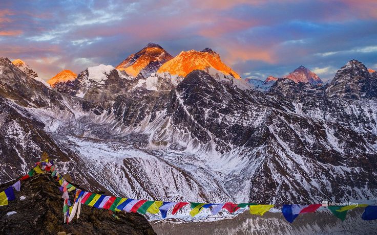
How does the park fit into a transboundary landscape?
Makalu Barun is one link in a chain. To the west, Sagarmatha National Park protects the Everest massif, including Everest itself at 8,849 metres. To the north lies the Qomolangma National Nature Preserve in Tibet. To the east, across the Arun, the Kanchenjunga Conservation Area continues the belt to the Indian border. Large-bodied species with big ranges, snow leopard above all, depend on that continuity rather than on any single park boundary.
The buffer zone, roughly 830 square kilometres around the park, is where most people actually live and where most management effort goes. Community forest user groups manage timber and fodder harvest, run anti-poaching patrols and receive a share of park revenue. In practice the boundary that matters for wildlife is not the line on the map but whether the forest between villages stays connected.
How hard is trekking in Makalu Barun National Park?
Harder than the Everest and Annapurna standards, and much less developed. Teahouses exist along the main Makalu base camp route but are basic and seasonal, and side valleys require camping. The trail loses and regains large amounts of altitude on the approach, crosses the Shipton La at around 4,200 metres, and then follows the Barun gorge on rough ground.
Best seasons are late March to May and October to November. Spring gives rhododendron in flower and better chances of forest wildlife; autumn gives stable weather and the clearest views of Makalu. Monsoon brings leeches, landslides and cloud, and winter closes the upper valley. Trekkers accustomed to the lodge comfort of the Langtang valley should expect a significant step down in facilities and a step up in remoteness.
FAQ
How high is Makalu and where is it in the park?
Makalu is 8,485 metres and the fifth highest mountain in the world. It stands on the northern boundary of the park near the Tibetan frontier, at the head of the Barun valley. Makalu base camp, at around 4,870 metres, is the standard trekking destination below the south face.
Can you see red pandas in Makalu Barun National Park?
The park is genuine red panda habitat, but sightings are difficult. The animal is small, mostly arboreal, largely crepuscular and superbly camouflaged against moss-covered branches. Realistic chances improve with a local guide who knows specific bamboo blocks, several patient days in forest between 2,500 and 3,500 metres, and dawn or dusk searching.
When was Makalu Barun National Park established?
The park was established in 1992, making it one of the newer national parks in Nepal, with a buffer zone of roughly 830 square kilometres added around it. It was designed from the outset with community management in the buffer zone rather than as a strictly exclusionary reserve.
How many days does the Makalu base camp trek take?
Most itineraries run eighteen to twenty-two days from Kathmandu, including the flight to Tumlingtar, road transfer to the Num or Seduwa road head, roughly seven to nine days of walking to base camp, acclimatisation days and the return. Weather delays on the Tumlingtar flight are common enough to justify spare days.
Do you need a permit for Makalu Barun National Park?
Yes. A national park entry permit is required, along with the standard trekker information card. The main Makalu base camp route is not a restricted area, so a licensed agency is not compulsory in the way it is for Upper Dolpo, but a guide is strongly advised given the remoteness and limited facilities.