
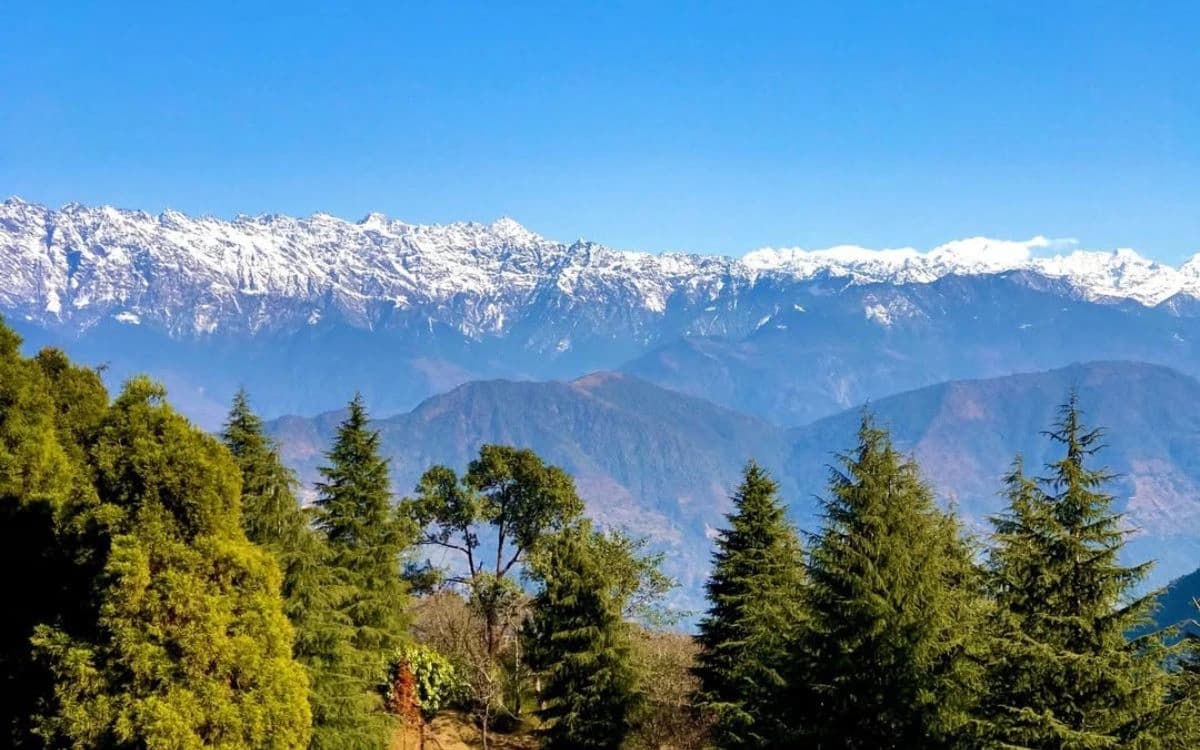
Shivapuri Nagarjun National Park wraps around the northern rim of the Kathmandu Valley, 159 sq km of mid-hill forest rising to 2,732 m at Shivapuri peak. Gates at Sundarijal, Budhanilkantha, Tokha and Balaju sit under an hour from central Kathmandu, which makes it by a wide margin the most reachable protected area in Nepal.
Two blocks, one park
The park is really two forests joined by an administrative decision. Shivapuri, the larger northern block, was declared a national park in 2002 after decades as a protected watershed. Nagarjun, the isolated forested hill west of the city that Kathmandu residents call Rani Ban, was added in 2009 and the combined area renamed.
They feel different. Shivapuri is a long forested ridge, steeply terraced at the base and increasingly wild as you climb, with oak and rhododendron replacing pine towards the top. Nagarjun is a single hill of around 2,100 m with a stupa on the summit and a short road spiralling up it, closer to a large city forest than to wilderness. Both charge entry at the gate and both are genuinely worth a day.
The park boundary reaches beyond Kathmandu district into Nuwakot and Dhading, though almost all visitor access is from the valley side. For how the valley's districts fit together, our guide to the Kathmandu Valley districts covers the administrative picture.
The walks worth doing
Sundarijal to Chisapani is the classic. It starts at the reservoir above Sundarijal, climbs through Mulkharka and out over the ridge, and reaches Chisapani in four to six hours with a lodge at the end. This is also the first day of the Helambu trek, which means you can either turn round or keep walking north into Langtang National Park.
Budhanilkantha to Shivapuri peak is the harder day walk and the better one for views. The route climbs past Nagi Gompa, a Buddhist nunnery on a shelf with a clear outlook over the valley, and continues to the summit at 2,732 m. On a clear winter morning the Ganesh and Langtang ranges are visible north. Allow five to seven hours return and start early, because afternoon cloud closes the view reliably from March onwards.
Bagdwar, the traditional source of the Bagmati River, is a shorter target from the Budhanilkantha side and carries real religious weight. Nagarjun from Balaju to the Jamacho stupa is the easy option, two to three hours up through good forest with prayer flags at the top. All of these are day walks; none require a guide, though the Shivapuri peak trail has unmarked junctions.
Water, and why this forest is protected
Shivapuri was protected as a watershed long before anyone thought of it as a park, and that remains its primary function. The streams draining its southern face feed the Bagmati and Bishnumati, and a significant share of Kathmandu's piped water is drawn from catchments inside the boundary. Sundarijal's reservoir and pipeline are the visible end of that system.
This is why the boundary is enforced more seriously than the recreational use suggests, why grazing and firewood collection are restricted, and why the gates keep records. It also explains the odd sight of army posts inside what feels like a city park. The protected area system guide covers how watershed protection sits alongside biodiversity in Nepal's park categories, and our Shivapuri Nagarjun guide covers the trails in more detail.
Wildlife and birds
Leopard are present and occasionally taken on camera traps, Himalayan black bear are recorded in the upper forest, and jungle cat, barking deer, wild boar, rhesus macaque and yellow-throated marten are all reasonably common. You will almost certainly see none of the large mammals on a day walk. What you will see is birds.
More than 300 species have been recorded, and the elevation range from around 1,350 m to 2,732 m means you cross several bands in one climb. Laughingthrushes, sunbirds, minivets, warblers and woodpeckers are the working list, and winter brings altitudinal migrants down from higher forest. The Budhanilkantha to Nagi Gompa stretch in early morning is the standard birding walk. Our birdwatching guide lists what to expect at each band.
| Detail | Shivapuri Nagarjun National Park |
|---|---|
| Shivapuri declared | 2002 |
| Nagarjun added | 2009 |
| Area | 159 sq km |
| Districts | Kathmandu, with parts in Nuwakot and Dhading |
| Province | Bagmati |
| Elevation range | About 1,350 m to 2,732 m |
| Highest point | Shivapuri peak, 2,732 m |
| Main gates | Sundarijal, Budhanilkantha, Tokha, Balaju for Nagarjun |
| Bird species recorded | More than 300 |
| Time from Thamel | 30 to 60 minutes to any gate |
| Best season | Year-round; October to April clearest |
Fees, gates and the practical bits
Entry is ticketed at each gate, with separate rates for Nepali, SAARC and other foreign visitors, as at every Nepali national park. Rates change periodically, so treat any figure you read online as indicative and carry rupees in cash. There is no card payment at the gates and no ATM at Sundarijal or Budhanilkantha.
Take a taxi rather than a bus if time matters; buses run to Budhanilkantha and Sundarijal but are slow. Start early, both for the views and because the gates close in the late afternoon and rangers do check. Carry water, because there is little to buy above the villages, and expect leeches on the Sundarijal side during and just after the monsoon.
The park works year-round, which is unusual in Nepal. October to April gives the mountain views; the monsoon gives green forest, waterfalls and cloud, which is its own thing if you are not there for the panorama. If you are combining this with the valley's religious sites, Budhanilkantha's sleeping Vishnu is at the gate itself and is covered in our guide to Budhanilkantha and Doleshwor Mahadev. For a sunrise viewpoint on the valley's eastern rim instead, see Nagarkot.
Frequently Asked Questions
How far is Shivapuri from Kathmandu?
The nearest gates are thirty to sixty minutes from Thamel by taxi. Budhanilkantha and Sundarijal are the two most used entrances, and Balaju for the separate Nagarjun block is closer still.
Do I need a permit or a guide?
You need an entry ticket bought at the gate, with different rates for Nepali, SAARC and other foreign visitors. A guide is not required for the main day walks, though the Shivapuri peak trail has unmarked junctions where one helps.
How long does the Sundarijal to Chisapani walk take?
Four to six hours depending on pace and stops. There are simple lodges at Chisapani, which makes it a comfortable overnight, and the route continues north as the first day of the Helambu trek.
Can you see the Himalaya from Shivapuri peak?
On clear mornings between October and April, yes, with the Ganesh and Langtang ranges to the north. Cloud builds through the day from spring onwards, so start before dawn if the view is the point.
Is it safe to walk alone?
The main trails are busy at weekends and generally fine, but the upper forest is quiet on weekdays. Tell someone your route, carry a phone, and avoid starting a long walk late in the day.
Are there leeches?
Yes, on the wetter Sundarijal side during the monsoon and for several weeks afterwards. Long trousers, socks over the cuffs and a small bottle of salt deal with them adequately.