
Dhaulagiri I is 8,167 metres, the seventh highest mountain on earth and the highest peak that lies entirely within Nepal. Its name comes from the Sanskrit dhavala giri, white mountain. It was first climbed on 13 May 1960 by a Swiss and Austrian expedition led by Max Eiselin, and it forms the western wall of the Kali Gandaki, the valley running between Dhaulagiri I and Annapurna I that is commonly described as the deepest gorge in the world.
Where is Dhaulagiri and why is it significant?
The massif sits in western Nepal, spanning parts of Myagdi, Baglung and Mustang districts, immediately west of the Annapurna range. Unlike Everest, Kangchenjunga and Makalu, which straddle borders, Dhaulagiri I stands wholly inside Nepal. It is the seventh of the fourteen eight-thousanders by height and the mountain that anchors an entire chain of 7,000 metre summits running west toward Dolpa.
It also has a curious cartographic history. From around 1808, when survey work in northern India first put a figure on it, Dhaulagiri was believed to be the highest mountain in the world. It held that status for about three decades until Kangchenjunga displaced it, and Kangchenjunga in turn gave way to Everest after the calculations of 1852. Very few mountains have been demoted twice.
Seen from the south the mountain is a single enormous white wall with no approach and no obvious weakness, which is why the 1950 French expedition, sent to climb it, gave up on the reconnaissance and switched to Annapurna I instead. That decision handed the first eight-thousander to the Annapurna massif and left Dhaulagiri unclimbed for another decade.
How was Dhaulagiri first climbed?
By an expedition that arrived partly by air. Max Eiselin’s 1960 Swiss and Austrian team used a Pilatus PC-6 Porter, a short take-off aircraft nicknamed Yeti, to ferry loads and climbers onto the glacier at high altitude. It was the first serious use of powered aircraft to supply a Himalayan expedition, and it cut the punishing multi-week approach march to almost nothing.
The summit was reached on 13 May 1960 by Kurt Diemberger, Peter Diener, Ernst Forrer and Albin Schelbert, together with the Sherpas Nyima Dorje and Nawang Dorje. Diemberger has the rare distinction of first ascents on two eight-thousanders, having also been on Broad Peak in 1957. The aircraft itself was wrecked on the glacier and never flew out, a detail that has kept the story in circulation ever since.
The mountain has stayed serious. The standard northeast ridge route is exposed to weather that arrives from the west with little warning, and the massif as a whole has a long accident record. In October 2018 a storm at the base camp of Gurja Himal, on the southern side of the range, killed nine climbers in a single night. Anyone planning even a trekking route here should treat western Nepal weather with more respect than the Khumbu demands.
Is the Kali Gandaki really the deepest gorge in the world?
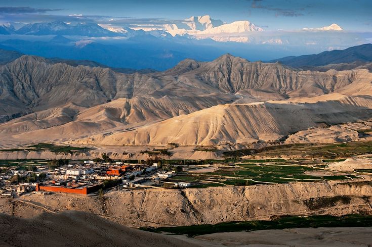
By the usual measure, yes, and the measure is worth understanding because it is not the one most people assume. The claim does not compare canyon walls in the way the Grand Canyon is measured. It compares the altitude of the river with the altitude of the summits standing on either side of it.
Dhaulagiri I at 8,167 metres and Annapurna I at 8,091 metres are roughly 34 kilometres apart. The Kali Gandaki runs between them, and near Tatopani the river bed sits at around 1,200 metres. That gives a vertical difference of close to 7,000 metres between the water and the peaks flanking it, which no other river valley on earth matches.
The gorge is more than a statistic. It is the historic trade corridor between the Nepali middle hills and the Tibetan plateau, the reason salt moved south and grain moved north for centuries, and the route that carried Buddhism into the valleys of Upper Mustang. It is also the source of shaligram, the black ammonite fossils venerated in Hinduism as forms of Vishnu, washed out of marine sediments that were seabed before the Himalaya existed. The pilgrimage temple of Muktinath stands above its upper reaches at 3,710 metres.
One more consequence: wind. The gorge funnels a fierce daily up-valley wind that starts late morning and blows hard through the afternoon, which is why every walker and every flight in and out of Jomsom moves in the early hours.
What peaks and passes make up the Dhaulagiri massif?
The massif is a chain rather than a single mountain, with Dhaulagiri I at the eastern end and a run of 7,000 metre summits extending west. The Dhaulagiri Circuit, the main trekking route, crosses the northern side of this chain by way of two passes above 5,200 metres.
| Point on the route | Approx. elevation | Type | Note |
|---|---|---|---|
| Beni | 830 m | Road head | Usual start, on the Kali Gandaki below Tatopani |
| Muri | 1,850 m | Village | Last substantial settlement before the Myagdi Khola narrows |
| Italian Base Camp | about 3,660 m | Camp | First high camp under the west flank; no lodges |
| Dhaulagiri Base Camp | about 4,750 m | Camp | On the Chhonbardan Glacier below the north face |
| French Pass | 5,360 m | Pass | High point of the circuit, named for the 1950 reconnaissance |
| Hidden Valley | about 5,100 m | Camp | Bleak high basin between the two passes, brutally cold at night |
| Dhampus Pass | 5,240 m | Pass | Exit east toward Mustang |
| Marpha | 2,670 m | Village | Kali Gandaki apple-growing village; end of the walking |
Beyond Dhaulagiri I, the chain carries Dhaulagiri II at 7,751 metres, Dhaulagiri III, IV and V all above 7,600 metres, Churen Himal at 7,371 metres, Putha Hiunchuli at 7,246 metres and Gurja Himal at 7,193 metres. Putha Hiunchuli marks the western end of the massif and the beginning of the country that leads into Dolpa.
How hard is the Dhaulagiri Circuit trek?
Considerably harder than the Annapurna Circuit, and not comparable to it in style. There are no lodges on the high section. From roughly Italian Base Camp to Marpha the trek is fully supported camping, with tents, a cook crew and everything carried in. It normally takes 16 to 21 days from Beni and crosses two passes above 5,200 metres with a night at about 5,100 metres in Hidden Valley in between.
The technical demands are modest in good conditions but the margins are thin. The route crosses the Chhonbardan Glacier, where crampons and a rope are standard practice, and both passes can hold deep snow well into the spring season. Weather closes the route outright some years. Parties have been turned back at French Pass and forced to retrace the entire approach.
Acclimatisation is the real constraint, because the profile climbs steadily from 830 metres at Beni with few natural rest points. Any sensible itinerary builds spare days into the base camp section rather than counting on making them up later. Rescue is difficult and slow: the valley is remote, helicopter access is weather dependent and there is no road within days of the high camps.
West of the massif, across the Uttarganga watershed, lies Dhorpatan, Nepal’s only hunting reserve, established in 1987 and covering roughly 1,325 square kilometres of high pasture and forest. Some longer itineraries link the two, walking out west from the Dhaulagiri approach instead of crossing to Mustang. Regulations in the reserve change and must be confirmed with the department before any trip is planned around it.
How can you see Dhaulagiri without a full expedition?
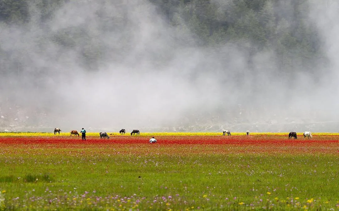
Easily, which is the paradox of this mountain. The hardest eight-thousander in Nepal to walk around is one of the simplest to look at. Poon Hill at 3,210 metres, reachable on a three to five day loop from Pokhara, gives a full-frontal view of the Dhaulagiri wall across the Kali Gandaki at sunrise, and it is the single most photographed view of the mountain.
Flights between Pokhara and Jomsom pass directly through the gorge with the massif on the western side, weather permitting, and take about twenty minutes. From the ground, the walk up the Kali Gandaki through Tatopani, Ghasa, Kalopani and Marpha keeps Dhaulagiri in view for days while staying on lodge trails at moderate altitude. Kalopani in particular has a clear line on Dhaulagiri I and Tukuche Peak.
For a middle option, the short trek to Khopra ridge west of the Ghorepani area climbs above 3,600 metres for a considerably closer and quieter view than Poon Hill offers, with community-run lodges and a fraction of the traffic. October and November give the cleanest air. December and January are colder but often exceptionally clear.
FAQ
How high is Dhaulagiri?
Dhaulagiri I is 8,167 metres, the seventh highest mountain in the world. It is the highest peak lying entirely within the borders of Nepal, since Everest, Kangchenjunga and Makalu all sit on international frontiers.
Who first climbed Dhaulagiri and when?
A Swiss and Austrian expedition led by Max Eiselin made the first ascent on 13 May 1960. Kurt Diemberger, Peter Diener, Ernst Forrer, Albin Schelbert and the Sherpas Nyima Dorje and Nawang Dorje reached the summit. The expedition was notable for using a Pilatus Porter aircraft to supply its high camps.
Why is the Kali Gandaki called the deepest gorge in the world?
Because of the difference between the river bed and the summits on either side. Dhaulagiri I at 8,167 metres and Annapurna I at 8,091 metres stand about 34 kilometres apart, and the river between them drops to around 1,200 metres near Tatopani, a vertical difference of nearly 7,000 metres.
How long is the Dhaulagiri Circuit trek?
Most itineraries run 16 to 21 days from Beni to Marpha, crossing French Pass at 5,360 metres and Dhampus Pass at 5,240 metres. The high section is camping only, with no lodges, and requires a full support crew and glacier equipment.
Where is the best view of Dhaulagiri for trekkers?
Poon Hill at 3,210 metres gives the classic sunrise view across the Kali Gandaki and needs only three to five days from Pokhara. Khopra ridge, above 3,600 metres, is closer and much quieter, and the lodge villages of Kalopani and Marpha in the gorge itself keep the mountain in sight for days.