
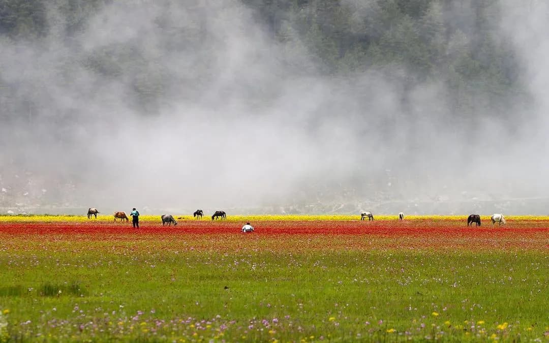
Dhorpatan is the only hunting reserve in Nepal, 1,325 sq km of alpine meadow, fir forest and rock spread across Baglung, Myagdi and East Rukum districts. It was gazetted in 1987, is divided into seven management blocks, and is centred on a broad open valley at around 3,000 m below the western end of the Dhaulagiri range. Most people who come here walk rather than hunt.
How you reach the valley
The practical approach is from Pokhara. Drive to Baglung, then on to Burtibang, which is the last town of any size and the point where the surfaced road gives out. From Burtibang a rough track pushes towards Dhorpatan and jeeps use it in the dry months, but whether it is running depends on the year, the last landslide and the driver you find. Ask in Burtibang rather than trusting a map or a booking made from Kathmandu.
If the track is closed, or if you would rather walk, it is two to three days on foot from Burtibang over forested ridges into the valley. Coming from the north-west, Dhorpatan also sits on the long trekking line that links Rolpa and Rukum with the Dolpo country beyond, which is how most people who arrive on foot get here.
The reserve in numbers
| Established | 1987, the only hunting reserve in Nepal |
| Area | 1,325 sq km |
| Districts | Baglung, Myagdi and East Rukum |
| Management blocks | Seven |
| Elevation | About 3,000 m on the valley floor, rising above 5,000 m |
| Road head | Burtibang, Baglung district |
| Walk in | 2 to 3 days from Burtibang |
| Nearest airport | Pokhara |
| Best season | April to June, September to November |
What a hunting reserve actually means here
The designation confuses people, so it is worth being plain about it. Dhorpatan is not open season on wildlife. Licensed trophy hunting is permitted for two species, blue sheep and Himalayan tahr, under quotas set block by block and issued for a spring and an autumn season by the Department of National Parks and Wildlife Conservation. Licences are applied for in advance, are priced per animal and per block, and are not something a visitor arranges on arrival. Every other species in the reserve is protected exactly as it would be in a national park, and snow leopard, musk deer and red panda are all present and fully protected.
In practice the great majority of foreign visitors here are trekkers, and the blocks in season are a small part of a very large area. If the arrangement strikes you as odd, the reasoning behind it is set out at length in our Dhorpatan reserve guide, and the wider logic of how Nepal classifies its protected land is covered in the protected area system explained.
What you see
Blue sheep are the animal you are most likely to spot, usually as a grey smear on a scree slope that only resolves through binoculars once something moves. Himalayan tahr work the steeper ground. Above them, snow leopard territory begins, and while sightings are rare in any season, winter pushes both cats and prey lower and gives the best odds anyone gets. Danphe, the Himalayan monal, breaks out of the rhododendron with a noise that will make you jump at least once.
The valley itself is the other draw. It is unusually broad and flat for Nepal at this height, ringed by forest, with seasonal herder settlements and a grass airstrip that no longer sees scheduled service. On a clear morning the Dhaulagiri peaks show at the eastern end. There is a small resident community, largely Tibetan in origin, and a scattering of teahouses that run in season.
Trekking through rather than to
Dhorpatan works better as a stage than as a destination. It sits on the Guerrilla Trek, the route through Rolpa and Rukum that our Rukum and Rolpa highlands page covers, and a long, committing line runs north-west from here towards Dolpo across high passes. Either turns a three-day walk-in into a two or three week trip, which is a better use of the effort it takes to get to Burtibang in the first place.
You need an entry permit for the reserve, charged per person and issued by the department or at the reserve office. Trekking here is camping-led: there is some village lodging in and around the valley, but the ridges either side have none, and food beyond the valley is what you carry. Where Dhorpatan sits against the better-known parks is set out in Nepal national parks compared.
When to go
April to June and September to November. Spring brings rhododendron through the approach forest and the meadows greening; autumn gives the most reliable weather and the clearest views. The monsoon makes the Burtibang track a lottery and the forest walk a slog. Winter is when snow leopard sightings are most plausible, but the valley is cold, the track is shut and much of the resident population moves lower, so it is an expedition rather than a trek. The full historical background to the reserve is in our article on the Dhorpatan hunting reserve.
Frequently Asked Questions
Can anyone hunt in Dhorpatan?
No. Licensed hunting is limited to blue sheep and Himalayan tahr, under quotas set per block for a spring and an autumn season, with licences applied for in advance through the national parks department. Everything else is protected.
How do you get to Dhorpatan?
Drive from Pokhara to Baglung and on to Burtibang, then either take a dry-season jeep on the rough track or walk two to three days into the valley. Confirm the track locally rather than relying on a map.
Do you need a permit to trek in Dhorpatan?
Yes, a reserve entry permit charged per person, at different rates for foreign visitors, SAARC nationals and Nepalis. Hunting licences are entirely separate and are not issued to walk-in visitors.
Is there any chance of seeing a snow leopard?
They are present, but sightings are rare in any season. Winter offers the best odds because snow pushes prey lower, and that is also when the valley is hardest to reach and coldest to camp in.
Is there accommodation in the reserve?
There is basic village lodging in and around the Dhorpatan valley that runs in season. Beyond the valley there is nothing, so any trek that crosses the ridges needs tents, a cook and carried food.
How does Dhorpatan combine with other treks?
It lies on the Guerrilla Trek through Rolpa and Rukum, and a long high route runs north-west from the valley towards Dolpo. Either turns the journey into a two to three week trip rather than a short visit.