
Api Nampa Conservation Area covers 1,903 square kilometres of Darchula district in the far west of Nepal, and Gaurishankar Conservation Area covers 2,179 square kilometres across Dolakha, Ramechhap and Sindhupalchok in the centre. Both were declared in 2010, which makes them the two newest conservation areas in the country, and both receive a tiny fraction of the visitors that Annapurna takes in a single autumn. Api Nampa is administered directly by the Department of National Parks and Wildlife Conservation, while Gaurishankar is managed by the National Trust for Nature Conservation.
What is a conservation area in Nepal and how does it differ from a national park?
Nepal runs two broadly different kinds of protected land. A national park, created under the National Parks and Wildlife Conservation Act of 1973, is strict protection: no permanent settlement in the core zone, no commercial resource extraction, an army garrison on the boundary and management by the Department of National Parks and Wildlife Conservation. A conservation area, created under the Conservation Area Management Regulations of 1996, is a multiple-use category designed for landscapes where people already live and are not going to leave.
Inside a conservation area, residents keep farming, grazing livestock, cutting firewood and timber under quota and collecting medicinal plants. Elected Conservation Area Management Committees hold real authority at village level, and entry fee revenue stays in the district to pay for trails, water systems, schools and health posts rather than going to the national treasury. There is no army presence. Nepal has six conservation areas in total, and management is deliberately mixed: the National Trust for Nature Conservation runs Annapurna, Manaslu and Gaurishankar, a community council runs Kanchenjunga, and the department runs Api Nampa and the small Blackbuck Conservation Area in the western Terai.
Api Nampa is the exception that proves how flexible the category is. It carries the conservation area label and the multiple-use rules that go with it, but the management sits with the same government department that runs the national parks. The label describes the land-use regime, not the agency.
What does the Api Nampa Conservation Area protect?
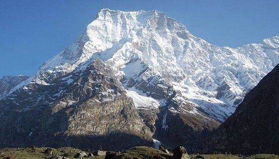
Api Nampa occupies the north of Darchula district in Sudurpashchim province, against the Tibetan border and the Mahakali river that forms the western frontier of Nepal. It takes its name from two peaks: Api at 7,132 metres, the highest mountain in far western Nepal and first climbed in 1960, and Nampa at 6,757 metres. Between them lie glaciers, alpine pasture, birch and fir forest, and a string of villages in the Byas valley including Tinkar and Chhangru, which sit on an old trade route over the passes towards the Tibetan plateau and the Kailash pilgrimage.
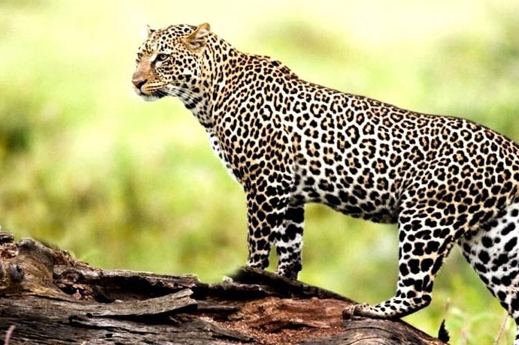
Wildlife follows the classic western Himalayan pattern. Snow leopard occupy the high country, blue sheep provide the prey base, and musk deer, Himalayan tahr, serow and Himalayan black bear all occur. The forests carry Himalayan monal, koklass pheasant and cheer pheasant, the last of which is scarce and largely confined to western Nepal. Yarsagumba collection in the alpine meadows through May and June is a significant part of the local cash economy and, as in Dolpa and Humla, is one of the harder things for managers to regulate.
Almost no foreign trekkers go. The Api Base Camp route from Darchula through Latinath and the Kali Dhunga valley takes around a fortnight and can be walked lodge-free with a tent and a local crew. Access alone deters most people: a flight to Dhangadhi, then a long day of road north through the Mahakali corridor into Darchula, and no reliable air link beyond. Anyone travelling this far west should also budget days for Shuklaphanta National Park in the Terai, which sits on the same road route and holds the largest swamp deer herds in Nepal.
What does the Gaurishankar Conservation Area protect?
Gaurishankar covers the ground between Langtang and Sagarmatha national parks, filling what used to be a gap in the protected chain across the central Himalaya. It is named for Gaurishankar at 7,134 metres, a peak sacred to both Hindu and Buddhist communities that was closed to climbing until 1979. The area takes in the Rolwaling valley, the upper Tamakoshi, the Bhote Koshi headwaters and a large block of temperate forest that is prime red panda habitat.
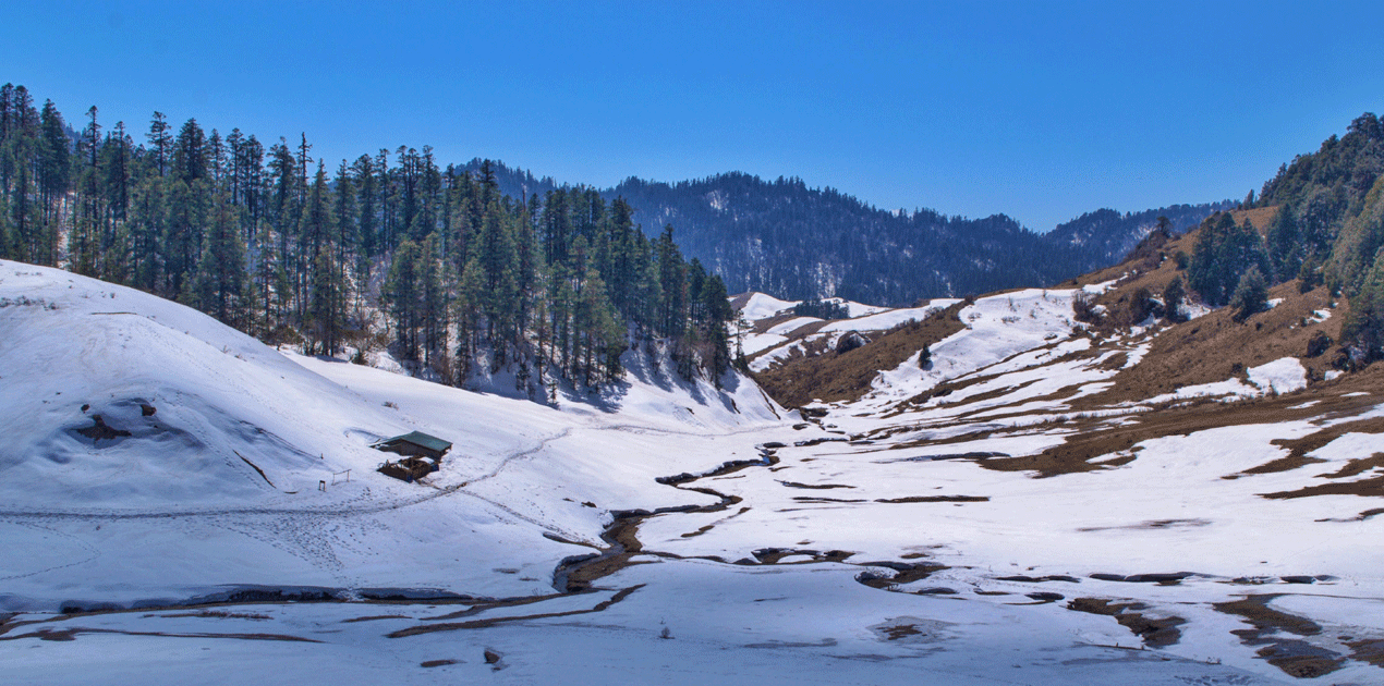
Rolwaling is the reason most trekkers who do come, come. The valley runs east from Simigaun towards the Tibetan border and holds Tsho Rolpa, the largest glacial lake in Nepal at roughly 4,580 metres, which has been the subject of long-running work to lower its level and reduce outburst flood risk to the Tamakoshi below. At the head of the valley, Tashi Lapcha at around 5,755 metres crosses into the Khumbu, a technical pass requiring rope, crampons and a guided party rather than a walking route. The Menlung basin on the far side of the ridge is where the yeti footprint photographs of 1951 were taken, which has kept the valley in mountaineering folklore ever since.
How do Api Nampa and Gaurishankar compare?
The two areas are similar in size and age and very different in everything else. The table below sets out the practical contrasts for anyone deciding between them.
| Feature | Api Nampa | Gaurishankar |
|---|---|---|
| Declared | 2010 | 2010 |
| Area | 1,903 sq km | 2,179 sq km |
| Districts | Darchula, Sudurpashchim | Dolakha, Ramechhap, Sindhupalchok |
| Managed by | Department of National Parks and Wildlife Conservation | National Trust for Nature Conservation |
| Highest peak | Api, 7,132 m | Gaurishankar, 7,134 m |
| Main route | Api Base Camp, about 12 to 16 days, camping | Rolwaling and Tsho Rolpa, about 10 to 14 days, mixed |
| Access from Kathmandu | Flight to Dhangadhi then a full day by road | Road to Charikot and Singati, roughly 7 to 9 hours |
| Lodge availability | Minimal, tents required | Basic lodges to Beding, camping above |
Gaurishankar is the easier of the two to attempt, simply because Kathmandu is a day away by road and the lower Rolwaling has enough lodges to make a short trip feasible. Api Nampa demands a full expedition setup and a week of travel before the walking begins. Neither is a first Himalayan trek.
What permits do you need for Api Nampa and Gaurishankar?
Both areas require a conservation area entry permit for foreign visitors, issued by the managing body or the Nepal Tourism Board. Neither is a restricted zone in the way Manaslu, Upper Mustang or Kanchenjunga are, so you do not need an agency-issued restricted-area permit for the standard routes. A licensed guide is required on most Nepali trekking routes under rules the tourism board tightened in 2023, and in both of these areas a guide is a practical necessity as well as a legal one because route-finding is genuinely hard and there is no trail traffic to follow.
Fees are revised periodically and are not worth quoting from an article. Confirm the current rate with the tourism board or your operator, and carry cash, because there is no card payment anywhere near either trailhead. Registration points exist at the district headquarters in Darchula and Charikot; check in properly, because in an area with almost no other trekkers, the permit record is the only trace of your route that a search party would have.
Why do so few people visit these conservation areas?
Three reasons, in order of weight. Access is expensive and slow: neither area has a working mountain airstrip, so the approach eats days at both ends of the trip. Infrastructure is thin, meaning tents, a cook crew and porters for most itineraries rather than a lodge-to-lodge walk, which roughly doubles the cost per day compared with Annapurna. And neither has a marketing story, because both were gazetted in 2010, long after the classic Nepali trekking brands were established in the 1970s and 1980s.
The consequence is that two protected areas covering more than four thousand square kilometres of high Himalaya sit almost unused by tourism, while the trails of Annapurna and Khumbu take the pressure. That is a management problem as much as a missed opportunity: without visitor revenue, both areas rely more heavily on government budget and donor projects, and the local incentive to protect snow leopard and red panda habitat is weaker than in the areas where trekking pays the bills. For a traveller with three weeks, prior Himalayan experience and a tolerance for uncertainty, the far west in particular offers something Nepal has almost run out of, which is empty mountains with people still living traditionally beneath them.
FAQ
When were Api Nampa and Gaurishankar declared conservation areas?
Both were gazetted in 2010, making them the newest of the six conservation areas in Nepal. Api Nampa covers 1,903 square kilometres in Darchula and Gaurishankar covers 2,179 square kilometres across Dolakha, Ramechhap and Sindhupalchok.
Who manages Api Nampa Conservation Area?
The Department of National Parks and Wildlife Conservation manages it directly, which is unusual for a conservation area. Gaurishankar, Annapurna and Manaslu are managed by the National Trust for Nature Conservation, and Kanchenjunga by an elected community council.
Do you need a restricted area permit for Api Nampa or Gaurishankar?
No. Both need only a conservation area entry permit for the standard routes, unlike Manaslu, Upper Mustang, Nar Phu and Kanchenjunga, which are restricted zones requiring an agency-issued permit and a minimum party of two.
How high are Api and Gaurishankar?
Api reaches 7,132 metres and is the highest peak in far western Nepal. Gaurishankar reaches 7,134 metres and was closed to climbing until 1979 because of its religious significance to both Hindu and Buddhist communities.
What is Tsho Rolpa?
Tsho Rolpa is the largest glacial lake in Nepal, sitting at roughly 4,580 metres at the head of the Rolwaling valley inside the Gaurishankar Conservation Area. It has been monitored and partially drained for years to reduce the risk of a glacial lake outburst flood down the Tamakoshi.