
Bajhang is one of the few districts in Nepal that kept its own king into the twentieth century. The Bajhangi ruling house held a titular royal title long after the rest of the western hills had been folded into the Gorkhali state, and the last figure of real consequence in that line, Jaya Prithvi Bahadur Singh, spent his energy on textbooks, literacy and an early campaign for world peace rather than on territory. The district headquarters, Chainpur, still carries his name in its municipal title.
That is the unusual part. The rest of Bajhang is a large, thinly populated far-western district in Sudurpashchim Province, running from mid-hill terraces up to the Tibetan border, with a 7,000 metre peak on its northern skyline and almost no trekking infrastructure anywhere in between.
Where Bajhang is and why so few people go
Bajhang occupies the north-west of Sudurpashchim. Darchula lies to its west, Bajura to its east, Humla to the north-east, and Doti and Baitadi to the south. The northern boundary is the Tibetan frontier. The district drains largely through the far-western Seti river, which rises in the glaciers below Saipal and runs south through Bajhang before continuing into Doti and eventually joining the Karnali.
The reason so few travellers arrive is straightforward. There is no through route. Bajhang is not on the way to anywhere a foreign visitor is likely to be going, and reaching it means committing two days at each end of a trip. The district gets Nepali pilgrims, traders and returning migrants. It gets very few tourists, and the ones who come tend to be walking rather than sightseeing. Background notes on the district sit on the Bajhang page.
The Bajhangi kingdom and Jaya Prithvi Bahadur Singh
After the Khas Malla kingdom fragmented in the fourteenth century, the western hills settled into a patchwork of small principalities. Bajhang was one of them, ruled by a house that traced its descent from that Malla line. Unification under the Shah state absorbed the far west, but Bajhang retained an unusual degree of internal autonomy and a recognised raja for far longer than most.
Jaya Prithvi Bahadur Singh, born in the late nineteenth century, is the figure worth knowing. He wrote and published Nepali-language teaching material at a time when formal education was effectively restricted to a narrow elite, argued for schooling in the mother tongue, and campaigned internationally for pacifism. For a hill principality with no road, no press and no printing tradition, it was a remarkable output. Chainpur has a modest set of historical remains connected to the old court, and the municipality is named after him.
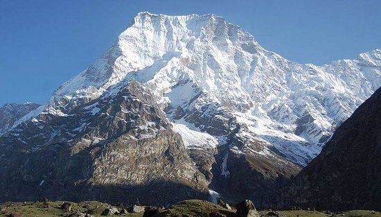
Saipal Himal and the head of the Seti
Saipal, at 7,031 metres, is the dominant peak of Bajhang and one of the least-visited 7,000 metre mountains in Nepal. It sits in the same far-western Himalayan chain as Api and Nampa across the district line in Darchula, and the whole group is usually described together as the Api-Saipal Himal. Expeditions to Saipal are rare, approach logistics are heavy, and the surrounding valleys have no lodges at all.
For walkers rather than climbers, the interest is the approach country: high summer pasture, seasonal herder settlements, glacial streams and long empty valleys where the only traffic is livestock moving up or down with the season. If you want the broader picture of this range and how it compares to the better-known Nepali Himalaya, the Api and Saipal guide covers it in more detail.
Surma Sarovar, Khaptad and the walking country
Bajhang has two destinations that draw people from outside the district. The first is Surma Sarovar, a sacred high lake in the north-east with an annual fair that pulls pilgrims from across the far west. The second is the southern share of Khaptad National Park, the rolling grassland plateau that Bajhang holds jointly with Bajura, Achham and Doti. Khaptad is the gentlest high-altitude walking in the region, more meadow than mountain, and it doubles as a spiritual retreat because of the ashram associated with Khaptad Baba.
| Place | Setting | Why it matters | Best months |
|---|---|---|---|
| Chainpur, Jaya Prithvi Municipality | Seti valley, mid hills | District headquarters, airstrip, road head for the north | March to May, October to November |
| Khaptad plateau | Rolling grassland around 3,000 metres | National park shared with three neighbouring districts | April to June, September to November |
| Surma Sarovar | High alpine basin, north-east Bajhang | Sacred lake and the annual Surma fair | May to early October |
| Saipal approach valleys | Glacier country under a 7,031 metre peak | The head of the Seti and the district skyline | May to June, September to October |
| Urai ridge, northern border | Trans-Himalayan pass country | Historic salt and wool route towards Tibet | June to September |
| Bungal and the lower Seti | Mid-hill terraces and old bazaars | Market settlements and deuda heartland | October to April |
Festivals, Masta gods and deuda nights
Gaura Parva, in Bhadra, is the far-western festival that matters most here. Women fast, the goddess Gaura is worshipped in the form of a sheaf of sacred grasses, and the evenings dissolve into deuda: a linked-arm circle dance with sung couplets traded between two groups. In Bajhang the singing can run most of the night and the verses are frequently improvised on the spot.
Underneath the mainstream Hindu calendar sits the Masta tradition of territorial deities served by dhami oracles, which is stronger in Bajhang than almost anywhere. Village disputes, illness and misfortune are still brought to the dhami in many wards. Dashain, Tihar, Maghe Sankranti and Shivaratri are all observed, but a visitor who wants to see something specific to the far west should aim for Gaura or the Surma fair.
Practical information for travellers
Getting to Bajhang
Chainpur has an airstrip served irregularly by small aircraft from Nepalgunj, subject to weather and demand. The dependable route is overland: fly to Dhangadhi, drive north through Doti, and continue on to Chainpur. Allow a long day on the road and a second day to reach anywhere beyond the headquarters. Public jeeps run, they are crowded, and they leave when they are full rather than at an advertised hour.
Accommodation and food
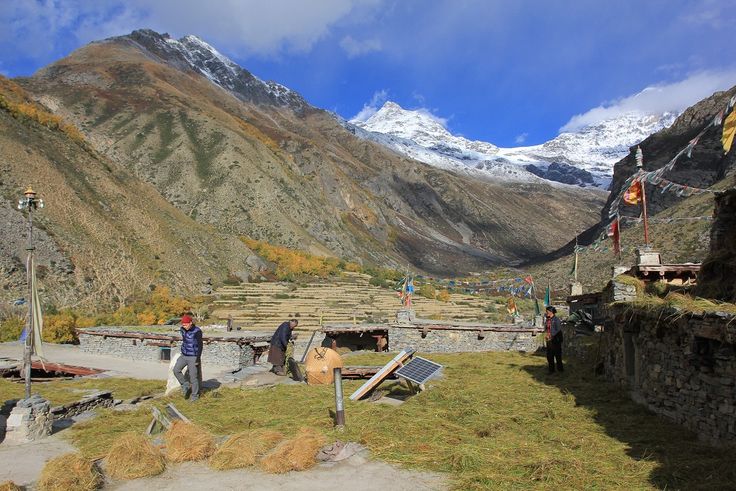
Chainpur has simple hotels. Bungal and larger bazaar settlements have basic rooms. Beyond that, you are camping or arranging a homestay through a guide or a local contact. Food is dal bhat with seasonal vegetables, supplemented by potato, barley and buckwheat as you climb. Carry cash, carry water treatment and do not count on mobile data outside the main valleys.
Season and permits
Bajhang is not a restricted area, so no special trekking permit is required, though a national park entry fee applies inside Khaptad. Spring and autumn are the reliable windows. Summer is the only time the high northern pastures and the Surma basin are properly open, but it is also the monsoon, which means landslides on the roads. Winter shuts the north entirely and makes the mid hills cold and quiet.
Guides and language
A guide is close to essential outside Chainpur, less for route-finding than for arranging beds, food and transport in a district with no visitor economy. Doteli and Bajhangi dialects dominate. Standard Nepali is understood widely and English is rare.
FAQ
What is Bajhang district known for?
Saipal Himal at 7,031 metres, the source of the far-western Seti river, Surma Sarovar, a share of Khaptad National Park, and its history as a semi-independent principality with its own raja into the twentieth century.
How do I get to Bajhang from Kathmandu?
Fly Kathmandu to Dhangadhi, then travel overland north through Doti to Chainpur, which takes most of a day. Small aircraft occasionally serve the Chainpur airstrip from Nepalgunj, but the schedule is not dependable enough to plan around.
Is there trekking infrastructure in Bajhang?
No. There is no lodge circuit, no marked trail network and no rescue infrastructure comparable to Annapurna or Everest. Trekking here means camping, carrying food or arranging homestays, and travelling with someone who knows the valleys.
When is the Surma Sarovar fair?
The main gathering falls in the monsoon and early autumn period when the high basin is snow-free and reachable. Dates follow the lunar calendar and shift year to year, so confirm locally in Chainpur before committing to the walk in.
Can Bajhang be combined with Khaptad and Bajura?
Yes. Khaptad sits on the boundary of four districts, so a route linking Chainpur, the Khaptad plateau and the Badimalika ridge in Bajura is a natural far-western circuit for anyone with two or three weeks.