
The Karnali is the longest river in Nepal, running roughly 507 km inside the country before crossing into India as the Ghaghara and eventually joining the Ganges. It rises on the Tibetan plateau near Mount Kailash and Lake Manasarovar, enters Nepal through Humla in the far northwest, and is frequently described as Nepal's deepest river as well as its longest. It is also the last major Nepali river with no dam on its main stem.
That last fact is the interesting one. Every other big river in Nepal has been engineered somewhere along its length. The Karnali has not, and a 900 MW hydropower scheme has been proposed on its middle reaches for long enough that arguing about it has become a national pastime.
Where the Karnali starts
The headwaters lie in southwestern Tibet, in the same upland that gives rise to the Indus, the Sutlej and the Yarlung Tsangpo. Four of Asia's major rivers begin within a few days' travel of Kailash, which is a good part of why the mountain matters as much as it does to Hindus, Buddhists, Jains and Bon practitioners alike.
The river enters Nepal at the northern edge of Humla district and runs southeast down a steepening valley. This upper stretch is called the Humla Karnali. Simikot, the district headquarters and the only airstrip for a very long way, sits above it. The country here is dry, brown and high, in the rain shadow north of the main Himalayan chain, and the villages are Tibetan in architecture and largely Buddhist in practice. Our Humla district guide covers what living up there involves.
A second major headwater, the Mugu Karnali, drains the country east of Humla including the catchment above Rara. The two meet in Kalikot district, and from that confluence downstream the river is simply the Karnali. It picks up two more large tributaries on its way south: the Bheri, which drains Dolpa and Rukum from the east and is the largest of them, and the West Seti, which comes down from the Api and Saipal massifs on the western side.
The tributaries that make the Karnali
The Karnali is better understood as a basin than as a single line on a map. It drains almost the whole of western Nepal, and each of its major tributaries has its own character and its own district attached to it.
| Tributary | Drains | Joins |
|---|---|---|
| Humla Karnali | The Tibetan headwaters and Humla district | The northwestern headwater; becomes the main stem |
| Mugu Karnali | Mugu district, including the country above Rara | Meets the Humla Karnali in Kalikot |
| Tila | Jumla district. Khalanga sits on its bank | The Karnali in Kalikot |
| Bheri | Dolpa via the Thuli Bheri, plus Rukum and Jajarkot | The largest tributary, joining in the Surkhet region |
| West Seti | The Api and Saipal massifs, Bajhang, Doti and Achham | The Karnali from the west, in the lower hills |
What this means practically is that almost any journey in western Nepal is a journey up one of these tributaries. The road to Jumla follows the Tila for its last stretch. The walk into Dolpa follows the Thuli Bheri. The approach to Saipal goes up the Seti. Understanding which valley you are in tells you where you can get to next, which is more useful in the Karnali than a map of the road network, because the roads follow the rivers anyway.
Is the Karnali the deepest river in Nepal?
It is the one usually named, and the claim is about the gorge rather than the water column. Between Kalikot and Surkhet the Karnali runs through a series of very deep, very narrow bedrock canyons where the valley walls rise thousands of metres above a river channel that can be startlingly tight. Standing on the road above it, the scale is hard to take in.
What nobody should quote is a figure. Maximum river depth is not a routinely measured quantity in Nepal, it varies enormously between the winter low and the monsoon flood, and the numbers that circulate online have no survey behind them. The Karnali carries the largest discharge of any river in Nepal, which is the defensible version of the claim and the one that actually matters for anything you might do on it.
Rafting the Karnali
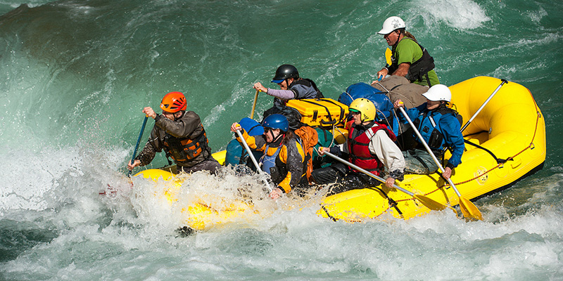
The Karnali expedition is the classic multi-day river trip in Nepal and the reason many people come to the west at all. Put-in is usually near Dungeswor or Sauli, reached by road from Surkhet, and take-out is at Chisapani where the river leaves the hills. Most operators run it in seven to ten days.
The character changes as you go. The upper section holds the significant whitewater, with big-volume Class IV rapids that get considerably bigger at high water in the immediate post-monsoon weeks. The lower half calms into wide, fast, quiet water between forested banks, and by the final days you are watching for gharial and dolphin rather than reading rapids.
| Aspect | Detail |
|---|---|
| Usual duration | Seven to ten days on the water |
| Put-in | Near Dungeswor or Sauli, road access from Surkhet |
| Take-out | Chisapani, on the East-West Highway |
| Grade | Class IV at normal flows, harder immediately after the monsoon |
| Best months | October to early December, and March to April |
| Style | Fully self-contained. Camping on sandbars, no lodges |
| Getting there | Fly Kathmandu to Nepalgunj, then road to Surkhet |
Two practical points that trip planners routinely underestimate. The river is genuinely remote for the first half, with no road access and no realistic evacuation, so the operator's safety kit and the guides' experience matter more here than on the Trishuli. And late October is not the same river as late November: the flow drops noticeably across those weeks and so does the difficulty.
The Chisapani gorge and the bridge
Chisapani is where the Karnali stops being a mountain river. The water comes out of the last gorge, the Siwalik hills fall away, and within a few kilometres the river is spreading across the flat.
The bridge here carries the East-West Highway and is the most recognisable piece of infrastructure in the far west: a single-tower cable-stayed span of roughly 500 m, unusual in Nepal, opened in the early 1990s. Before it existed the whole region beyond the Karnali was effectively cut off from the rest of the country during high water. Almost everybody driving between Nepalgunj and Dhangadhi crosses it, and it is worth stopping for.
Below the bridge the river divides. The eastern branch, the Geruwa, runs along the western boundary of Bardiya National Park; the western branch, the Kauriala, carries the main flow towards the Indian border. The braided country between them is one of the best pieces of riverine habitat left in the Terai.
Wildlife on the lower river
The lower Karnali is where the river becomes a wildlife destination. The Geruwa branch through Bardiya holds a resident population of gharial, the fish-eating crocodile with the narrow snout, alongside mugger crocodile. Gangetic river dolphin still occur in the system, in small and fragile numbers, and the Karnali is one of the very few places in Nepal where they can be seen at all.
The riverbanks and the grassland behind them are the reason Bardiya has become the best tiger destination in the country. The detail is in our Bardiya National Park guide. For anglers, the Karnali system is also the home water of the golden mahseer, a large migratory carp that runs upstream to spawn and is now catch-and-release only in most stretches.
The hydropower question
The Upper Karnali project, a proposed scheme in the region of 900 MW on the middle river, has been discussed, agreed, re-negotiated and delayed for well over a decade. Supporters point to the export revenue and to a country that still imports electricity in the dry season. Opponents point at the fisheries, the sediment budget of a river that builds the Terai, the rafting economy and the settlements that would be displaced.
Whichever way it goes, the Karnali being undammed today is a matter of delay rather than protection. There is no legal designation stopping it. That is worth understanding if you are choosing when to see the river.
Travelling along the Karnali
You can follow the river for most of its Nepali length, though not comfortably. The Karnali Highway runs north from Surkhet to Jumla, and it is one of the roughest all-weather roads in the country: gravel and cut rock most of the way, single track in places, slow, and closed by landslides for stretches of the monsoon. The buses take the best part of two days from Surkhet to Jumla and the jeeps are not much faster.
What that road opens up is the whole Karnali basin, and it is the spine of any overland trip through the region. Our ten-day Karnali circuit itinerary puts a workable route together. If you are heading further up into the headwaters, the district guides for Mugu and Kalikot cover the ground either side of the confluence.
Frequently Asked Questions
Which is the longest river in Nepal?
The Karnali, at roughly 507 km within Nepal. It rises in southwestern Tibet near Kailash and Manasarovar, enters through Humla, and crosses into India as the Ghaghara before joining the Ganges.
Which is the deepest river of Nepal?
The Karnali is the river usually given that title, on the strength of the extremely deep bedrock gorges it cuts between Kalikot and Surkhet. Treat any specific depth figure with caution, as no reliable survey underlies the numbers that circulate. What is well established is that the Karnali carries Nepal's largest discharge.
Where does the Karnali river start?
On the Tibetan plateau in the Kailash and Manasarovar region, in the same upland that gives rise to the Indus, the Sutlej and the Yarlung Tsangpo. It enters Nepal at the top of Humla district as the Humla Karnali.
How long does it take to raft the Karnali?
Seven to ten days on the water for the full expedition, from a put-in near Dungeswor or Sauli to the take-out at Chisapani, plus travel days to Nepalgunj and Surkhet at either end.
What grade are the Karnali rapids?
Class IV at normal autumn and spring flows, concentrated in the upper half. Immediately after the monsoon the volume is much higher and the river is considerably more serious. The lower half is wide, fast and calm.
Is the Karnali dammed?
Not on its main stem. It is the last major Nepali river without a dam. The Upper Karnali hydropower project, in the region of 900 MW, has been proposed for many years but has not been built, and no legal protection prevents it.
What is the Karnali bridge at Chisapani?
A single-tower cable-stayed bridge of roughly 500 m carrying the East-West Highway over the river where it leaves the hills. It opened in the early 1990s and connected the far west to the rest of the country year-round for the first time.
Can you see dolphins in the Karnali?
Gangetic river dolphin still occur in the lower Karnali system, including near Bardiya, but the population is small and fragile and sightings are a matter of luck. Gharial and mugger crocodile are far more reliably seen along the Geruwa branch.