
Stand on the riverbank at Khalanga, the headquarters of Darchula, and you can see another country across the water. The Mahakali river is the international boundary here, and the Indian town of Dharchula sits directly opposite the Nepali one, connected by a suspension footbridge that local people on both sides cross daily for shopping, work and family. Very few places in Nepal put the border in front of you so plainly.
Darchula is the far north-western corner of the country, the last district in Sudurpashchim before India to the west and Tibet to the north. It holds the highest mountain in western Nepal and one of the least-walked Himalayan approaches in the country.
Where Darchula is and what shape it takes
The district runs as a long north-south strip along the Mahakali. Baitadi lies to the south, Bajhang to the east, the Indian state of Uttarakhand across the river to the west, and Tibet at the northern head. The Chameliya river drains the eastern half and joins the Mahakali below Khalanga. Elevation swings enormously across a short horizontal distance: from under 1,000 metres at the district headquarters to over 7,000 metres on the northern skyline, which is why Darchula contains subtropical river valleys and permanent glaciers in the same administrative unit.
Api Himal and Nampa: the far-western Himalaya
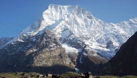
Api, at 7,132 metres, is the highest peak in far-western Nepal. Nampa, at 6,757 metres, stands to its east. Together they form the western end of the Himalayan chain inside Nepal, and they are visible on clear days from a surprising distance across the far-western hills. Neither peak sees much climbing traffic. Expeditions are occasional, approach logistics are heavy and the surrounding country has no commercial trekking infrastructure at all.
The walk to Api base camp is the district’s signature trek. It leaves the road head above Khalanga and climbs through forest, terraced villages and herder pasture to a meadow camp under the north side of the mountain. Most itineraries budget somewhere between six and nine days round trip depending on the road head and the pace, and every night is a tent or a negotiated village floor. The wider range context is covered in the Api and Saipal guide.
Api Nampa Conservation Area
The northern part of the district was declared the Api Nampa Conservation Area in 2010, making it one of Nepal’s newer protected areas. It covers the high valleys, the glacier systems around Api and Nampa, and a range of habitats from subtropical forest through to alpine and permanent snow. Snow leopard, musk deer, Himalayan black bear and blue sheep are all recorded within it, alongside a long list of medicinal plants that the local economy depends on. Unlike the national parks of the Terai, the conservation area is managed with resident communities inside it rather than around it, so villages, grazing and collection continue within the boundary.
The Byas valley, Tinkar and the northern border
At the top of the district lies Byas, the northernmost rural municipality, a trans-Himalayan valley culturally closer to Tibet than to the hills below. The people of this valley, known as Byansi or Rang, have historically been a trading community moving goods over high passes between Nepal, India and Tibet, and many households still move seasonally between high summer villages and lower winter ones. Tinkar and the settlements around it sit high and are snowbound for a long part of the year.
This is also the area at the centre of an unresolved territorial dispute. Nepal claims the Kalapani, Limpiyadhura and Lipulekh area at the head of the Mahakali; India administers it. The disagreement is longstanding and unsettled, movement in the far north can be restricted at short notice, and travellers should check current conditions with local authorities before heading up. Notes on the district as a whole are on the Darchula page.
Darchula at a glance
The table below sets out the landmarks a visitor is most likely to be planning around, with approximate heights where they are well established.
| Feature | Where it sits | Approximate height | Notes |
|---|---|---|---|
| Api | Northern Darchula | 7,132 metres | Highest peak in far-western Nepal |
| Nampa | East of Api | 6,757 metres | The second anchor of the Api Nampa massif |
| Api base camp | Upper Chameliya side | Around 4,000 metres | Meadow camp below the north face |
| Byas valley settlements | Far north, on the Mahakali | Roughly 3,000 metres and above | Seasonal Byansi villages near the Tibet frontier |
| Khalanga, district headquarters | Mahakali riverbank | Under 1,000 metres | Faces Dharchula in India across a footbridge |
People, language and festivals
Darchula is culturally layered. The lower and middle hills are Khas country, speaking Doteli and related dialects, celebrating Gaura Parva in Bhadra with fasting and deuda dancing, and maintaining the Masta shrines and dhami oracles common across the far west. The far north is Byansi, with Tibetan-influenced practice, its own language and a trading rather than farming economy. Between them sit communities shaped by generations of seasonal migration into India, which is close enough that many families treat work across the river as ordinary rather than exceptional.
Practical information for travellers
Getting to Darchula
The realistic route is overland. Fly Kathmandu to Dhangadhi, drive north to Attariya, then follow the Mahakali corridor road up through Baitadi to Khalanga. It is a long journey, usually broken over two days, on a road that suffers badly in the monsoon. There is no commercial airport in the district. Jeeps and buses run, and departure times bear only a loose relationship to schedules.
Permits and paperwork
Api Nampa Conservation Area charges an entry fee and requires registration. Darchula is not a restricted area in the way Upper Dolpa or Upper Humla are, but the border zone in the far north is sensitive and access can be limited by local decision, so carry your passport and expect to be checked. If you are unfamiliar with how the restricted system works elsewhere in the west, the restricted area permit guide explains the mechanics.
Season
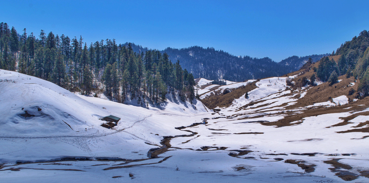
April to early June and mid September to early November are the workable windows for the high country. The monsoon brings landslides, leeches and closed roads. Winter closes the passes and the base camp approach. The lower Mahakali valley is warm and walkable in winter, which makes a low-altitude visit in December or January perfectly reasonable if the mountains are not the point.
What to expect on the ground
Khalanga has basic hotels, mobile coverage and shops. Beyond it, plan on tents, homestays, carried food and no reliable communications. A local guide is close to mandatory for the base camp trek, both for route-finding and for arranging food in villages with no visitor economy.
FAQ
How high is Api Himal?
Api stands at 7,132 metres and is the highest peak in far-western Nepal. Its neighbour Nampa reaches 6,757 metres, and the two together define the Api Nampa massif that gives the conservation area its name.
Do I need a permit to trek in Darchula?
You need an Api Nampa Conservation Area entry permit for the northern part of the district. Darchula is not in the restricted-area category, but the far northern border zone is sensitive and access can be limited, so carry your passport and check locally before heading up.
Can I cross into India from Darchula?
There is a long-established local crossing between Khalanga and Dharchula in India used daily by residents of both towns. Rules for foreign nationals differ from those for Nepali and Indian citizens, so confirm current arrangements with immigration before planning to cross.
How long does the Api base camp trek take?
Most itineraries run six to nine days round trip from the road head, depending on how far vehicles get and how much altitude you want to gain per day. There are no lodges, so the trek is run as a camping expedition with a guide and porters.
What is the best time to visit Darchula?
April to early June and mid September to early November for the mountains. The monsoon between roughly late June and early September makes the roads unreliable and the trails unpleasant, while winter closes the high approaches completely.