
Baise means twenty-two and Chaubise means twenty-four. They are the conventional names for two clusters of small hill kingdoms that governed western Nepal from roughly the fourteenth century until the Gorkha conquests of the late eighteenth: the Baise in the Karnali and Bheri basins, the Chaubise in the Gandaki. Gorkha was one of the Chaubise, and it absorbed all the others.
Nepali histories tend to move straight from the Khas Malla kingdom to Prithvi Narayan Shah, which leaves four centuries as a blank. They were not a blank. They were the period in which the political geography of the western hills was set, and the district boundaries of Karnali and Sudurpashchim still follow it more closely than most people realise.
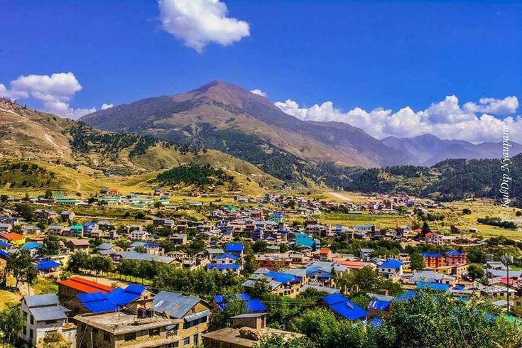
Why the Numbers Are Approximate
Neither figure is a census. Twenty-two and twenty-four are conventional, and the surviving lists disagree with each other about which states belong on them. Small principalities split when a raja died with two sons, merged when one absorbed a neighbour, and lapsed when a line failed. A state that was independent in 1600 might be a tributary by 1650 and independent again by 1700.
What the numbers do convey accurately is the scale. These were not kingdoms in the sense that the Kathmandu valley had kingdoms. Many controlled a single river valley and a few dozen villages, with revenue measured in grain rather than coin, a fort on a ridge, and a raja whose practical authority stopped where the next watershed began. Treat any list of exactly twenty-two Baise states as a tidy simplification of something that was not tidy.
How the Khas Malla Collapse Produced Them
The Khas Malla kingdom, ruled from the Sinja valley in what is now Jumla district, held a large stretch of the western Himalaya and reached into western Tibet at its height in the thirteenth and fourteenth centuries. It is covered in our article on the lost Khas Malla kingdom.
Its end was not a conquest. The kingdom fragmented from the inside during the fourteenth century, as succession disputes divided territory between claimants and the trans-Himalayan trade that had funded it shifted eastwards. What was left were the pieces, each holding a valley, each ruled by a family that could claim some connection to the old court. Jumla inherited the senior position and the prestige of the former capital. It never regained the reach.
That is the crucial point about the Baise. They were not new states built on empty ground. They were a large kingdom that had come apart along its internal seams, which is why so many of them share administrative vocabulary, land tenure practice and dialect features. Why the centre of gravity moved away from the Karnali altogether is a longer question, taken up in our article on the shift from Sinja to Kathmandu.
The Baise of the Karnali and Bheri
The states most consistently named across the surviving lists are these. Modern district names are given because the correspondence is often exact.
| State | Where it was | Note |
|---|---|---|
| Jumla | Jumla district, upper Karnali | The senior Baise state, successor to the Khas Malla court |
| Doti | Doti and the far-western hills | The largest western state, with its own long dynasty |
| Achham | Achham district | Between the Seti and the Karnali |
| Bajhang | Bajhang district | Ruling family retained titles into the twentieth century |
| Bajura | Bajura district | North of Achham on the Budhiganga |
| Dailekh and Dullu | Dailekh district | Dullu holds inscribed stones from the Khas Malla period |
| Jajarkot | Jajarkot district | Above the Bheri; ruling family kept its status into the 1900s |
| Salyan | Salyan district | On the route between the Bheri hills and the Dang valley |
| Rukum and Musikot | Rukum district | High valleys on the approach to Dhorpatan |
Several of these were, at various points, tributaries of Jumla rather than fully independent, and the relationship was renegotiated with each generation. Dailekh and Dullu are sometimes counted as one state and sometimes as two, which is a good illustration of why the list never comes out at exactly twenty-two.
The Chaubise of the Gandaki
East of the Karnali watershed, in the basin of the Gandaki and its tributaries, the same pattern produced the Chaubise. The country here is lower, warmer and better watered than the upper Karnali, and the states were correspondingly richer.
| State | Where it was | Note |
|---|---|---|
| Palpa | Palpa district, around Tansen | The strongest of the Chaubise; the last to be annexed |
| Kaski | Kaski district, around Pokhara | Controlled the approach to the Annapurna valleys |
| Lamjung | Lamjung district | The parent state from which the Gorkha line came |
| Gorkha | Gorkha district | Small, poor, and the one that took everything |
| Tanahun | Tanahun district | On the Marsyangdi and Seti confluence country |
| Parbat | Parbat district | West of the Kali Gandaki gorge |
| Gulmi | Gulmi district | Ridge country between the Kali Gandaki and the Bheri hills |
| Argha and Khanchi | Arghakhanchi district | Two states whose names survive fused in the modern district |
The Chaubise sat astride the trade routes running from the Tarai up to Mustang and the Tibetan passes, which is why Palpa and Kaski grew wealthy enough to matter and why control of a single river gorge could decide a war.
How These States Were Actually Governed
The picture most visitors carry over from the Kathmandu valley is misleading here. A Baise raja was not a monarch with a treasury and a bureaucracy. He was the senior landholder in a valley, with a fort, an armed following drawn largely from his own kin and clients, and a revenue collected in grain rather than coin.
Land was the whole of it. Grants fixed who held what, and the categories used ran on long after the states that issued them: birta, a grant of land and its revenue to an individual or family, and guthi, an endowment supporting a temple, a festival or a rite in perpetuity. Birta was abolished only in 1959. Guthi still exists as a legal category and still funds temple upkeep across the country. Below the raja, local headmen collected in kind and kept a share, which is why the arithmetic of these states is measured in maunds of grain rather than in rupees.
The kot was the physical expression of the arrangement. A fort on a ridge nose commanding two valleys was not a castle in the European sense: usually dry-stone walling, a courtyard, roofed storage for grain, and a force that assembled when called rather than a standing garrison. It was strongpoint, granary and revenue office at once. That combination is why so many kot sites now carry a school, a health post or a ward office. The reason to put a building there has not changed.
How Gorkha Rose From Among Them
Gorkha was founded as a separate state in 1559 by Dravya Shah, a son of the ruling house of Lamjung, and for the next two centuries it was unremarkable. It had a ridge, a fort, a shrine to the yogi Gorakhnath and not much revenue. It was smaller than Palpa, poorer than Kaski and militarily unimportant.
What changed was a run of capable rulers and a strategic reading of the map. Gorkha sat between the Chaubise and the Kathmandu valley, and the valley was the richest prize in the hills. Prithvi Narayan Shah, who came to the throne in 1743, decided the target was the valley rather than his Chaubise neighbours, and spent twenty-five years taking it. The campaign is set out in our article on Prithvi Narayan Shah and the unification of Nepal.
That choice is why the confederacies fell. A Chaubise state that beat its neighbours would have won a slightly larger share of the Gandaki. Gorkha instead took the valley, and with it the trade revenue, the coinage, the craft economy and the manpower to turn on everyone else from a position none of them could match.
How the Confederacies Ended
| Year | Event |
|---|---|
| 1559 | Dravya Shah establishes the Shah line at Gorkha |
| 1743 | Prithvi Narayan Shah succeeds to the throne of Gorkha |
| 1768 to 1769 | The Kathmandu valley falls to Gorkha |
| 1780s | Kaski, Lamjung, Tanahun and most of the Chaubise annexed |
| 1789 | Jumla, the senior Baise state, taken |
| 1790 | Doti annexed, bringing the far west under Kathmandu |
| 1806 | Palpa, the last independent Chaubise state, annexed |
Absorption was not uniform. Several western houses, Salyan, Jajarkot, Bajhang and Bajura among them, kept their titles and a measure of internal authority as rajya or rajauta under Kathmandu, collecting revenue and settling local disputes. That arrangement outlasted the Ranas. It was abolished only around 1960, under the land reforms of the early Panchayat years, which is within living memory in those districts.
What Survives on the Ground
There is no Baise equivalent of Bhaktapur Durbar Square. The building tradition here was stone, timber and slate rather than carved brick, the states were poor, and four centuries of weather at 2,000 metres are unforgiving. What survives is mostly siting rather than structure.
Look for the word kot in a place name and you are looking at a fort site: a defensible ridge nose or spur end, usually with a commanding view down two valleys, often now carrying a temple, a school or a telecoms mast. Jajarkot, Musikot, Rukumkot and dozens of smaller kot villages are named for exactly this. Durbar in a place name marks a palace site, and several district headquarters, Khalanga in Jumla among them, sit where they do because a Baise raja put his seat there.
The most substantial physical remains of the period that produced these states are at Dullu in Dailekh, where inscribed stones from the Khas Malla court still stand, and in the Sinja valley reached from Jumla. Both are described in our article on where the Nepali language came from, because the inscriptions matter more as language evidence than as architecture.
Frequently Asked Questions
What does Baise rajya mean?
Baise means twenty-two in Nepali, and rajya means kingdom or principality. The Baise rajya were the group of small hill states in the Karnali and Bheri basins of western Nepal that emerged after the Khas Malla kingdom fragmented.
What does Chaubise rajya mean?
Chaubise means twenty-four. The Chaubise rajya were the equivalent group in the Gandaki basin, east of the Karnali watershed, and included Palpa, Kaski, Lamjung and Gorkha.
Were there exactly twenty-two and twenty-four states?
No. Both numbers are conventional and the surviving lists disagree about which states belong on them. Principalities split, merged and lapsed constantly, so the real count changed from one generation to the next.
Which was the most important Baise state?
Jumla. It inherited the senior position from the Khas Malla court at Sinja and other Karnali states were periodically its tributaries, although its practical reach was a fraction of what the Khas Malla kingdom had held.
Was Gorkha one of the Chaubise states?
Yes. Gorkha was founded in 1559 by a son of the ruling house of Lamjung and was one of the smaller and poorer Chaubise states for two centuries before Prithvi Narayan Shah turned it on the Kathmandu valley.
When did the Baise and Chaubise states end?
Between 1768 and 1806. The Chaubise fell first, mostly in the 1780s, Jumla in 1789 and Doti in 1790. Palpa, the last independent Chaubise state, was annexed in 1806.
Did any of the ruling families survive?
Several kept titles and limited local authority as rajya or rajauta under Kathmandu, including Salyan, Jajarkot, Bajhang and Bajura. Those arrangements were abolished only around 1960 under the early Panchayat land reforms.
What can you see of the Baise states today?
Mostly fort sites rather than buildings. Place names containing kot mark defensive ridge positions and names containing durbar mark palace sites. The best physical remains from the preceding Khas Malla period are the inscribed stones at Dullu in Dailekh and in the Sinja valley above Jumla.