
Most people choose a trek in Nepal the way they choose a film: by the title they recognise. That is how Everest Base Camp and the Annapurna Circuit end up carrying a disproportionate share of the country’s trekkers while entire mountain ranges in the west see fewer visitors in a season than Namche Bazaar sees in an afternoon.
The regions differ in ways that matter far more than the brand. Some are lodge-to-lodge, where you carry a day pack and sleep in a heated dining room. Some require tents, a cook and a permit that cannot be issued to an individual. Some can be reached by a morning bus, others by a flight that gets cancelled for three days at a stretch. This is a comparison of what you are actually signing up for.
How do the main trekking regions in Nepal compare?
The table below sets the standard route in each region side by side. Altitudes are for the usual high point on the classic itinerary, and day counts are walking days from the trailhead, excluding travel from Kathmandu and excluding acclimatisation contingency.
| Region | Access from Kathmandu | High point on standard route | Walking days | Accommodation | Permit type | Crowds |
|---|---|---|---|---|---|---|
| Everest, Khumbu | Flight to Lukla, or road plus walk-in | Kala Patthar, 5,545m | 12 to 14 | Lodges throughout | National park entry plus local municipality fee | Very high in season |
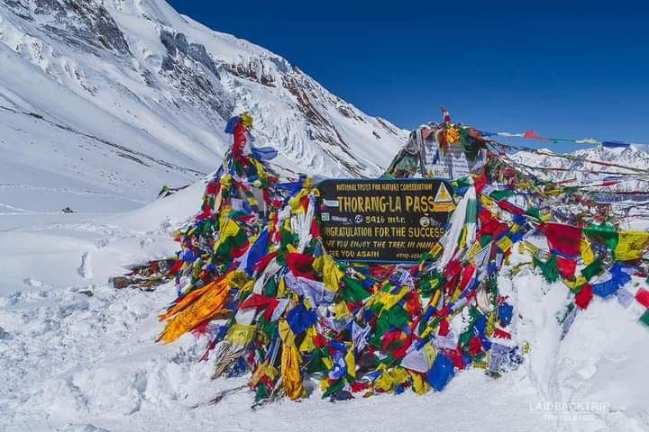
| Annapurna Circuit | Road to Besisahar or beyond | Thorong La, 5,416m | 12 to 16 | Lodges throughout | Conservation area permit | High, and roads now shorten it |
| Annapurna Base Camp | Road from Pokhara | Base camp, about 4,130m | 7 to 10 | Lodges throughout | Conservation area permit | High |
| Langtang | Road to Syabrubesi, about 7 hours | Kyanjin Ri, about 4,770m | 7 to 9 | Lodges throughout | National park entry | Moderate |
| Manaslu Circuit | Road to Soti Khola or Machha Khola | Larkya La, about 5,100m | 13 to 15 | Lodges, basic in the upper valley | Restricted area permit, guide required | Moderate and rising |
| Upper Mustang | Flight or road to Jomsom | Lo Manthang, about 3,840m | 8 to 12 | Lodges and guesthouses | Restricted area permit, guide required | Low to moderate |
| Kanchenjunga | Flight east then long drive | North base camp, about 5,140m | 18 to 22 | Basic lodges and some camping | Restricted area permit | Very low |
| Dolpo | Flight to Nepalgunj then Juphal | Passes above 5,000m on upper routes | 10 to 25 | Homestay and camping | National park plus restricted permit for Upper Dolpo | Very low |
| Humla and Limi Valley | Flight to Nepalgunj then Simikot | Nyalu La, about 4,900m | 14 to 18 | Camping and village homestay | Restricted area permit | Extremely low |
| Far west, Api and Saipal | Long road or flight to Dhangadhi | Api base camp, about 4,000m | 7 to 12 | Homestay and camping | Conservation area permit | Extremely low |
Everest and Annapurna: what the crowds buy you
The two famous regions are famous for good reasons that have nothing to do with marketing. Both have lodge networks dense enough that you can walk with a day pack, eat a hot meal at lunch and sleep somewhere heated. Both have rescue infrastructure, working communications and enough traffic that a serious problem gets noticed quickly. For a first Himalayan trek, that safety margin is worth a great deal.
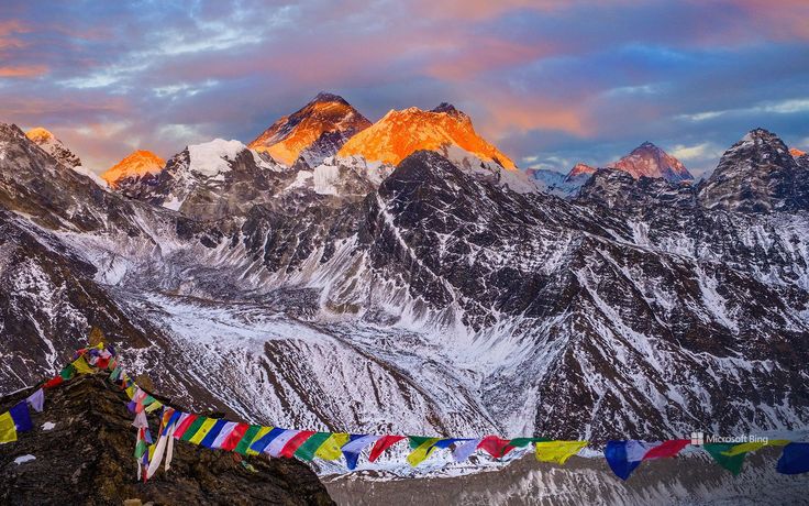
The Everest Base Camp route is a high-altitude walk before it is anything else. The scenery is unmatched, but so is the altitude exposure, and the flight into Lukla is the single least reliable link in Nepali trekking. Build in spare days at both ends. The Annapurna Circuit is a different proposition: more varied, lower for most of its length, and running from subtropical valley through pine forest to the arid Tibetan plateau edge in one continuous walk. Road building has shortened the classic route considerably, and many trekkers now start higher and finish at Muktinath or Jomsom.
Langtang, Manaslu and Mustang: the middle ground
Langtang is the most underrated trek in central Nepal. It starts a seven-hour drive from Kathmandu with no flight involved, it reaches genuine high mountain scenery in four days, and it can be done comfortably in a week. The valley was devastated by a landslide during the 2015 earthquake and has been rebuilt by the community, which gives the route a weight that the busier trails have lost.
Manaslu is the circuit for people who want Annapurna as it was two decades ago. It crosses Larkya La at roughly 5,100 metres and passes through Tibetan-influenced villages in the upper Budhi Gandaki, and it sits inside a restricted area, which means a permit issued through an agency and a licensed guide. Upper Mustang is restricted for different reasons: a walled medieval capital at Lo Manthang, cave complexes cut into cliff faces, and a landscape that is culturally and geologically Tibetan. Mustang also lies in the rain shadow, so it stays walkable through the monsoon when almost everything else does not.
The west: Dolpo, Humla and the far Himalaya
West of the Dhaulagiri massif the character of trekking changes completely. There are far fewer lodges, so most routes involve camping or arranged village homestays. Access runs through Nepalgunj rather than Kathmandu, and the onward flights to Juphal, Simikot or Talcha are small aircraft on weather-dependent schedules. Restricted area permits apply across Upper Dolpo, Humla and parts of Mugu, and they cannot be issued to solo trekkers.
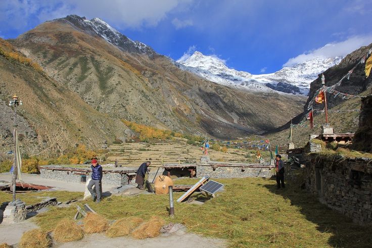
What you get in exchange is the thing every trekker claims to want. On the Limi Valley route you can walk for a week without meeting another foreign party, through Tibetan Buddhist villages that trade across the border rather than with Kathmandu. Dolpo delivers the same in a different register, with Shey Phoksundo lake and the Bon monasteries beyond it. The far west around Api and Saipal is barely on the trekking map at all. If you want a direct assessment of the trade-offs, our comparison of west Nepal against Everest and Annapurna goes into detail.
Permits, guides and the rules that keep changing
Nepal runs three broad permit categories. National park entry permits cover Sagarmatha, Langtang and the other parks. Conservation area permits cover Annapurna, Manaslu Conservation Area, Kanchenjunga and Api Nampa. Restricted area permits cover the politically or ecologically sensitive zones including Upper Mustang, Upper Dolpo, Humla, Nar Phu, Tsum and the Manaslu valley, and these must be arranged through a registered agency.
Rules on solo trekking and mandatory guides have tightened in recent years and continue to be revised, with different provinces and municipalities applying different requirements. Do not rely on a forum post from two seasons ago. Confirm the current position with the Nepal Tourism Board or a registered agency shortly before you travel, and budget time for permit processing in Kathmandu or Pokhara. Fees are set by the government and are periodically increased.
So which region should you pick?
Choose by constraint rather than by name. With one week and no appetite for internal flights, take Langtang or Ghorepani and Poon Hill. With two weeks and a wish for the classic Himalayan experience, take Everest or the Annapurna Circuit and accept the company. With two weeks and a strong preference for quiet, take Manaslu or Upper Mustang. With three weeks, real fitness and tolerance for uncertainty, go west to Dolpo or Humla and do the trip that most people only talk about.
FAQ
Which trekking region in Nepal is best for beginners?
Langtang or the Poon Hill circuit in the Annapurna foothills. Both are reached by road rather than by flight, both have continuous lodge accommodation, and neither pushes you above the altitude at which acclimatisation becomes the dominant concern.
Do you need a guide to trek in Nepal?
In restricted areas such as Upper Mustang, Manaslu, Upper Dolpo and Humla, yes, and permits are only issued to groups through registered agencies. Elsewhere the rules have been changing, so check the current requirement with the Nepal Tourism Board before you finalise plans.
What is the highest point on the Annapurna Circuit?
Thorong La at 5,416 metres. It is normally crossed early in the morning from Thorong Phedi or High Camp, and it is the single hardest day on the standard itinerary.
Can you trek in Nepal during the monsoon?
Yes, but only in the rain shadow. Upper Mustang, Dolpo and Nar Phu sit behind the main Himalayan barrier and stay relatively dry through July and August, while trails in Everest, Annapurna and Langtang become wet, leech-ridden and heavily clouded.
Which trek in Nepal has the fewest people?
The far western routes: Limi Valley in Humla, Upper Dolpo, and the approaches to Api and Saipal in Sudurpashchim. All require flights through Nepalgunj, camping or homestay arrangements, and considerably more planning than the central regions.